
TIANJIN HIGHWAY
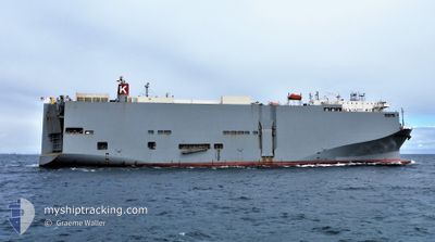
Vehicles Carrier
Current Trip
| Time Travelled | 6 days |
|---|---|
| Remaining Time | --- |
| Distance Travelled | 2016.51 nm |
| Remaining Distance | 110.89 nm |
| AVG Speed | 12.3 Knots |
| MAX Speed | 20.9 Knots |
| AVG Wind | 16.1 knots |
| MAX Wind | 28.8 knots |
| MIN Temp | 11.3°C / 52.34°F |
| MAX Temp | 24.4°C / 75.92°F |
| Draught | 8.1 m |
| Position Received | 5 d ago |
Current Position
| Longitude | -127.32310° |
|---|---|
| Latitude | 35.78022° |
| Status | Under way using engine |
| Speed | 12.4 Knots |
| Course | 251° |
| Area | North Pacific Ocean |
| Station | T-AIS |
| Position Received | 5 d ago |
Info
Information
The current position of TIANJIN HIGHWAY is in North Pacific Ocean with coordinates 35.78022° / -127.32310° as reported on 2024-06-18 01:49 by AIS to our vessel tracker app. The vessel's current speed is 12.4 Knots and is heading at the port of HONOLULU . The estimated time of arrival as calculated by vessel tracking app is 2024-06-24 08:00 LT
The vessel TIANJIN HIGHWAY (IMO: 9294355, MMSI: 371559000) is a Vehicles Carrier that was built in 2005 ( 19 years old ). It's sailing under the flag of [PA] Panama.
In this page you can find informations about the vessels current position, last detected port calls, and current voyage information. If the vessels is not in coverage by AIS you will find the latest position.
The current position of TIANJIN HIGHWAY is detected by our AIS receivers and we are not responsible for the reliability of the data. The last position was recorded while the vessel was in Coverage by the Ais receivers of our vessel tracking app.
The current draught of TIANJIN HIGHWAY as reported by AIS is 8.1 meters
Weather
| Temperature | 24.4°C / 75.92°F |
|---|---|
| Wind Speed | 18 knots |
| Direction | 83° E |
| Pressure | 1019.2 hPa |
| Humidity | 79.1 % |
| Cloud Coverage | 100 % |
Featured Company
Last Port Calls
| Port | Arrival | Departure | Time In Port |
|---|---|---|---|
| 2024-06-16 02:53 | 2024-06-17 01:32 | 22 h | |
| 2024-06-13 16:09 | 2024-06-14 00:44 | 8 h | |
| 2024-06-10 10:23 | |||
| 2024-05-23 21:37 | 2024-05-24 08:11 | 10 h | |
| 2024-05-12 05:08 | 2024-05-13 06:24 | 1 d | |
| 2024-04-30 16:42 | 2024-05-01 13:22 | 20 h | |
| 2024-04-25 23:11 | 2024-04-27 14:47 | 1 d | |
| 2024-04-23 11:27 | 2024-04-23 21:29 | 10 h | |
| 2024-04-20 20:24 | 2024-04-21 11:43 | 15 h | |
| 2024-04-10 23:54 | 2024-04-11 06:46 | 6 h |
Last Trips
| Origin | Departure | Destination | Arrival | Distance | |
|---|---|---|---|---|---|
| 2024-06-13 17:44 | 2024-06-15 19:53 | 502.00 nm | |||
| 2024-06-10 05:23 | 2024-06-13 09:09 | 1366.25 nm | |||
| 2024-05-13 13:24 | 2024-05-24 06:37 | 3286.59 nm | |||
| 2024-05-01 22:52 | 2024-05-12 12:08 | 4430.32 nm | |||
| 2024-04-28 00:47 | 2024-05-01 02:12 | 976.16 nm | |||
| 2024-04-24 07:29 | 2024-04-26 09:11 | 602.39 nm | |||
| 2024-04-21 21:43 | 2024-04-23 21:27 | 701.00 nm | |||
| 2024-04-11 15:46 | 2024-04-21 06:24 | 3655.68 nm | |||
| 2024-04-09 17:24 | 2024-04-11 08:54 | 397.57 nm | |||
| 2024-04-08 14:33 | 2024-04-09 07:04 | 241.00 nm |
Events
| Time | Event | Details | Position / Dest | Info |
|---|---|---|---|---|
| 2024-06-18 01:55 | Status Changed | Default Under way using engine |
35.77437 / -127.34528
US HNL
|
Speed: 12.4 kn Course: 251° |
| 2024-06-18 01:49 | Status Changed | Under way using engine Default |
35.78022 / -127.32310
US HNL
|
Speed: 12.4 kn Course: 251° |
| 2024-06-18 01:49 | OUT of Coverage |
35.78022 / -127.32310
North Pacific Ocean
US HNL
|
Speed: 12.4 kn Course: 251° |
|
| 2024-06-18 01:41 | Status Changed | Default Under way using engine |
35.78895 / -127.29079
US HNL
|
Speed: 12.3 kn Course: 251° |
| 2024-06-18 00:58 | Change Sea Area | High seas of the North Pacific Ocean United States part of the North Pacific Ocean |
35.83912 / -127.11922
North Pacific Ocean
US HNL
|
Speed: 12.2 kn Course: 252° |
| 2024-06-18 00:58 | Status Changed | Under way using engine Default |
35.83912 / -127.11922
US HNL
|
Speed: 12.3 kn Course: 252° |
| 2024-06-18 00:58 | IN Coverage |
35.83912 / -127.11922
North Pacific Ocean
US HNL
|
Speed: 12.2 kn Course: 252° |
|
| 2024-06-17 20:39 | Status Changed | Default Under way using engine |
36.20757 / -126.09122
US HNL
|
Speed: 13.1 kn Course: 242° |
| 2024-06-17 20:32 | OUT of Coverage |
36.21928 / -126.06390
North Pacific Ocean
US HNL
|
Speed: 13.1 kn Course: 242° |
|
| 2024-06-17 20:27 | Status Changed | Under way using engine Default |
36.22800 / -126.04412
US HNL
|
Speed: 12.8 kn Course: 241° |