
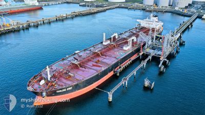
TIANLONG SPIRIT
Crude Oil Tanker
Current Trip
FOR ORDERS
| Time Travelled | 2 days |
|---|---|
| Remaining Time | --- |
| Distance Travelled | 368.20 nm |
| Remaining Distance | --- |
| AVG Speed | 10.7 Knots |
| MAX Speed | 14.6 Knots |
| AVG Wind | 10.2 knots |
| MAX Wind | 22.9 knots |
| MIN Temp | 11.8°C / 53.24°F |
| MAX Temp | 15.7°C / 60.26°F |
| Draught | 9.1 m |
| Position Received | 2 d ago |
Current Position
| Longitude | -72.07480° |
|---|---|
| Latitude | -32.68680° |
| Status | Under way using engine |
| Speed | 3.4 Knots |
| Course | 275° |
| Area | South Pacific Ocean |
| Station | T-AIS |
| Position Received | 2 d ago |
Info
Information
The current position of TIANLONG SPIRIT is in South Pacific Ocean with coordinates -32.68680° / -72.07480° as reported on 2024-05-16 17:05 by AIS to our vessel tracker app. The vessel's current speed is 3.4 Knots
The vessel TIANLONG SPIRIT (IMO: 9378369, MMSI: 309686000) is a Crude Oil Tanker that was built in 2009 ( 15 years old ). It's sailing under the flag of [BS] Bahamas.
In this page you can find informations about the vessels current position, last detected port calls, and current voyage information. If the vessels is not in coverage by AIS you will find the latest position.
The current position of TIANLONG SPIRIT is detected by our AIS receivers and we are not responsible for the reliability of the data. The last position was recorded while the vessel was in Coverage by the Ais receivers of our vessel tracking app.
The current draught of TIANLONG SPIRIT as reported by AIS is 9.1 meters
Weather
| Temperature | 15.7°C / 60.26°F |
|---|---|
| Wind Speed | 21 knots |
| Direction | 168° SSE |
| Pressure | 1019.9 hPa |
| Humidity | 71.7 % |
| Cloud Coverage | 100 % |
Featured Company
Most Visited Ports (Last year)
| Port | Arrivals | |
|---|---|---|
| 2 | ||
| 1 | ||
| 1 | ||
| 1 | ||
| 1 | ||
| 1 |
Events
| Time | Event | Details | Position / Dest | Info |
|---|---|---|---|---|
| 2024-05-17 11:28 | START Moving |
-32.45667 / -72.24167
FOR ORDERS
|
Speed: 4 kn Course: -1° |
|
| 2024-05-17 02:28 | STOP Moving |
-32.53833 / -72.07667
FOR ORDERS
|
Speed: Course: -1° |
|
| 2024-05-16 22:05 | START Moving |
-32.61941 / -72.05260
FOR ORDERS
|
Speed: 3.3 kn Course: 230° |
|
| 2024-05-16 17:52 | STOP Moving |
-32.67166 / -72.08833
FOR ORDERS
|
Speed: Course: -1° |
|
| 2024-05-16 17:13 | Status Changed | Default Under way using engine |
-32.68500 / -72.08167
FOR ORDERS
|
Speed: 3.4 kn Course: 275° |
| 2024-05-16 17:05 | OUT of Coverage |
-32.68680 / -72.07480
South Pacific Ocean
FOR ORDERS
|
Speed: 3.4 kn Course: 273.6° |
|
| 2024-05-16 15:22 | Status Changed | Under way using engine Default |
-32.71281 / -71.79188
FOR ORDERS
|
Speed: 9.2 kn Course: 278° |
| 2024-05-16 15:20 | Status Changed | Default Under way using engine |
-32.71357 / -71.78545
FOR ORDERS
|
Speed: 9.3 kn Course: 278.3° |
| 2024-05-16 13:45 | PORT DEPARTURE |
|
-32.75479 / -71.51966
FOR ORDERS
|
Speed: 5.1 kn Course: 330° |
| 2024-05-16 13:42 | Status Changed | Under way using engine Moored |
-32.75860 / -71.51725
[CL] QUINTERO
|
Speed: 3.4 kn Course: 332° |