
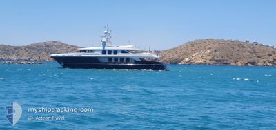
TIMBUKTU
Yacht
Current Trip
AIGEAN SEA
| Time Travelled | 2 days |
|---|---|
| Remaining Time | --- |
| Distance Travelled | 165.49 nm |
| Remaining Distance | --- |
| AVG Speed | 14.1 Knots |
| MAX Speed | 17.2 Knots |
| AVG Wind | 4.6 knots |
| MAX Wind | 24.9 knots |
| MIN Temp | 22.3°C / 72.14°F |
| MAX Temp | 36.3°C / 97.34°F |
| Draught | 3 m |
| Position Received | 2 m ago |
Current Position
| Longitude | 20.80898° |
|---|---|
| Latitude | 38.42142° |
| Status | Under way sailing |
| Speed | 15.9 Knots |
| Course | 187.4° |
| Area | Ionian Sea |
| Station | T-AIS |
| Position Received | 2 m ago |
Info
Information
The current position of TIMBUKTU is in Ionian Sea with coordinates 38.42142° / 20.80898° as reported on 2024-06-15 08:30 by AIS to our vessel tracker app. The vessel's current speed is 15.9 Knots
The vessel TIMBUKTU (IMO: 9559822, MMSI: 241780000) is a Yacht that was built in 2009 ( 15 years old ). It's sailing under the flag of [GR] Greece.
In this page you can find informations about the vessels current position, last detected port calls, and current voyage information. If the vessels is not in coverage by AIS you will find the latest position.
The current position of TIMBUKTU is detected by our AIS receivers and we are not responsible for the reliability of the data. The last position was recorded while the vessel was in Coverage by the Ais receivers of our vessel tracking app.
The current draught of TIMBUKTU as reported by AIS is 3 meters
Weather
| Temperature | 22.4°C / 72.32°F |
|---|---|
| Wind Speed | 11 knots |
| Direction | 269° W |
| Pressure | 1012.8 hPa |
| Humidity | 68.9 % |
| Cloud Coverage | --- |
Featured Company
Last Port Calls
| Port | Arrival | Departure | Time In Port |
|---|---|---|---|
| 2024-06-08 15:05 | 2024-06-12 18:06 | 4 d | |
| 2024-06-01 17:33 | 2024-06-07 12:36 | 5 d | |
| 2024-05-27 12:01 | 2024-06-01 07:05 | 4 d | |
| 2024-05-26 15:05 | 2024-05-27 09:31 | 18 h | |
| 2024-05-21 16:20 | 2024-05-24 11:53 | 2 d | |
| 2024-05-20 14:07 | 2024-05-21 06:51 | 16 h | |
| 2024-05-19 08:22 | 2024-05-20 06:49 | 22 h | |
| 2024-05-17 16:16 | 2024-05-19 07:07 | 1 d | |
| 2024-05-17 13:50 | 2024-05-17 15:28 | 1 h | |
| 2024-05-02 10:28 | 2024-05-17 05:09 | 14 d |
Last Trips
| Origin | Departure | Destination | Arrival | Distance | |
|---|---|---|---|---|---|
| 2024-06-07 15:36 | 2024-06-08 18:05 | 83.60 nm | |||
| 2024-06-01 10:05 | 2024-06-01 20:33 | 26.28 nm | |||
| 2024-05-27 12:31 | 2024-05-27 15:01 | 33.57 nm | |||
| 2024-05-24 14:53 | 2024-05-26 18:05 | 125.27 nm | |||
| 2024-05-21 09:51 | 2024-05-21 19:20 | 77.28 nm | |||
| 2024-05-20 09:49 | 2024-05-20 17:07 | 30.15 nm | |||
| 2024-05-19 10:07 | 2024-05-19 11:22 | 19.97 nm | |||
| 2024-05-17 18:28 | 2024-05-17 19:16 | 9.68 nm | |||
| 2024-05-17 08:09 | 2024-05-17 16:50 | 85.57 nm | |||
| 2024-05-02 08:16 | 2024-05-02 13:28 | 75.82 nm |
Events
| Time | Event | Details | Position / Dest | Info |
|---|---|---|---|---|
| 2024-06-15 08:15 | IN Coverage |
38.48304 / 20.82572
Ionian Sea
|
Speed: 14.6 kn Course: 185.2° |
|
| 2024-06-15 07:14 | OUT of Coverage |
38.47714 / 20.82355
Ionian Sea
|
Speed: 13.1 kn Course: 37.4° |
|
| 2024-06-15 06:55 | IN Coverage |
38.43317 / 20.73794
Ionian Sea
|
Speed: 15.1 kn Course: 60.5° |
|
| 2024-06-14 14:29 | OUT of Coverage |
38.39567 / 20.72304
Ionian Sea
|
Speed: 11.4 kn Course: 278.2° |
|
| 2024-06-14 14:29 | IN Coverage |
38.39567 / 20.72304
Ionian Sea
|
Speed: 11.4 kn Course: 278.2° |
|
| 2024-06-14 11:54 | OUT of Coverage |
38.32964 / 20.74607
Ionian Sea
|
Speed: 0.8 kn Course: 134.5° |
|
| 2024-06-14 11:17 | IN Coverage |
38.32972 / 20.74577
Ionian Sea
|
Speed: 0.1 kn Course: 277.8° |
|
| 2024-06-14 09:29 | OUT of Coverage |
38.32982 / 20.74524
Ionian Sea
|
Speed: 0.5 kn Course: 133.9° |
|
| 2024-06-13 20:53 | IN Coverage |
38.33048 / 20.74478
Ionian Sea
|
Speed: Course: 237.1° |
|
| 2024-06-13 19:45 | OUT of Coverage |
38.33046 / 20.74476
Ionian Sea
|
Speed: Course: 237.1° |