
TIMUCIN A
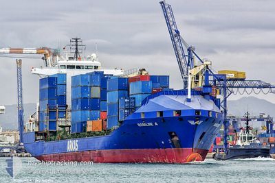
Container Ship
Aktuelle Reise
| Bisherige Reisezeit | 4 Tage |
|---|---|
| Verbleibende Reisezeit | --- |
| Zurückgelegte Distanz | 1108.70 nm |
| Verbleibende Distanz | --- |
| Durchschnittliche Geschwindigkeit | 13 Knoten |
| Maximale Geschwindigkeit | 15.1 Knoten |
| Durchschnittliche Windgeschwindigkeit | 17.9 Knoten |
| Maximale Windgeschwindigkeit | 29 Knoten |
| Minimale Temperatur | 9.3°C / 48.74°F |
| Maximale Temperatur | 22.9°C / 73.22°F |
| Tiefgang | 8.1 m |
| Position erhalten | 2 d alt |
Aktuelle Position
| Länge | --- |
|---|---|
| Breite | --- |
| Zustand | Under way using engine |
| Geschwindigkeit | 13.1 Knoten |
| Kurs | 221.2° |
| Gebiet | Aegean Sea |
| Station | T-AIS |
| Position erhalten | 2 d alt |
Schiffsdetails
Information
Die TIMUCIN A befindet sich derzeit in Aegean Sea mit den Koordinaten 36.48943° / 23.69065°, Diese Position wurde am 2024-11-07 18:18 von unserer Schiffsverfolgungs-App über AIS erfasst. Das Schiff fährt momentan mit einer Geschwindigkeit von 13.1 Knoten
Das Schiff TIMUCIN A (IMO: 9163984, MMSI: 271043491) ist Container Ship das wurde im Jahr 1998 ( 26 Jahre alt ) gebaut. und fährt unter der Flagge von [TR] Turkey.
Auf dieser Seite erhalten Sie Informationen zur aktuellen Position des Schiffes, zu den letzten bekannten Hafenanläufen und zu den aktuellen Reiseinformationen. Sollte das Schiff nicht durch AIS abgedeckt sein, wird die zuletzt erfasste Position angezeigt.
Die TIMUCIN A wird durch unsere AIS-Empfänger ermittelt. Wir übernehmen keine Gewähr für die Richtigkeit der Daten. Die letzte Position wurde von unseren AIS-Empfängern aufgezeichnet, während das Schiff in Reichweite war.
Der aktuelle Entwurf von TIMUCIN A, wie von AIS gemeldet, betragt 8.1 meter
Wetter
| Temperatur | 22.7°C / 72.86°F |
|---|---|
| Windgeschwindigkeit | 2 Knoten |
| Windrichtung | 72° ENE |
| Luftdruck | 1017.6 hPa |
| Luftfeuchtigkeit | 53.9 % |
| Wolken | 70 % |
Featured Company
Letzte Hafenanläufe
| Hafen | Ankunft | Abfahrt | Time In Port |
|---|---|---|---|
| 2024-11-05 11:13 | 2024-11-06 07:51 | 20 h | |
| 2024-11-01 09:33 | 2024-11-02 04:47 | 19 h | |
| 2024-10-30 17:00 | 2024-10-31 10:51 | 17 h | |
| 2024-10-27 09:11 | 2024-10-28 19:33 | 1 d | |
| 2024-10-18 11:00 | 2024-10-20 17:10 | 2 d | |
| 2024-10-14 08:00 | 2024-10-15 00:08 | 16 h | |
| 2024-10-12 17:58 | 2024-10-13 04:45 | 10 h | |
| 2024-10-11 15:11 | 2024-10-12 00:07 | 8 h | |
| 2024-10-07 23:17 | 2024-10-08 07:34 | 8 h | |
| 2024-10-06 12:06 | 2024-10-07 02:29 | 14 h |
Letzte Reisen
| Herkunft | Abfahrt | Ziel | Ankunft | Distanz | |
|---|---|---|---|---|---|
| 2024-11-02 07:47 | 2024-11-05 14:13 | 64.78 nm | |||
| 2024-10-31 13:51 | 2024-11-01 12:33 | 280.51 nm | |||
| 2024-10-28 21:33 | 2024-10-30 20:00 | 580.00 nm | |||
| 2024-10-20 19:10 | 2024-10-27 11:11 | 252.92 nm | |||
| 2024-10-15 03:08 | 2024-10-18 13:00 | 936.86 nm | |||
| 2024-10-13 07:45 | 2024-10-14 11:00 | 57.13 nm | |||
| 2024-10-12 03:07 | 2024-10-12 20:58 | 48.53 nm | |||
| 2024-10-08 10:34 | 2024-10-11 18:11 | 872.14 nm | |||
| 2024-10-07 05:29 | 2024-10-08 02:17 | 87.38 nm | |||
| 2024-10-01 22:56 | 2024-10-06 15:06 | 725.90 nm |
Events
| Zeit | Ereignis | Details | Position / Ziel | Information |
|---|---|---|---|---|
| 2024-11-09 22:44 | STOP Bewegung | 4.36 nm, South East of SFAX |
34.67760 / 10.84701
TNSFA
|
Geschwindigkeit: 0.2 kn Kurs: 17° |
| 2024-11-07 18:19 | geänderter Status | Default Under way using engine |
36.48801 / 23.68921
TNSFA
|
Geschwindigkeit: 13.1 kn Kurs: 221.2° |
| 2024-11-07 18:18 | außerhalb Abdeckung |
36.48943 / 23.69065
Aegean Sea
TNSFA
|
Geschwindigkeit: 13.1 kn Kurs: 221.2° |
|
| 2024-11-07 14:13 | geänderter Status | Under way using engine Default |
37.27765 / 24.24405
TNSFA
|
Geschwindigkeit: 13 kn Kurs: 198° |
| 2024-11-07 14:09 | geänderter Status | Default Under way using engine |
37.29361 / 24.25084
TNSFA
|
Geschwindigkeit: 13 kn Kurs: 198.1° |
| 2024-11-07 06:12 | geänderter Status | Under way using engine Default |
38.91849 / 25.21905
TNSFA
|
Geschwindigkeit: 13.6 kn Kurs: 210° |
| 2024-11-07 05:54 | geänderter Status | Default Under way using engine |
38.97661 / 25.26294
TNSFA
|
Geschwindigkeit: 13.4 kn Kurs: 208.5° |
| 2024-11-07 02:50 | geänderter Status | Under way using engine Default |
39.59045 / 25.65098
TNSFA
|
Geschwindigkeit: 13.5 kn Kurs: 204° |
| 2024-11-07 02:40 | geänderter Status | Default Under way using engine |
39.62488 / 25.66994
TNSFA
|
Geschwindigkeit: 13.5 kn Kurs: 203.5° |
| 2024-11-07 02:30 | geänderte voraussichtliche Ankunftszeit | 2024/11/10 00:15 2024/11/10 04:00 |
39.65769 / 25.68868
TNSFA
|
Geschwindigkeit: 13.6 kn Kurs: 204.1° |