
TOCONAO
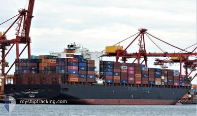
Container Ship
Current Trip
| Time Travelled | 22 days |
|---|---|
| Remaining Time | 7 days |
| Distance Travelled | 9487.71 nm |
| Remaining Distance | 2953.07 nm |
| AVG Speed | 17.3 Knots |
| MAX Speed | 20.7 Knots |
| AVG Wind | 13.2 knots |
| MAX Wind | 29.4 knots |
| MIN Temp | 15.3°C / 59.54°F |
| MAX Temp | 27.7°C / 81.86°F |
| Draught | 9.7 m |
| Position Received | 6 d ago |
Current Position
| Longitude | 18.96863° |
|---|---|
| Latitude | -34.93400° |
| Status | Under way using engine |
| Speed | 18.3 Knots |
| Course | 101° |
| Area | South Atlantic Ocean |
| Station | T-AIS |
| Position Received | 6 d ago |
Info
Information
The current position of TOCONAO is in South Atlantic Ocean with coordinates -34.93400° / 18.96863° as reported on 2024-06-21 03:05 by AIS to our vessel tracker app. The vessel's current speed is 18.3 Knots and is heading at the port of SINGAPORE. The estimated time of arrival as calculated by vessel tracking app is 2024-07-04 16:33 LT
The vessel TOCONAO (IMO: 9627899, MMSI: 636015980) is a Container Ship that was built in 2013 ( 11 years old ). It's sailing under the flag of [LR] Liberia.
In this page you can find informations about the vessels current position, last detected port calls, and current voyage information. If the vessels is not in coverage by AIS you will find the latest position.
The current position of TOCONAO is detected by our AIS receivers and we are not responsible for the reliability of the data. The last position was recorded while the vessel was in Coverage by the Ais receivers of our vessel tracking app.
The current draught of TOCONAO as reported by AIS is 9.7 meters
Weather
| Temperature | 23.9°C / 75.02°F |
|---|---|
| Wind Speed | 21 knots |
| Direction | 132° SE |
| Pressure | 1017.8 hPa |
| Humidity | 67 % |
| Cloud Coverage | 100 % |
Featured Company
Last Port Calls
| Port | Arrival | Departure | Time In Port |
|---|---|---|---|
| 2024-06-03 09:31 | 2024-06-04 19:57 | 1 d | |
| 2024-05-31 20:35 | 2024-06-01 15:57 | 19 h | |
| 2024-05-25 02:40 | 2024-05-27 05:16 | 2 d | |
| 2024-05-19 05:02 | 2024-05-20 20:26 | 1 d | |
| 2024-04-22 16:52 | 2024-04-24 05:41 | 1 d | |
| 2024-04-12 22:53 | 2024-04-13 23:10 | 1 d |
Most Visited Ports (Last year)
| Port | Arrivals | |
|---|---|---|
| 5 | ||
| 4 | ||
| 3 | ||
| 3 | ||
| 3 | ||
| 3 |
Last Trips
| Origin | Departure | Destination | Arrival | Distance | |
|---|---|---|---|---|---|
| 2024-06-01 11:57 | 2024-06-03 05:31 | 580.12 nm | |||
| 2024-05-27 01:16 | 2024-05-31 16:35 | 493.96 nm | |||
| 2024-05-20 15:26 | 2024-05-24 22:40 | 1584.16 nm | |||
| 2024-04-24 14:41 | 2024-05-19 00:02 | 8231.71 nm | |||
| 2024-04-14 07:10 | 2024-04-23 01:52 | 1337.16 nm | |||
| 2024-03-13 14:39 | 2024-04-13 06:53 | 13596.49 nm |
Events
| Time | Event | Details | Position / Dest | Info |
|---|---|---|---|---|
| 2024-06-21 03:12 | Status Changed | Default Under way using engine |
-34.94024 / 19.01008
SG SIN
|
Speed: 18.3 kn Course: 101° |
| 2024-06-21 03:05 | Status Changed | Under way using engine Default |
-34.93400 / 18.96863
SG SIN
|
Speed: 18.3 kn Course: 103° |
| 2024-06-21 03:05 | OUT of Coverage |
-34.93400 / 18.96863
South Atlantic Ocean
SG SIN
|
Speed: 18.3 kn Course: 101° |
|
| 2024-06-21 02:55 | IN Coverage |
-34.93400 / 18.96863
South Atlantic Ocean
SG SIN
|
Speed: 18.3 kn Course: 101° |
|
| 2024-06-21 01:56 | Status Changed | Default Under way using engine |
-34.85007 / 18.56350
SG SIN
|
Speed: 16.9 kn Course: 111.4° |
| 2024-06-21 01:48 | OUT of Coverage |
-34.83617 / 18.52211
South Atlantic Ocean
SG SIN
|
Speed: 16.9 kn Course: 111.4° |
|
| 2024-06-20 23:30 | Draught Changed | 9.7 9.8 |
-34.49768 / 17.92670
SG SIN
|
Speed: 15.2 kn Course: 132.3° |
| 2024-06-20 22:06 | Status Changed | Under way using engine Default |
-34.31692 / 17.55696
SG SIN
|
Speed: 15.9 kn Course: 129° |
| 2024-06-20 21:43 | Status Changed | Default Under way using engine |
-34.25099 / 17.46124
SG SIN
|
Speed: 16.2 kn Course: 127.6° |
| 2024-06-20 21:30 | Change Sea Area | South African part of the South Atlantic Ocean Bermudian part of the North Atlantic Ocean |
-34.21410 / 17.40932
South Atlantic Ocean
SG SIN
|
Speed: 16.1 kn Course: 131.3° |