
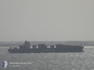
TOKYO EXPRESS
Container Ship
Current Trip
| Time Travelled | 7 days |
|---|---|
| Remaining Time | --- |
| Distance Travelled | 835.09 nm |
| Remaining Distance | 8.58 nm |
| AVG Speed | 13.6 Knots |
| MAX Speed | 19.5 Knots |
| AVG Wind | 10.9 knots |
| MAX Wind | 20.8 knots |
| MIN Temp | 14.5°C / 58.1°F |
| MAX Temp | 22.8°C / 73.04°F |
| Draught | 12.5 m |
| Position Received | 1 d ago |
Current Position
| Longitude | -48.51613° |
|---|---|
| Latitude | -26.94921° |
| Status | At anchor |
| Speed | 0.7 Knots |
| Course | 5° |
| Area | South Atlantic Ocean |
| Station | T-AIS |
| Position Received | 1 d ago |
Info
Information
The current position of TOKYO EXPRESS is in South Atlantic Ocean with coordinates -26.94921° / -48.51613° as reported on 2024-06-15 18:50 by AIS to our vessel tracker app. The vessel's current speed is 0.7 Knots and is heading at the port of NAVEGANTES. The estimated time of arrival as calculated by vessel tracking app is 2024-06-15 19:00 LT
The vessel TOKYO EXPRESS (IMO: 9193290, MMSI: 636093145) is a Container Ship that was built in 2000 ( 24 years old ). It's sailing under the flag of [LR] Liberia.
In this page you can find informations about the vessels current position, last detected port calls, and current voyage information. If the vessels is not in coverage by AIS you will find the latest position.
The current position of TOKYO EXPRESS is detected by our AIS receivers and we are not responsible for the reliability of the data. The last position was recorded while the vessel was in Coverage by the Ais receivers of our vessel tracking app.
The current draught of TOKYO EXPRESS as reported by AIS is 12.5 meters
Weather
| Temperature | 20.1°C / 68.18°F |
|---|---|
| Wind Speed | 4 knots |
| Direction | 147° SSE |
| Pressure | 1013.9 hPa |
| Humidity | 92.2 % |
| Cloud Coverage | 100 % |
Featured Company
Last Port Calls
| Port | Arrival | Departure | Time In Port |
|---|---|---|---|
| 2024-06-08 22:34 | 2024-06-09 14:50 | 16 h | |
| 2024-06-02 12:36 | 2024-06-03 08:54 | 20 h | |
| 2024-05-29 07:28 | 2024-05-30 05:52 | 22 h | |
| 2024-05-21 04:49 | 2024-05-22 03:48 | 22 h | |
| 2024-05-14 07:23 | 2024-05-15 19:53 | 1 d | |
| 2024-04-27 20:04 | 2024-04-28 10:01 | 13 h | |
| 2024-04-26 11:12 | 2024-04-27 10:03 | 22 h | |
| 2024-04-23 02:18 | 2024-04-24 01:06 | 22 h | |
| 2024-04-21 22:46 | 2024-04-22 14:13 | 15 h | |
| 2024-04-20 10:36 | 2024-04-21 01:04 | 14 h |
Last Trips
| Origin | Departure | Destination | Arrival | Distance | |
|---|---|---|---|---|---|
| 2024-06-03 05:54 | 2024-06-08 19:34 | 918.47 nm | |||
| 2024-05-30 02:52 | 2024-06-02 09:36 | 1295.39 nm | |||
| 2024-05-21 22:48 | 2024-05-29 04:28 | 3027.73 nm | |||
| 2024-05-15 14:53 | 2024-05-20 23:49 | 1652.27 nm | |||
| 2024-04-28 12:01 | 2024-05-14 02:23 | 5873.33 nm | |||
| 2024-04-27 12:03 | 2024-04-27 22:04 | 124.32 nm | |||
| 2024-04-24 03:06 | 2024-04-26 13:12 | 450.15 nm | |||
| 2024-04-22 15:13 | 2024-04-23 04:18 | 182.93 nm | |||
| 2024-04-21 03:04 | 2024-04-21 23:46 | 318.24 nm | |||
| 2024-04-07 19:14 | 2024-04-20 12:36 | 5070.61 nm |
Events
| Time | Event | Details | Position / Dest | Info |
|---|---|---|---|---|
| 2024-06-15 18:56 | Status Changed | Default At anchor |
-26.94936 / -48.51606
BRNVT
|
Speed: 0.7 kn Course: 5° |
| 2024-06-15 18:50 | OUT of Coverage |
-26.94921 / -48.51613
South Atlantic Ocean
BRNVT
|
Speed: 0.7 kn Course: 169° |
|
| 2024-06-15 18:41 | Status Changed | At anchor Under way using engine |
-26.94783 / -48.51641
BRNVT
|
Speed: 0.4 kn Course: 13° |
| 2024-06-15 18:38 | STOP Moving | 5.69 nm, North East of CAMBORIU |
-26.94759 / -48.51639
BRNVT
|
Speed: 0.2 kn Course: 12° |
| 2024-06-15 17:28 | Status Changed | Under way using engine Default |
-26.97198 / -48.33652
BRNVT
|
Speed: 15.3 kn Course: 296° |
| 2024-06-15 17:14 | Status Changed | Default Under way using engine |
-27.01251 / -48.28984
BRNVT
|
Speed: 17.7 kn Course: 322.2° |
| 2024-06-15 16:52 | Draught Changed | 12.5 11.8 |
-27.09924 / -48.21212
BRNVT
|
Speed: 18.4 kn Course: 322.2° |
| 2024-06-15 16:52 | Destination Changed | BRNVT BRRIG |
-27.09924 / -48.21212
BRNVT
|
Speed: 18.4 kn Course: 322.2° |
| 2024-06-15 16:52 | ETA Changed | 2024/06/15 19:00 2024/06/13 09:30 |
-27.09924 / -48.21212
BRNVT
|
Speed: 18.4 kn Course: 322.2° |
| 2024-06-15 16:21 | Status Changed | Under way using engine Default |
-27.25066 / -48.17305
BRRIG
|
Speed: 18.9 kn Course: 355° |