
TOLEDO
Vehicles Carrier
Current Trip
CNSHA
| Time Travelled | 9 days |
|---|---|
| Remaining Time | --- |
| Distance Travelled | 3595.41 nm |
| Remaining Distance | --- |
| AVG Speed | 15.6 Knots |
| MAX Speed | 18.1 Knots |
| AVG Wind | 11.4 knots |
| MAX Wind | 19.9 knots |
| MIN Temp | 19.9°C / 67.82°F |
| MAX Temp | 31°C / 87.8°F |
| Draught | 10 m |
| Position Received | 8 d ago |
Current Position
| Longitude | 120.97944° |
|---|---|
| Latitude | 25.48531° |
| Status | Under way using engine |
| Speed | 15 Knots |
| Course | 215.4° |
| Area | Eastern China Sea |
| Station | T-AIS |
| Position Received | 8 d ago |
Info
Information
The current position of TOLEDO is in Eastern China Sea with coordinates 25.48531° / 120.97944° as reported on 2024-05-25 23:34 by AIS to our vessel tracker app. The vessel's current speed is 15 Knots
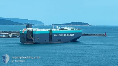
The vessel TOLEDO (IMO: 9293624, MMSI: 248917000) is a Vehicles Carrier that was built in 2005 ( 19 years old ). It's sailing under the flag of [MT] Malta.
In this page you can find informations about the vessels current position, last detected port calls, and current voyage information. If the vessels is not in coverage by AIS you will find the latest position.
The current position of TOLEDO is detected by our AIS receivers and we are not responsible for the reliability of the data. The last position was recorded while the vessel was in Coverage by the Ais receivers of our vessel tracking app.
The current draught of TOLEDO as reported by AIS is 10 meters
Weather
| Temperature | 27.4°C / 81.32°F |
|---|---|
| Wind Speed | 16 knots |
| Direction | 111° ESE |
| Pressure | 1012.5 hPa |
| Humidity | 81.7 % |
| Cloud Coverage | 36 % |
Featured Company
Last Port Calls
| Port | Arrival | Departure | Time In Port |
|---|---|---|---|
| 2024-05-24 04:32 | 2024-05-24 16:12 | 11 h | |
| 2024-05-19 21:21 | 2024-05-21 07:22 | 1 d | |
| 2024-05-19 03:11 | 2024-05-19 12:31 | 9 h | |
| 2024-05-16 02:52 | 2024-05-17 10:12 | 1 d | |
| 2024-05-14 08:32 | 2024-05-14 20:44 | 12 h | |
| 2024-04-02 07:02 | 2024-04-04 08:23 | 2 d | |
| 2024-04-01 17:59 |
Last Trips
| Origin | Departure | Destination | Arrival | Distance | |
|---|---|---|---|---|---|
| 2024-05-21 16:22 | 2024-05-24 12:32 | 498.46 nm | |||
| 2024-05-19 21:31 | 2024-05-20 06:21 | 90.38 nm | |||
| 2024-05-17 19:12 | 2024-05-19 12:11 | 592.73 nm | |||
| 2024-05-15 04:44 | 2024-05-16 11:52 | 504.68 nm | |||
| 2024-04-04 04:23 | 2024-05-14 16:32 | 12575.01 nm | |||
| 2024-04-01 13:59 | 2024-04-02 03:02 | 168.59 nm |
Events
| Time | Event | Details | Position / Dest | Info |
|---|---|---|---|---|
| 2024-05-25 23:40 | Status Changed | Default Under way using engine |
25.46379 / 120.96200
CNSHA
|
Speed: 15 kn Course: 215.4° |
| 2024-05-25 23:34 | OUT of Coverage |
25.48531 / 120.97944
Eastern China Sea
|
Speed: 15 kn Course: 215.4° |
|
| 2024-05-25 23:16 | Change Sea Area | Taiwanese part of the Eastern China Sea South Korean part of the Japan Sea |
25.54508 / 121.03001
Eastern China Sea
|
Speed: 15.1 kn Course: 217.3° |
| 2024-05-25 23:16 | Status Changed | Under way using engine Default |
25.54581 / 121.03064
CNSHA
|
Speed: 15 kn Course: 220° |
| 2024-05-25 23:05 | IN Coverage |
25.54508 / 121.03001
Eastern China Sea
|
Speed: 15.1 kn Course: 217.3° |
|
| 2024-05-24 16:12 | START Moving | 4.85 nm, South East of SHANGHAI |
31.32591 / 121.68717
CNSHA
|
Speed: 6.3 kn Course: 91° |
| 2024-05-24 16:12 | PORT DEPARTURE |
|
31.32591 / 121.68717
CNSHA
|
Speed: 3 kn Course: 100° |