
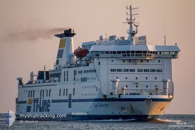
TOM SAWYER
Ro-Ro/Passenger Ship
Current Trip
| Trip Time | 12 h, 34 mins |
|---|---|
| Trip Distance | 217.25 nm |
| AVG Speed | 16.6 Knots |
| MAX Speed | 18.2 Knots |
| Draught | 5.7 m |
| AVG Wind | 9.9 knots |
| MAX Wind | 13.6 knots |
| MIN Temp | 12.4°C / 54.32°F |
| MAX Temp | 18°C / 64.4°F |
| Position Received | 3 m ago |
Current Position
| Longitude | 21.15465° |
|---|---|
| Latitude | 55.65824° |
| Status | Moored |
| Speed | |
| Course | 281° |
| Area | Baltic Sea |
| Station | T-AIS |
| Position Received | 3 m ago |
Info
Information
The current position of TOM SAWYER is in Baltic Sea with coordinates 55.65824° / 21.15465° as reported on 2024-06-01 04:35 by AIS to our vessel tracker app. The vessel's current speed is 0 Knots and is currently inside the port of KLAIPEDA.
The vessel TOM SAWYER (IMO: 8703232, MMSI: 210399000) is a Ro-Ro/Passenger Ship that was built in 1989 ( 35 years old ). It's sailing under the flag of [CY] Cyprus.
In this page you can find informations about the vessels current position, last detected port calls, and current voyage information. If the vessels is not in coverage by AIS you will find the latest position.
The current position of TOM SAWYER is detected by our AIS receivers and we are not responsible for the reliability of the data. The last position was recorded while the vessel was in Coverage by the Ais receivers of our vessel tracking app.
The current draught of TOM SAWYER as reported by AIS is 5.7 meters
Weather
| Temperature | 15.4°C / 59.72°F |
|---|---|
| Wind Speed | 6 knots |
| Direction | 99° E |
| Pressure | 1011.6 hPa |
| Humidity | 90.8 % |
| Cloud Coverage | 100 % |
Featured Company
Last Port Calls
| Port | Arrival | Departure | Time In Port |
|---|---|---|---|
| 2024-05-31 06:32 | |||
| 2024-05-30 05:53 | 2024-05-30 17:58 | 12 h | |
| 2024-05-29 08:01 | 2024-05-29 17:05 | 9 h | |
| 2024-05-28 06:47 | 2024-05-28 18:52 | 12 h | |
| 2024-05-24 06:38 | 2024-05-27 18:07 | 3 d | |
| 2024-05-23 05:49 | 2024-05-23 18:06 | 12 h | |
| 2024-05-22 07:02 | 2024-05-22 17:10 | 10 h | |
| 2024-05-21 06:41 | 2024-05-21 18:29 | 11 h | |
| 2024-05-20 13:01 | 2024-05-20 18:07 | 5 h | |
| 2024-05-19 05:18 | 2024-05-19 18:43 | 13 h |
Most Visited Ports (Last year)
| Port | Arrivals | |
|---|---|---|
| 148 | ||
| 90 | ||
| 81 | ||
| 73 | ||
| 42 | ||
| 35 |
Last Trips
| Origin | Departure | Destination | Arrival | Distance | |
|---|---|---|---|---|---|
| 2024-05-30 19:58 | 2024-05-31 09:32 | 217.25 nm | |||
| 2024-05-29 20:05 | 2024-05-30 07:53 | 217.49 nm | |||
| 2024-05-28 20:52 | 2024-05-29 11:01 | 217.54 nm | |||
| 2024-05-27 21:07 | 2024-05-28 08:47 | 217.01 nm | |||
| 2024-05-23 20:06 | 2024-05-24 09:38 | 217.36 nm | |||
| 2024-05-22 20:10 | 2024-05-23 07:49 | 217.38 nm | |||
| 2024-05-21 20:29 | 2024-05-22 10:02 | 217.31 nm | |||
| 2024-05-20 21:07 | 2024-05-21 08:41 | 216.97 nm | |||
| 2024-05-19 20:43 | 2024-05-20 16:01 | 280.25 nm | |||
| 2024-05-19 01:17 | 2024-05-19 07:18 | 80.89 nm |
Events
| Time | Event | Details | Position / Dest | Info |
|---|---|---|---|---|
| 2024-06-01 00:08 | ETA Changed | 2025/05/31 06:30 2024/05/31 06:30 |
55.65823 / 21.15465
[LT] KLAIPEDA
|
Speed: Course: 281° |
| 2024-05-31 07:27 | Status Changed | Moored Under way using engine |
55.65825 / 21.15463
[LT] KLAIPEDA
|
Speed: Course: 281° |
| 2024-05-31 07:17 | STOP Moving |
55.65827 / 21.15416
[LT] KLAIPEDA
|
Speed: 0.3 kn Course: 282° |
|
| 2024-05-31 06:32 | PORT ARRIVAL |
|
55.72459 / 21.09348
[LT] KLAIPEDA
|
Speed: 7.2 kn Course: 120° |
| 2024-05-31 05:49 | Detected in Sea | Lithuanian part of the Baltic Sea |
55.74560 / 20.77157
Baltic Sea
LT KLJ
|
Speed: 17.6 kn Course: 91.6° |
| 2024-05-31 05:49 | Status Changed | Under way using engine Default |
55.74560 / 20.77157
LT KLJ
|
Speed: 17.4 kn Course: 93° |
| 2024-05-31 05:49 | IN Coverage |
55.74560 / 20.77157
Baltic Sea
LT KLJ
|
Speed: 17.6 kn Course: 91.6° |
|
| 2024-05-30 23:58 | Status Changed | Default Under way using engine |
55.83305 / 17.77086
LT KLJ
|
Speed: 17 kn Course: 94° |
| 2024-05-30 23:54 | OUT of Coverage |
55.83435 / 17.73738
Baltic Sea
LT KLJ
|
Speed: 17 kn Course: 94° |
|
| 2024-05-30 18:08 | ETA Changed | 2024/05/31 06:30 2024/05/30 06:00 |
56.10918 / 14.85018
LT KLJ
|
Speed: 17.3 kn Course: 114.6° |