
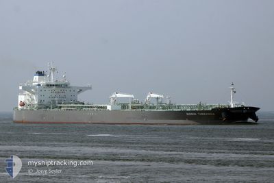
TORM KRISTINA
Tanker
Current Trip
QARLF
| Time Travelled | 45 days |
|---|---|
| Remaining Time | --- |
| Distance Travelled | 10452.34 nm |
| Remaining Distance | --- |
| AVG Speed | 11.7 Knots |
| MAX Speed | 15.3 Knots |
| AVG Wind | 12.2 knots |
| MAX Wind | 28 knots |
| MIN Temp | 14.8°C / 58.64°F |
| MAX Temp | 33.5°C / 92.3°F |
| Draught | 8.5 m |
| Position Received | 1 m ago |
Current Position
| Longitude | 54.62949° |
|---|---|
| Latitude | 25.67803° |
| Status | Under way using engine |
| Speed | 9.3 Knots |
| Course | 272.4° |
| Area | Persian Gulf |
| Station | T-AIS |
| Position Received | 1 m ago |
Info
Information
The current position of TORM KRISTINA is in Persian Gulf with coordinates 25.67803° / 54.62949° as reported on 2024-06-08 22:49 by AIS to our vessel tracker app. The vessel's current speed is 9.3 Knots
The vessel TORM KRISTINA (IMO: 9694646, MMSI: 219029025) is a Tanker It's sailing under the flag of [DK] Denmark.
In this page you can find informations about the vessels current position, last detected port calls, and current voyage information. If the vessels is not in coverage by AIS you will find the latest position.
The current position of TORM KRISTINA is detected by our AIS receivers and we are not responsible for the reliability of the data. The last position was recorded while the vessel was in Coverage by the Ais receivers of our vessel tracking app.
The current draught of TORM KRISTINA as reported by AIS is 8.5 meters
Weather
| Temperature | 31.6°C / 88.88°F |
|---|---|
| Wind Speed | 8 knots |
| Direction | 119° ESE |
| Pressure | 1001.4 hPa |
| Humidity | 72.5 % |
| Cloud Coverage | --- |
Featured Company
Last Port Calls
| Port | Arrival | Departure | Time In Port |
|---|---|---|---|
| 2024-04-23 23:56 | 2024-04-24 14:01 | 14 h | |
| 2024-04-22 03:01 | 2024-04-23 20:59 | 1 d | |
| 2024-04-18 16:32 | 2024-04-22 02:43 | 3 d |
Most Visited Ports (Last year)
| Port | Arrivals | |
|---|---|---|
| 6 | ||
| 1 | ||
| 1 | ||
| 1 | ||
| 1 | ||
| 1 |
Last Trips
| Origin | Departure | Destination | Arrival | Distance | |
|---|---|---|---|---|---|
| 2024-04-23 22:59 | 2024-04-24 01:56 | 19.03 nm | |||
| 2024-04-22 04:43 | 2024-04-22 05:01 | 1.09 nm |
Events
| Time | Event | Details | Position / Dest | Info |
|---|---|---|---|---|
| 2024-06-08 14:37 | Change Sea Area | United Arab Emirates part of the Persian Gulf Omani part of the Persian Gulf |
26.19302 / 55.85972
Persian Gulf
|
Speed: 9.5 kn Course: 225.3° |
| 2024-06-08 14:13 | Status Changed | Under way using engine Default |
26.24099 / 55.90942
QARLF
|
Speed: 9.1 kn Course: 226° |
| 2024-06-08 14:09 | Status Changed | Default Under way using engine |
26.24744 / 55.91679
QARLF
|
Speed: 9.2 kn Course: 224.5° |
| 2024-06-08 13:46 | Status Changed | Under way using engine Default |
26.29283 / 55.96536
QARLF
|
Speed: 10.6 kn Course: 224° |
| 2024-06-08 13:41 | Status Changed | Default Under way using engine |
26.30118 / 55.97424
QARLF
|
Speed: 11.5 kn Course: 224.4° |
| 2024-06-08 13:35 | Change Sea Area | Omani part of the Persian Gulf Omani part of the Gulf of Oman |
26.31555 / 55.98951
Persian Gulf
|
Speed: 11.5 kn Course: 224.4° |
| 2024-06-08 13:34 | Status Changed | Under way using engine Default |
26.31792 / 55.99200
QARLF
|
Speed: 11.5 kn Course: 224° |
| 2024-06-08 13:25 | IN Coverage |
26.31555 / 55.98951
Persian Gulf
|
Speed: 11.5 kn Course: 224.4° |
|
| 2024-06-08 06:46 | Status Changed | Default Under way using engine |
25.92505 / 56.71058
QARLF
|
Speed: 11.3 kn Course: 6° |
| 2024-06-08 06:45 | OUT of Coverage |
25.92221 / 56.71026
Gulf of Oman
|
Speed: 11.3 kn Course: 6° |