
TORNES
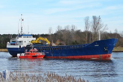
Self Discharging Bulk Carrier
Current Trip
| Time Travelled | 2 days |
|---|---|
| Remaining Time | --- |
| Distance Travelled | 97.51 nm |
| Remaining Distance | --- |
| AVG Speed | 7 Knots |
| MAX Speed | 8.9 Knots |
| AVG Wind | 3.5 knots |
| MAX Wind | 12 knots |
| MIN Temp | 9.4°C / 48.92°F |
| MAX Temp | 12.8°C / 55.04°F |
| Draught | 4.5 m |
| Position Received | 1 m ago |
Current Position
| Longitude | 6.39421° |
|---|---|
| Latitude | 62.48573° |
| Status | Under way using engine |
| Speed | |
| Course | 83° |
| Area | Norwegian Sea |
| Station | T-AIS |
| Position Received | 1 m ago |
Info
Information
The current position of TORNES is in Norwegian Sea with coordinates 62.48573° / 6.39421° as reported on 2024-06-01 21:53 by AIS to our vessel tracker app. The vessel's current speed is 0 Knots
The vessel TORNES (IMO: 7002318, MMSI: 258392000) is a Self Discharging Bulk Carrier that was built in 1969 ( 55 years old ). It's sailing under the flag of [NO] Norway.
In this page you can find informations about the vessels current position, last detected port calls, and current voyage information. If the vessels is not in coverage by AIS you will find the latest position.
The current position of TORNES is detected by our AIS receivers and we are not responsible for the reliability of the data. The last position was recorded while the vessel was in Coverage by the Ais receivers of our vessel tracking app.
The current draught of TORNES as reported by AIS is 4.5 meters
Weather
| Temperature | 8.9°C / 48.02°F |
|---|---|
| Wind Speed | 1 knots |
| Direction | 341° NNW |
| Pressure | 1023.4 hPa |
| Humidity | 85 % |
| Cloud Coverage | 53 % |
Featured Company
Last Port Calls
| Port | Arrival | Departure | Time In Port |
|---|---|---|---|
| 2024-05-30 09:12 | 2024-05-30 18:59 | 9 h | |
| 2024-05-29 06:52 | 2024-05-29 15:38 | 8 h | |
| 2024-05-28 05:09 | 2024-05-28 13:18 | 8 h | |
| 2024-05-27 05:46 | 2024-05-27 15:19 | 9 h | |
| 2024-05-16 04:59 | 2024-05-16 12:15 | 7 h |
Most Visited Ports (Last year)
| Port | Arrivals | |
|---|---|---|
| 5 | ||
| 4 | ||
| 2 | ||
| 2 | ||
| 2 | ||
| 1 |
Last Trips
| Origin | Departure | Destination | Arrival | Distance | |
|---|---|---|---|---|---|
| 2024-05-29 17:38 | 2024-05-30 11:12 | 87.91 nm | |||
| 2024-05-28 15:18 | 2024-05-29 08:52 | 85.21 nm | |||
| 2024-05-27 17:19 | 2024-05-28 07:09 | 85.28 nm | |||
| 2024-05-16 14:15 | 2024-05-27 07:46 | 724.50 nm |
Events
| Time | Event | Details | Position / Dest | Info |
|---|---|---|---|---|
| 2024-06-01 15:46 | STOP Moving | 1.31 nm, North East of SPJELKAVIK |
62.48578 / 6.39430
BINGSA>ALESUND
|
Speed: Course: 93° |
| 2024-06-01 13:43 | START Moving | 1.09 nm, North of SOVIK |
62.56330 / 6.26408
BINGSA>ALESUND
|
Speed: 3.6 kn Course: 306° |
| 2024-06-01 11:05 | STOP Moving | 0.92 nm, North of SOVIK |
62.56035 / 6.26384
BINGSA>ALESUND
|
Speed: Course: 145° |
| 2024-06-01 09:09 | START Moving | 1.16 nm, North East of SPJELKAVIK |
62.48703 / 6.38645
BINGSA>ALESUND
|
Speed: 3.5 kn Course: 266° |
| 2024-05-31 23:07 | STOP Moving | 1.31 nm, North East of SPJELKAVIK |
62.48581 / 6.39427
BINGSA>ALESUND
|
Speed: Course: 101° |
| 2024-05-31 22:02 | ETA Changed | 2024/06/01 01:30 2024/06/01 12:30 |
62.48693 / 6.20041
BINGSA>ALESUND
|
Speed: 6.9 kn Course: 92.2° |
| 2024-05-31 21:56 | ETA Changed | 2024/06/01 12:30 2024/05/31 12:30 |
62.48751 / 6.17083
BINGSA>ALESUND
|
Speed: 6.3 kn Course: 97.7° |
| 2024-05-31 21:01 | START Moving | 1.11 nm, North of SOVIK |
62.56344 / 6.26221
BINGSA>ALESUND
|
Speed: 3.7 kn Course: 326° |
| 2024-05-31 18:38 | STOP Moving | 0.92 nm, North of SOVIK |
62.56031 / 6.26388
BINGSA>ALESUND
|
Speed: 0.1 kn Course: 143° |
| 2024-05-31 17:05 | START Moving | 1.1 nm, North East of SPJELKAVIK |
62.48678 / 6.38403
BINGSA>ALESUND
|
Speed: 8.6 kn Course: 268° |