
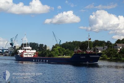
TORPO
General Cargo
Current Trip
| Time Travelled | 6 days |
|---|---|
| Remaining Time | 1 day |
| Distance Travelled | 1427.00 nm |
| Remaining Distance | 250.67 nm |
| AVG Speed | 9 Knots |
| MAX Speed | 10.1 Knots |
| AVG Wind | 8.7 knots |
| MAX Wind | 21.5 knots |
| MIN Temp | 18.4°C / 65.12°F |
| MAX Temp | 23.4°C / 74.12°F |
| Draught | 5.2 m |
| Position Received | 1 d ago |
Current Position
| Longitude | 5.57292° |
|---|---|
| Latitude | 37.36845° |
| Status | Under way using engine |
| Speed | 8.5 Knots |
| Course | 264.8° |
| Area | Mediterranean Sea - Western Basin |
| Station | T-AIS |
| Position Received | 1 d ago |
Info
Information
The current position of TORPO is in Mediterranean Sea - Western Basin with coordinates 37.36845° / 5.57292° as reported on 2024-05-27 16:16 by AIS to our vessel tracker app. The vessel's current speed is 8.5 Knots and is heading at the port of CEUTA. The estimated time of arrival as calculated by vessel tracking app is 2024-05-30 06:00 LT
The vessel TORPO (IMO: 8908791, MMSI: 314419000) is a General Cargo that was built in 1990 ( 34 years old ). It's sailing under the flag of [BB] Barbados.
In this page you can find informations about the vessels current position, last detected port calls, and current voyage information. If the vessels is not in coverage by AIS you will find the latest position.
The current position of TORPO is detected by our AIS receivers and we are not responsible for the reliability of the data. The last position was recorded while the vessel was in Coverage by the Ais receivers of our vessel tracking app.
The current draught of TORPO as reported by AIS is 5.2 meters
Weather
| Temperature | 19.5°C / 67.1°F |
|---|---|
| Wind Speed | 9 knots |
| Direction | 34° NE |
| Pressure | 1017.7 hPa |
| Humidity | 87.2 % |
| Cloud Coverage | --- |
Featured Company
Last Port Calls
| Port | Arrival | Departure | Time In Port |
|---|---|---|---|
| 2024-05-20 14:43 | 2024-05-22 09:44 | 1 d | |
| 2024-04-27 07:40 | 2024-05-14 11:56 | 17 d | |
| 2024-04-24 14:15 | 2024-04-25 10:07 | 19 h | |
| 2024-03-30 01:52 | 2024-04-02 13:37 | 3 d | |
| 2024-03-23 05:06 | 2024-03-23 17:33 | 12 h | |
| 2024-03-07 14:42 | 2024-03-07 16:49 | 2 h | |
| 2024-03-06 06:42 | 2024-03-06 23:52 | 17 h |
Last Trips
| Origin | Departure | Destination | Arrival | Distance | |
|---|---|---|---|---|---|
| 2024-05-14 14:56 | 2024-05-20 17:43 | 257.87 nm | |||
| 2024-04-25 13:07 | 2024-04-27 10:40 | 261.53 nm | |||
| 2024-04-02 15:37 | 2024-04-24 17:15 | 3525.85 nm | |||
| 2024-03-23 18:33 | 2024-03-30 02:52 | 1086.14 nm | |||
| 2024-03-07 17:49 | 2024-03-23 06:06 | 2241.32 nm | |||
| 2024-03-07 00:52 | 2024-03-07 15:42 | 146.79 nm | |||
| 2024-02-22 18:34 | 2024-03-06 07:42 | 2260.21 nm |
Events
| Time | Event | Details | Position / Dest | Info |
|---|---|---|---|---|
| 2024-05-27 16:21 | Status Changed | Default Under way using engine |
37.36726 / 5.55858
ES CEU
|
Speed: 8.5 kn Course: 264.8° |
| 2024-05-27 16:16 | Status Changed | Under way using engine Default |
37.36845 / 5.57292
ES CEU
|
Speed: 8.5 kn Course: 265° |
| 2024-05-27 16:16 | IN Coverage |
37.36845 / 5.57292
Mediterranean Sea - Western Basin
|
Speed: 8.5 kn Course: 264.8° |
|
| 2024-05-27 16:16 | OUT of Coverage |
37.36845 / 5.57292
Mediterranean Sea - Western Basin
|
Speed: 8.5 kn Course: 264.8° |
|
| 2024-05-27 15:09 | Status Changed | Default Under way using engine |
37.38834 / 5.77034
ES CEU
|
Speed: 8.5 kn Course: 262.9° |
| 2024-05-27 15:03 | OUT of Coverage |
37.39006 / 5.78848
Mediterranean Sea - Western Basin
|
Speed: 8.5 kn Course: 262.9° |
|
| 2024-05-27 13:25 | Status Changed | Under way using engine Default |
37.41056 / 6.10442
ES CEU
|
Speed: 9.4 kn Course: 263° |
| 2024-05-27 13:18 | Status Changed | Default Under way using engine |
37.41242 / 6.12614
ES CEU
|
Speed: 9.4 kn Course: 263.5° |
| 2024-05-27 12:31 | Status Changed | Under way using engine Default |
37.42377 / 6.28231
ES CEU
|
Speed: 9.6 kn Course: 265° |
| 2024-05-27 11:27 | OUT of Coverage |
37.44313 / 6.49451
Mediterranean Sea - Western Basin
|
Speed: 9.8 kn Course: 263.3° |