
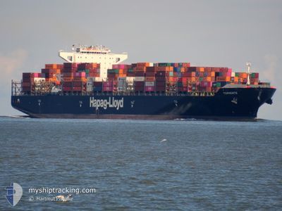
TORRENTE
Container Ship
Current Trip
| Time Travelled | 38 days |
|---|---|
| Remaining Time | --- |
| Distance Travelled | 11522.21 nm |
| Remaining Distance | --- |
| AVG Speed | 14 Knots |
| MAX Speed | 20.1 Knots |
| AVG Wind | 15.5 knots |
| MAX Wind | 28.9 knots |
| MIN Temp | 11.3°C / 52.34°F |
| MAX Temp | 29.7°C / 85.46°F |
| Draught | 12.1 m |
| Position Received | 9 d ago |
Current Position
| Longitude | 31.73626° |
|---|---|
| Latitude | -30.09619° |
| Status | Under way using engine |
| Speed | 14.9 Knots |
| Course | 41.9° |
| Area | Indian Ocean |
| Station | T-AIS |
| Position Received | 9 d ago |
Info
Information
The current position of TORRENTE is in Indian Ocean with coordinates -30.09619° / 31.73626° as reported on 2024-06-11 07:55 by AIS to our vessel tracker app. The vessel's current speed is 14.9 Knots and is heading at the port of JEBEL ALI. The estimated time of arrival as calculated by vessel tracking app is 2024-06-26 22:00 LT
The vessel TORRENTE (IMO: 9447914, MMSI: 636092782) is a Container Ship that was built in 2011 ( 13 years old ). It's sailing under the flag of [LR] Liberia.
In this page you can find informations about the vessels current position, last detected port calls, and current voyage information. If the vessels is not in coverage by AIS you will find the latest position.
The current position of TORRENTE is detected by our AIS receivers and we are not responsible for the reliability of the data. The last position was recorded while the vessel was in Coverage by the Ais receivers of our vessel tracking app.
The current draught of TORRENTE as reported by AIS is 12.1 meters
Weather
| Temperature | 30.1°C / 86.18°F |
|---|---|
| Wind Speed | 19 knots |
| Direction | 245° WSW |
| Pressure | 1002.3 hPa |
| Humidity | 80.7 % |
| Cloud Coverage | 100 % |
Featured Company
Last Port Calls
| Port | Arrival | Departure | Time In Port |
|---|---|---|---|
| 2024-05-12 16:43 | 2024-05-13 16:07 | 23 h | |
| 2024-05-09 08:21 | 2024-05-10 13:11 | 1 d | |
| 2024-04-04 09:16 | 2024-04-26 11:15 | 22 d | |
| 2024-04-01 15:43 |
Most Visited Ports (Last year)
| Port | Arrivals | |
|---|---|---|
| 9 | ||
| 8 | ||
| 8 | ||
| 8 | ||
| 8 | ||
| 7 |
Events
| Time | Event | Details | Position / Dest | Info |
|---|---|---|---|---|
| 2024-06-11 07:55 | OUT of Coverage |
-30.09619 / 31.73626
Indian Ocean
JEBEL ALI
|
Speed: 14.9 kn Course: 41.9° |
|
| 2024-06-11 07:40 | Status Changed | Under way using engine Default |
-30.14310 / 31.68894
JEBEL ALI
|
Speed: 14.6 kn Course: 42° |
| 2024-06-11 07:35 | Status Changed | Default Under way using engine |
-30.15734 / 31.67442
JEBEL ALI
|
Speed: 14.5 kn Course: 42.3° |
| 2024-06-11 06:35 | Status Changed | Under way using engine Default |
-30.33713 / 31.49257
JEBEL ALI
|
Speed: 14.1 kn Course: 40° |
| 2024-06-11 06:24 | Status Changed | Default Under way using engine |
-30.37343 / 31.45723
JEBEL ALI
|
Speed: 14 kn Course: 40° |
| 2024-06-11 05:57 | Detected in Sea | South African part of the Indian Ocean |
-30.45408 / 31.37932
Indian Ocean
JEBEL ALI
|
Speed: 14 kn Course: 39.8° |
| 2024-06-11 05:57 | Status Changed | Under way using engine Default |
-30.45408 / 31.37932
JEBEL ALI
|
Speed: 14 kn Course: 46° |
| 2024-06-11 05:57 | IN Coverage |
-30.45408 / 31.37932
Indian Ocean
JEBEL ALI
|
Speed: 14 kn Course: 39.8° |