
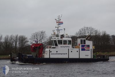
TORSTEN
Tug
Current Trip
| Trip Time | 23 h, 59 mins |
|---|---|
| Trip Distance | 49.61 nm |
| AVG Speed | 8.6 Knots |
| MAX Speed | 12.1 Knots |
| Draught | 3 m |
| AVG Wind | 9.1 knots |
| MAX Wind | 13 knots |
| MIN Temp | 13.6°C / 56.48°F |
| MAX Temp | 21.9°C / 71.42°F |
| Position Received | 1 m ago |
Current Position
| Longitude | 9.41105° |
|---|---|
| Latitude | 53.78466° |
| Status | Under way using engine |
| Speed | 0.3 Knots |
| Course | 252° |
| Area | North Sea |
| Station | T-AIS |
| Position Received | 1 m ago |
Info
Information
The current position of TORSTEN is in North Sea with coordinates 53.78466° / 9.41105° as reported on 2024-05-22 16:43 by AIS to our vessel tracker app. The vessel's current speed is 0.3 Knots and is currently inside the port of GLUECKSTADT.
The vessel TORSTEN (IMO: 9623142, MMSI: 245439000) is a Tug that was built in 2012 ( 12 years old ). It's sailing under the flag of [NL] Netherlands.
In this page you can find informations about the vessels current position, last detected port calls, and current voyage information. If the vessels is not in coverage by AIS you will find the latest position.
The current position of TORSTEN is detected by our AIS receivers and we are not responsible for the reliability of the data. The last position was recorded while the vessel was in Coverage by the Ais receivers of our vessel tracking app.
The current draught of TORSTEN as reported by AIS is 3 meters
Weather
| Temperature | 14.8°C / 58.64°F |
|---|---|
| Wind Speed | 8 knots |
| Direction | 279° W |
| Pressure | 1007.7 hPa |
| Humidity | 96.7 % |
| Cloud Coverage | 100 % |
Featured Company
Last Port Calls
| Port | Arrival | Departure | Time In Port |
|---|---|---|---|
| 2024-05-22 16:26 | |||
| 2024-05-21 14:09 | 2024-05-21 16:27 | 2 h | |
| 2024-05-20 00:03 | 2024-05-20 00:44 | 40 m | |
| 2024-05-19 05:32 | 2024-05-19 13:17 | 7 h | |
| 2024-05-13 18:04 | 2024-05-14 15:02 | 20 h | |
| 2024-05-10 08:40 | 2024-05-10 10:16 | 1 h | |
| 2024-04-22 05:52 | 2024-04-22 06:20 | 27 m | |
| 2024-04-18 05:53 | 2024-04-18 06:29 | 35 m | |
| 2024-03-28 13:20 | 2024-04-16 16:38 | 19 d | |
| 2024-03-27 15:15 | 2024-03-27 15:40 | 25 m |
Most Visited Ports (Last year)
| Port | Arrivals | |
|---|---|---|
| 37 | ||
| 35 | ||
| 10 | ||
| 9 | ||
| 7 | ||
| 4 |
Last Trips
| Origin | Departure | Destination | Arrival | Distance | |
|---|---|---|---|---|---|
| 2024-05-21 18:27 | 2024-05-22 18:26 | 49.61 nm | |||
| 2024-05-20 02:44 | 2024-05-21 16:09 | 38.63 nm | |||
| 2024-05-19 15:17 | 2024-05-20 02:03 | 77.47 nm | |||
| 2024-05-14 17:02 | 2024-05-19 07:32 | 90.54 nm | |||
| 2024-05-10 12:16 | 2024-05-13 20:04 | 17.31 nm | |||
| 2024-04-22 08:20 | 2024-05-10 10:40 | 109.11 nm | |||
| 2024-04-18 08:29 | 2024-04-22 07:52 | 24.95 nm | |||
| 2024-04-16 18:38 | 2024-04-18 07:53 | 93.62 nm | |||
| 2024-03-27 16:40 | 2024-03-28 14:20 | 127.69 nm | |||
| 2024-03-27 10:46 | 2024-03-27 16:15 | 48.09 nm |
Events
| Time | Event | Details | Position / Dest | Info |
|---|---|---|---|---|
| 2024-05-22 16:28 | STOP Moving |
53.78485 / 9.40980
[DE] GLUECKSTADT
|
Speed: 0.3 kn Course: 108° |
|
| 2024-05-22 16:26 | PORT ARRIVAL |
|
53.78478 / 9.40852
[DE] GLUECKSTADT
|
Speed: 3.7 kn Course: 98° |
| 2024-05-22 14:59 | START Moving | 0.95 nm, South of BRUNSBUETTEL |
53.88762 / 9.16601
GLUCKSTADT
|
Speed: 3.2 kn Course: 131° |
| 2024-05-22 14:53 | Destination Changed | GLUCKSTADT ELBEPORT |
53.88796 / 9.16715
GLUCKSTADT
|
Speed: Course: 46° |
| 2024-05-22 14:53 | ETA Changed | 2024/05/22 21:00 2024/05/22 02:00 |
53.88796 / 9.16715
GLUCKSTADT
|
Speed: Course: 46° |
| 2024-05-22 14:52 | Status Changed | Under way using engine At anchor |
53.88797 / 9.16714
ELBEPORT
|
Speed: Course: 47° |
| 2024-05-22 14:51 | Status Changed | At anchor Default |
53.88797 / 9.16713
ELBEPORT
|
Speed: 1.6 kn Course: 109° |
| 2024-05-22 14:36 | Status Changed | Default At anchor |
53.88754 / 9.16435
ELBEPORT
|
Speed: 1.6 kn Course: 109° |
| 2024-05-22 11:51 | Status Changed | At anchor Under way using engine |
53.88761 / 9.16099
ELBEPORT
|
Speed: 0.3 kn Course: 266° |
| 2024-05-22 11:50 | STOP Moving | 0.93 nm, South of BRUNSBUETTEL |
53.88763 / 9.16080
ELBEPORT
|
Speed: 0.2 kn Course: 278° |