
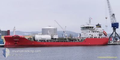
TOSCA
Tanker
Current Trip
| Time Travelled | 1 day |
|---|---|
| Remaining Time | --- |
| Distance Travelled | 489.98 nm |
| Remaining Distance | --- |
| AVG Speed | 7.1 Knots |
| MAX Speed | 13.5 Knots |
| AVG Wind | 24.5 knots |
| MAX Wind | 30 knots |
| MIN Temp | 17.7°C / 63.86°F |
| MAX Temp | 19.9°C / 67.82°F |
| Draught | 5.4 m |
| Position Received | 3 m ago |
Current Position
| Longitude | 2.10218° |
|---|---|
| Latitude | 38.43819° |
| Status | Under way using engine |
| Speed | 11.9 Knots |
| Course | 243.4° |
| Area | Mediterranean Sea - Western Basin |
| Station | T-AIS |
| Position Received | 3 m ago |
Info
Information
The current position of TOSCA is in Mediterranean Sea - Western Basin with coordinates 38.43819° / 2.10218° as reported on 2024-05-23 12:12 by AIS to our vessel tracker app. The vessel's current speed is 11.9 Knots and is heading at the port of ALGECIRAS. The estimated time of arrival as calculated by vessel tracking app is 2024-05-24 20:30 LT
The vessel TOSCA (IMO: 9870678, MMSI: 210254000) is a Tanker It's sailing under the flag of [CY] Cyprus.
In this page you can find informations about the vessels current position, last detected port calls, and current voyage information. If the vessels is not in coverage by AIS you will find the latest position.
The current position of TOSCA is detected by our AIS receivers and we are not responsible for the reliability of the data. The last position was recorded while the vessel was in Coverage by the Ais receivers of our vessel tracking app.
The current draught of TOSCA as reported by AIS is 5.4 meters
Weather
| Temperature | 20.1°C / 68.18°F |
|---|---|
| Wind Speed | 10 knots |
| Direction | 86° E |
| Pressure | 1017.1 hPa |
| Humidity | 71.6 % |
| Cloud Coverage | 100 % |
Featured Company
Last Port Calls
| Port | Arrival | Departure | Time In Port |
|---|---|---|---|
| 2024-05-20 07:22 | 2024-05-21 15:33 | 1 d | |
| 2024-05-15 02:20 | 2024-05-15 17:23 | 15 h | |
| 2024-05-13 01:46 | 2024-05-14 12:09 | 1 d | |
| 2024-05-10 05:58 | 2024-05-11 06:22 | 1 d | |
| 2024-05-06 16:59 | 2024-05-08 19:42 | 2 d | |
| 2024-05-04 06:05 | 2024-05-04 12:12 | 6 h | |
| 2024-05-02 17:34 | 2024-05-03 08:46 | 15 h | |
| 2024-04-30 13:19 | 2024-05-01 10:49 | 21 h | |
| 2024-04-28 06:25 | 2024-04-29 07:20 | 1 d | |
| 2024-04-25 19:45 | 2024-04-26 21:38 | 1 d |
Most Visited Ports (Last year)
| Port | Arrivals | |
|---|---|---|
| 32 | ||
| 28 | ||
| 13 | ||
| 9 | ||
| 5 | ||
| 3 |
Last Trips
| Origin | Departure | Destination | Arrival | Distance | |
|---|---|---|---|---|---|
| 2024-05-15 19:23 | 2024-05-20 09:22 | 1044.92 nm | |||
| 2024-05-14 14:09 | 2024-05-15 04:20 | 126.23 nm | |||
| 2024-05-11 08:22 | 2024-05-13 03:46 | 294.64 nm | |||
| 2024-05-08 21:42 | 2024-05-10 07:58 | 375.67 nm | |||
| 2024-05-04 14:12 | 2024-05-06 18:59 | 133.33 nm | |||
| 2024-05-03 09:46 | 2024-05-04 08:05 | 194.25 nm | |||
| 2024-05-01 12:49 | 2024-05-02 18:34 | 201.11 nm | |||
| 2024-04-29 09:20 | 2024-04-30 15:19 | 281.69 nm | |||
| 2024-04-26 23:38 | 2024-04-28 08:25 | 374.00 nm | |||
| 2024-04-23 15:11 | 2024-04-25 21:45 | 637.94 nm |
Events
| Time | Event | Details | Position / Dest | Info |
|---|---|---|---|---|
| 2024-05-23 11:44 | Status Changed | Under way using engine Default |
38.47975 / 2.20570
ALGECIRAS ES
|
Speed: 12 kn Course: 242° |
| 2024-05-23 11:28 | IN Coverage |
38.47975 / 2.20570
Mediterranean Sea - Western Basin
ALGECIRAS ES
|
Speed: 11.9 kn Course: 242.8° |
|
| 2024-05-23 09:41 | Status Changed | Default Under way using engine |
38.68930 / 2.66926
ALGECIRAS ES
|
Speed: 12.6 kn Course: 239.2° |
| 2024-05-23 09:32 | Status Changed | Under way using engine Default |
38.70376 / 2.70072
ALGECIRAS ES
|
Speed: 12.5 kn Course: 239° |
| 2024-05-23 09:32 | OUT of Coverage |
38.70376 / 2.70072
Mediterranean Sea - Western Basin
ALGECIRAS ES
|
Speed: 12.6 kn Course: 239.2° |
|
| 2024-05-23 09:28 | IN Coverage |
38.70376 / 2.70072
Mediterranean Sea - Western Basin
ALGECIRAS ES
|
Speed: 12.6 kn Course: 239.2° |
|
| 2024-05-23 08:10 | Status Changed | Default Under way using engine |
38.85678 / 3.02101
ALGECIRAS ES
|
Speed: 12.9 kn Course: 238.9° |
| 2024-05-23 08:08 | OUT of Coverage |
38.86047 / 3.02890
Mediterranean Sea - Western Basin
ALGECIRAS ES
|
Speed: 12.9 kn Course: 238.9° |
|
| 2024-05-23 08:07 | Status Changed | Under way using engine Default |
38.86296 / 3.03420
ALGECIRAS ES
|
Speed: 12.9 kn Course: 239° |
| 2024-05-23 08:01 | Status Changed | Default Under way using engine |
38.87521 / 3.06043
ALGECIRAS ES
|
Speed: 12.8 kn Course: 239.8° |