
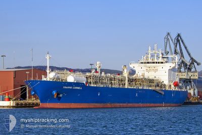
TRAMMO CORNELL
Tanker
Current Trip
| Trip Time | 15 days |
|---|---|
| Trip Distance | 1125.29 nm |
| AVG Speed | 9.1 Knots |
| MAX Speed | 9.1 Knots |
| Draught | 10.4 m |
| AVG Wind | 8.6 knots |
| MAX Wind | 19 knots |
| MIN Temp | 13°C / 55.4°F |
| MAX Temp | 33.7°C / 92.66°F |
| Position Received | 9 d ago |
Current Position
| Longitude | 29.10346° |
|---|---|
| Latitude | 41.49889° |
| Status | Under way using engine |
| Speed | 7.9 Knots |
| Course | 325.6° |
| Area | Black Sea |
| Station | T-AIS |
| Position Received | 9 d ago |
Info
Information
The current position of TRAMMO CORNELL is in Black Sea with coordinates 41.49889° / 29.10346° as reported on 2024-05-23 07:05 by AIS to our vessel tracker app. The vessel's current speed is 7.9 Knots and is currently inside the port of VARNA.
The vessel TRAMMO CORNELL (IMO: 9543081, MMSI: 563026400) is a Tanker It's sailing under the flag of [SG] Singapore.
In this page you can find informations about the vessels current position, last detected port calls, and current voyage information. If the vessels is not in coverage by AIS you will find the latest position.
The current position of TRAMMO CORNELL is detected by our AIS receivers and we are not responsible for the reliability of the data. The last position was recorded while the vessel was in Coverage by the Ais receivers of our vessel tracking app.
The current draught of TRAMMO CORNELL as reported by AIS is 10.4 meters
Weather
| Temperature | 20.2°C / 68.36°F |
|---|---|
| Wind Speed | 3 knots |
| Direction | 130° SE |
| Pressure | 1016.2 hPa |
| Humidity | 68 % |
| Cloud Coverage | 14 % |
Featured Company
Last Port Calls
| Port | Arrival | Departure | Time In Port |
|---|---|---|---|
| 2024-05-31 10:54 | |||
| 2024-05-17 04:53 | 2024-05-17 13:29 | 8 h | |
| 2024-05-14 18:55 | 2024-05-15 22:55 | 1 d | |
| 2024-05-14 06:48 | 2024-05-14 15:33 | 8 h | |
| 2024-05-05 18:10 | 2024-05-07 09:53 | 1 d | |
| 2024-04-02 20:57 | 2024-04-04 08:30 | 1 d |
Most Visited Ports (Last year)
| Port | Arrivals | |
|---|---|---|
| 7 | ||
| 6 | ||
| 5 | ||
| 2 | ||
| 2 | ||
| 2 |
Last Trips
| Origin | Departure | Destination | Arrival | Distance | |
|---|---|---|---|---|---|
| 2024-05-16 00:55 | 2024-05-31 13:54 | 1125.29 nm | |||
| 2024-05-16 00:55 | 2024-05-17 06:53 | 30.56 nm | |||
| 2024-05-07 10:53 | 2024-05-14 20:55 | 2301.18 nm | |||
| 2024-05-07 10:53 | 2024-05-14 08:48 | 2189.99 nm | |||
| 2024-04-04 11:30 | 2024-05-05 19:10 | 10160.73 nm | |||
| 2024-03-02 06:57 | 2024-04-02 23:57 | 10135.80 nm |
Events
| Time | Event | Details | Position / Dest | Info |
|---|---|---|---|---|
| 2024-05-31 11:34 | STOP Moving |
43.19154 / 27.66277
[BG] VARNA
|
Speed: 0.2 kn Course: 63° |
|
| 2024-05-31 10:54 | PORT ARRIVAL |
|
43.19014 / 27.66334
[BG] VARNA
|
Speed: 3.1 kn Course: 253° |
| 2024-05-31 08:50 | START Moving | 2.71 nm, South West of ST CONSTANTIN HELENA |
43.18685 / 27.97566
FOR ORDERS
|
Speed: 5.6 kn Course: 277° |
| 2024-05-31 08:34 | STOP Moving | 2.44 nm, South West of ST CONSTANTIN HELENA |
43.18935 / 27.98163
FOR ORDERS
|
Speed: 0.3 kn Course: 189° |
| 2024-05-31 05:50 | START Moving | 6.93 nm, South of VARNA |
43.08008 / 27.95921
FOR ORDERS
|
Speed: 6.1 kn Course: 64° |
| 2024-05-23 22:05 | STOP Moving | 6.92 nm, South of VARNA |
43.07937 / 27.95506
FOR ORDERS
|
Speed: 0.2 kn Course: 280° |
| 2024-05-23 07:07 | Status Changed | Default Under way using engine |
41.50340 / 29.09908
FOR ORDERS
|
Speed: 7.9 kn Course: 325.6° |
| 2024-05-23 07:05 | OUT of Coverage |
41.49889 / 29.10346
Black Sea
|
Speed: 7.9 kn Course: 325.6° |
|
| 2024-05-23 04:46 | Change Sea Area | Turkish part of the Black Sea Turkish part of the Sea of Marmara |
41.23371 / 29.14578
Black Sea
|
Speed: 7.7 kn Course: 44.8° |
| 2024-05-23 01:14 | START Moving | 9.72 nm, South of YESILKOY |
40.80022 / 28.76384
FOR ORDERS
|
Speed: 3.4 kn Course: 52° |