
TRITO NAVIGATOR
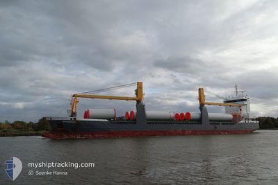
General Cargo
Current Trip
| Time Travelled | 6 days |
|---|---|
| Remaining Time | 2 days |
| Distance Travelled | 273.74 nm |
| Remaining Distance | 608.93 nm |
| AVG Speed | 11.7 Knots |
| MAX Speed | 16.3 Knots |
| AVG Wind | 5 knots |
| MAX Wind | 11.9 knots |
| MIN Temp | 10.5°C / 50.9°F |
| MAX Temp | 23.4°C / 74.12°F |
| Draught | 4.8 m |
| Position Received | 2 m ago |
Current Position
| Longitude | 25.70743° |
|---|---|
| Latitude | 38.92613° |
| Status | Under way using engine |
| Speed | 11.2 Knots |
| Course | 179.9° |
| Area | Aegean Sea |
| Station | T-AIS |
| Position Received | 2 m ago |
Info
Information
The current position of TRITO NAVIGATOR is in Aegean Sea with coordinates 38.92613° / 25.70743° as reported on 2024-05-30 14:36 by AIS to our vessel tracker app. The vessel's current speed is 11.2 Knots and is heading at the port of DAMIETTA. The estimated time of arrival as calculated by vessel tracking app is 2024-06-01 22:25 LT
The vessel TRITO NAVIGATOR (IMO: 9631357, MMSI: 245237000) is a General Cargo that was built in 2013 ( 11 years old ). It's sailing under the flag of [NL] Netherlands.
In this page you can find informations about the vessels current position, last detected port calls, and current voyage information. If the vessels is not in coverage by AIS you will find the latest position.
The current position of TRITO NAVIGATOR is detected by our AIS receivers and we are not responsible for the reliability of the data. The last position was recorded while the vessel was in Coverage by the Ais receivers of our vessel tracking app.
The current draught of TRITO NAVIGATOR as reported by AIS is 4.8 meters
Weather
| Temperature | 21.3°C / 70.34°F |
|---|---|
| Wind Speed | 6 knots |
| Direction | 181° S |
| Pressure | 1011.1 hPa |
| Humidity | 73.4 % |
| Cloud Coverage | 10 % |
Featured Company
Last Port Calls
| Port | Arrival | Departure | Time In Port |
|---|---|---|---|
| 2024-05-22 17:32 | 2024-05-23 19:34 | 1 d | |
| 2024-05-20 02:59 | 2024-05-21 12:48 | 1 d | |
| 2024-05-15 15:10 | 2024-05-16 16:48 | 1 d | |
| 2024-05-14 06:51 | 2024-05-14 12:00 | 5 h | |
| 2024-05-11 03:38 | 2024-05-11 20:47 | 17 h | |
| 2024-04-28 07:16 | 2024-04-30 08:23 | 2 d | |
| 2024-04-26 12:51 | 2024-04-26 23:20 | 10 h | |
| 2024-04-24 17:52 | |||
| 2024-04-21 15:32 | 2024-04-22 20:28 | 1 d | |
| 2024-04-14 15:16 | 2024-04-17 22:43 | 3 d |
Last Trips
| Origin | Departure | Destination | Arrival | Distance | |
|---|---|---|---|---|---|
| 2024-05-21 15:48 | 2024-05-22 20:32 | 322.75 nm | |||
| 2024-05-16 18:48 | 2024-05-20 05:59 | 823.20 nm | |||
| 2024-05-14 14:00 | 2024-05-15 17:10 | 328.52 nm | |||
| 2024-05-11 22:47 | 2024-05-14 08:51 | 718.04 nm | |||
| 2024-04-30 10:23 | 2024-05-11 05:38 | 2898.29 nm | |||
| 2024-04-27 01:20 | 2024-04-28 09:16 | 355.74 nm | |||
| 2024-04-24 20:52 | 2024-04-26 14:51 | 511.32 nm | |||
| 2024-04-18 01:43 | 2024-04-21 17:32 | 436.52 nm | |||
| 2024-04-14 17:50 | 2024-04-14 18:16 | 0.70 nm | |||
| 2024-04-11 18:53 | 2024-04-11 22:59 | 43.50 nm |
Events
| Time | Event | Details | Position / Dest | Info |
|---|---|---|---|---|
| 2024-05-30 09:33 | Change Sea Area | Greek part of the Aegean Sea Turkish part of the Aegean Sea |
39.83658 / 25.79703
Aegean Sea
DAMIETTA
|
Speed: 10.9 kn Course: 186.6° |
| 2024-05-30 09:32 | Status Changed | Under way using engine Default |
39.84055 / 25.79748
DAMIETTA
|
Speed: 11.7 kn Course: 222° |
| 2024-05-30 09:06 | Status Changed | Default Under way using engine |
39.90535 / 25.86765
DAMIETTA
|
Speed: 12.1 kn Course: 221.3° |
| 2024-05-30 09:01 | Status Changed | Under way using engine Default |
39.91740 / 25.88183
DAMIETTA
|
Speed: 11.7 kn Course: 223° |
| 2024-05-30 08:36 | Status Changed | Default Under way using engine |
39.97901 / 25.95470
DAMIETTA
|
Speed: 11.3 kn Course: 222.5° |
| 2024-05-30 08:32 | Status Changed | Under way using engine Default |
39.98673 / 25.96393
DAMIETTA
|
Speed: 10.8 kn Course: 219° |
| 2024-05-30 08:24 | Status Changed | Default Under way using engine |
40.00554 / 25.98698
DAMIETTA
|
Speed: 11.9 kn Course: 261.9° |
| 2024-05-30 07:43 | Change Sea Area | Turkish part of the Aegean Sea Turkish part of the Sea of Marmara |
40.02755 / 26.17098
Aegean Sea
DAMIETTA
|
Speed: 13.5 kn Course: 261° |
| 2024-05-30 05:00 | Status Changed | Under way using engine Default |
40.44217 / 26.77395
DAMIETTA
|
Speed: 10.1 kn Course: 243° |
| 2024-05-30 04:47 | Status Changed | Default Under way using engine |
40.46041 / 26.81933
DAMIETTA
|
Speed: 10.1 kn Course: 244.2° |