
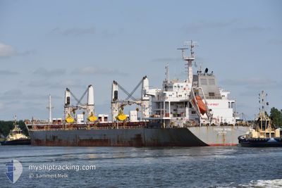
TRITON WIND I
Bulk Carrier
Current Trip
| Time Travelled | 14 days |
|---|---|
| Remaining Time | --- |
| Distance Travelled | 3837.08 nm |
| Remaining Distance | 578.16 nm |
| AVG Speed | 10.5 Knots |
| MAX Speed | 13.6 Knots |
| AVG Wind | 11.9 knots |
| MAX Wind | 25.3 knots |
| MIN Temp | 5.9°C / 42.62°F |
| MAX Temp | 29.3°C / 84.74°F |
| Draught | 10.3 m |
| Position Received | 3 d ago |
Current Position
| Longitude | -52.91016° |
|---|---|
| Latitude | 36.13571° |
| Status | Under way using engine |
| Speed | 9.9 Knots |
| Course | 338.1° |
| Area | North Atlantic Ocean |
| Station | T-AIS |
| Position Received | 3 d ago |
Info
Information
The current position of TRITON WIND I is in North Atlantic Ocean with coordinates 36.13571° / -52.91016° as reported on 2024-05-27 20:22 by AIS to our vessel tracker app. The vessel's current speed is 9.9 Knots and is heading at the port of MONTREAL. The estimated time of arrival as calculated by vessel tracking app is 2024-06-02 12:00 LT
The vessel TRITON WIND I (IMO: 9621003, MMSI: 636017611) is a Bulk Carrier that was built in 2013 ( 11 years old ). It's sailing under the flag of [LR] Liberia.
In this page you can find informations about the vessels current position, last detected port calls, and current voyage information. If the vessels is not in coverage by AIS you will find the latest position.
The current position of TRITON WIND I is detected by our AIS receivers and we are not responsible for the reliability of the data. The last position was recorded while the vessel was in Coverage by the Ais receivers of our vessel tracking app.
The current draught of TRITON WIND I as reported by AIS is 10.3 meters
Weather
| Temperature | 7.1°C / 44.78°F |
|---|---|
| Wind Speed | 3 knots |
| Direction | 351° N |
| Pressure | 1013.2 hPa |
| Humidity | 75 % |
| Cloud Coverage | 100 % |
Featured Company
Last Port Calls
| Port | Arrival | Departure | Time In Port |
|---|---|---|---|
| 2024-05-04 09:00 | 2024-05-16 15:35 | 12 d | |
| 2024-04-15 19:31 | 2024-04-20 13:13 | 4 d | |
| 2024-04-08 19:10 | 2024-04-15 10:58 | 6 d | |
| 2024-03-28 03:01 | 2024-03-29 04:49 | 1 d | |
| 2024-03-24 16:33 | 2024-03-28 01:41 | 3 d | |
| 2024-03-02 12:16 |
Last Trips
| Origin | Departure | Destination | Arrival | Distance | |
|---|---|---|---|---|---|
| 2024-04-20 10:13 | 2024-05-04 06:00 | 270.34 nm | |||
| 2024-04-15 07:58 | 2024-04-15 16:31 | 84.79 nm | |||
| 2024-03-29 01:49 | 2024-04-08 16:10 | 2563.61 nm | |||
| 2024-03-27 22:41 | 2024-03-28 00:01 | 9.77 nm | |||
| 2024-03-02 13:16 | 2024-03-24 13:33 | 4476.36 nm |
Events
| Time | Event | Details | Position / Dest | Info |
|---|---|---|---|---|
| 2024-05-27 20:28 | Status Changed | Default Under way using engine |
36.15041 / -52.91740
CN MONTREAL
|
Speed: 9.9 kn Course: 338.1° |
| 2024-05-27 20:22 | OUT of Coverage |
36.13571 / -52.91016
North Atlantic Ocean
CN MONTREAL
|
Speed: 9.9 kn Course: 338.1° |
|
| 2024-05-27 20:13 | Status Changed | Under way using engine Default |
36.11248 / -52.89895
CN MONTREAL
|
Speed: 9 kn Course: 339° |
| 2024-05-27 19:57 | Status Changed | Default Under way using engine |
36.07167 / -52.87833
CN MONTREAL
|
Speed: 9.7 kn Course: 337.2° |
| 2024-05-27 19:31 | Change Sea Area | High seas of the North Atlantic Ocean Brazilian part of the South Atlantic Ocean |
36.00658 / -52.84461
North Atlantic Ocean
CN MONTREAL
|
Speed: 9.7 kn Course: 338.6° |
| 2024-05-27 19:31 | Status Changed | Under way using engine Default |
36.00658 / -52.84461
CN MONTREAL
|
Speed: 9 kn Course: 335° |
| 2024-05-27 19:24 | IN Coverage |
36.00658 / -52.84461
North Atlantic Ocean
CN MONTREAL
|
Speed: 9.7 kn Course: 338.6° |