
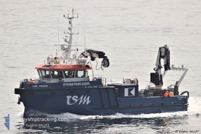
TSM PENZER
Other Type
Current Trip
Current Position
| Longitude | -3.96493° |
|---|---|
| Latitude | 48.72164° |
| Status | Under way using engine |
| Speed | |
| Course | 290° |
| Area | English Channel |
| Station | T-AIS |
| Position Received | Now |
Info
Information
The current position of TSM PENZER is in English Channel with coordinates 48.72164° / -3.96493° as reported on 2024-06-20 13:39 by AIS to our vessel tracker app. The vessel's current speed is 0 Knots and is currently inside the port of ROSCOFF.
The vessel TSM PENZER (MMSI: 228076900) is a Other Type It's sailing under the flag of [FR] France.
In this page you can find informations about the vessels current position, last detected port calls, and current voyage information. If the vessels is not in coverage by AIS you will find the latest position.
The current position of TSM PENZER is detected by our AIS receivers and we are not responsible for the reliability of the data. The last position was recorded while the vessel was in Coverage by the Ais receivers of our vessel tracking app.
The current draught of TSM PENZER as reported by AIS is 1.5 meters
Weather
| Temperature | 15.6°C / 60.08°F |
|---|---|
| Wind Speed | 15 knots |
| Direction | 44° NE |
| Pressure | 1019 hPa |
| Humidity | 89 % |
| Cloud Coverage | 53 % |
Featured Company
Last Port Calls
| Port | Arrival | Departure | Time In Port |
|---|---|---|---|
| 2024-06-18 21:35 | |||
| 2024-06-08 16:11 | 2024-06-17 10:34 | 8 d | |
| 2024-06-06 15:15 | 2024-06-07 04:24 | 13 h | |
| 2024-06-05 18:08 | 2024-06-06 05:32 | 11 h | |
| 2024-06-03 15:38 | 2024-06-05 04:59 | 1 d | |
| 2024-06-03 10:30 | 2024-06-03 15:21 | 4 h | |
| 2024-05-31 09:50 | 2024-06-03 06:47 | 2 d | |
| 2024-05-31 06:48 | 2024-05-31 09:25 | 2 h | |
| 2024-05-30 11:10 | 2024-05-31 06:17 | 19 h | |
| 2024-05-30 06:57 | 2024-05-30 10:50 | 3 h |
Most Visited Ports (Last year)
| Port | Arrivals | |
|---|---|---|
| 36 | ||
| 21 | ||
| 19 | ||
| 16 | ||
| 14 | ||
| 9 |
Last Trips
| Origin | Departure | Destination | Arrival | Distance | |
|---|---|---|---|---|---|
| 2024-06-17 12:34 | 2024-06-18 23:35 | 31.77 nm | |||
| 2024-06-07 06:24 | 2024-06-08 18:11 | 28.83 nm | |||
| 2024-06-06 07:32 | 2024-06-06 17:15 | 15.50 nm | |||
| 2024-06-05 06:59 | 2024-06-05 20:08 | 20.50 nm | |||
| 2024-06-03 17:21 | 2024-06-03 17:38 | 2.30 nm | |||
| 2024-06-03 08:47 | 2024-06-03 12:30 | 2.41 nm | |||
| 2024-05-31 11:25 | 2024-05-31 11:50 | 2.76 nm | |||
| 2024-05-31 08:17 | 2024-05-31 08:48 | 2.40 nm | |||
| 2024-05-30 12:50 | 2024-05-30 13:10 | 2.64 nm | |||
| 2024-05-30 08:50 | 2024-05-30 08:57 | 0.36 nm |
Events
| Time | Event | Details | Position / Dest | Info |
|---|---|---|---|---|
| 2024-06-18 21:38 | STOP Moving |
48.72168 / -3.96473
[FR] ROSCOFF
|
Speed: 0.3 kn Course: 301° |
|
| 2024-06-18 21:35 | PORT ARRIVAL |
|
48.71969 / -3.96052
[FR] ROSCOFF
|
Speed: 6.3 kn Course: 226.4° |
| 2024-06-18 20:37 | Destination Changed | ROSCOFF OPERATION AREA |
48.71854 / -4.09840
ROSCOFF
|
Speed: 7.6 kn Course: 26.1° |
| 2024-06-18 20:28 | START Moving | 4.44 nm, South West of ILE DE BATZ |
48.70096 / -4.10479
OPERATION AREA
|
Speed: 5.1 kn Course: 18.6° |
| 2024-06-18 19:04 | STOP Moving | 4.54 nm, South West of ILE DE BATZ |
48.69919 / -4.10596
OPERATION AREA
|
Speed: 0.3 kn Course: 226° |
| 2024-06-18 19:01 | START Moving | 4.47 nm, South West of ILE DE BATZ |
48.70060 / -4.10531
OPERATION AREA
|
Speed: 4.9 kn Course: 356° |
| 2024-06-18 07:58 | Status Changed | Under way using engine At anchor |
48.70249 / -4.10412
OPERATION AREA
|
Speed: 0.1 kn Course: 251° |
| 2024-06-18 06:40 | STOP Moving | 4.43 nm, South West of ILE DE BATZ |
48.70245 / -4.10572
OPERATION AREA
|
Speed: 0.3 kn Course: 258° |
| 2024-06-18 06:37 | START Moving | 4.48 nm, South West of ILE DE BATZ |
48.70023 / -4.10529
OPERATION AREA
|
Speed: 4.8 kn Course: 356° |
| 2024-06-17 19:11 | STOP Moving | 4.54 nm, South West of ILE DE BATZ |
48.69843 / -4.10520
OPERATION AREA
|
Speed: 0.3 kn Course: 178° |