
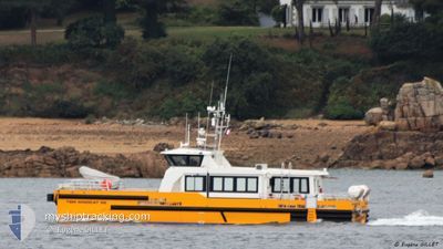
TSM WINDCAT 52
High speed craft
Current Trip
LZX/STB-OWF
| Time Travelled | --- |
|---|---|
| Remaining Time | --- |
| Distance Travelled | 3568.07 nm |
| Remaining Distance | --- |
| AVG Speed | 17.6 Knots |
| MAX Speed | 17.6 Knots |
| AVG Wind | 10.1 knots |
| MAX Wind | 25.8 knots |
| MIN Temp | 6.1°C / 42.98°F |
| MAX Temp | 19.2°C / 66.56°F |
| Draught | 2.5 m |
| Position Received | 8 h, 0 m ago |
Current Position
| Longitude | -2.96003° |
|---|---|
| Latitude | 48.89194° |
| Status | Under way using engine |
| Speed | 25.1 Knots |
| Course | 250.6° |
| Area | English Channel |
| Station | T-AIS |
| Position Received | 8 h, 0 m ago |
Info
Information
The current position of TSM WINDCAT 52 is in English Channel with coordinates 48.89194° / -2.96003° as reported on 2024-06-25 15:16 by AIS to our vessel tracker app. The vessel's current speed is 25.1 Knots
The vessel TSM WINDCAT 52 (IMO: 9957713, MMSI: 228414800) is a High speed craft It's sailing under the flag of [FR] France.
In this page you can find informations about the vessels current position, last detected port calls, and current voyage information. If the vessels is not in coverage by AIS you will find the latest position.
The current position of TSM WINDCAT 52 is detected by our AIS receivers and we are not responsible for the reliability of the data. The last position was recorded while the vessel was in Coverage by the Ais receivers of our vessel tracking app.
The current draught of TSM WINDCAT 52 as reported by AIS is 2.5 meters
Weather
| Temperature | 18.7°C / 65.66°F |
|---|---|
| Wind Speed | 9 knots |
| Direction | 8° N |
| Pressure | 1014.6 hPa |
| Humidity | 77.9 % |
| Cloud Coverage | 3 % |
Featured Company
Last Port Calls
Most Visited Ports (Last year)
| Port | Arrivals | |
|---|---|---|
| 1 |
Last Trips
| Origin | Departure | Destination | Arrival | Distance |
|---|
Events
| Time | Event | Details | Position / Dest | Info |
|---|---|---|---|---|
| 2024-06-25 15:24 | Status Changed | Default Under way using engine |
48.85986 / -3.02133
LZX/STB-OWF
|
Speed: 25.1 kn Course: 250.6° |
| 2024-06-25 15:16 | OUT of Coverage |
48.89194 / -2.96003
English Channel
LZX/STB-OWF
|
Speed: 25.1 kn Course: 250.6° |
|
| 2024-06-25 14:45 | ETA Changed | 2024/06/25 17:30 2024/06/25 09:00 |
48.85439 / -2.63069
LZX/STB-OWF
|
Speed: 26.6 kn Course: 289.4° |
| 2024-06-25 14:39 | START Moving | 15.12 nm, North East of SAINT QUAY PORTRIEUX |
48.83952 / -2.57193
LZX/STB-OWF
|
Speed: 14.5 kn Course: 298.5° |
| 2024-06-25 14:28 | STOP Moving | 15.16 nm, North East of SAINT QUAY PORTRIEUX |
48.83877 / -2.56896
LZX/STB-OWF
|
Speed: 0.2 kn Course: 317° |
| 2024-06-25 14:24 | Status Changed | Under way using engine Default |
48.84215 / -2.57741
LZX/STB-OWF
|
Speed: Course: 318° |
| 2024-06-25 14:24 | START Moving | 15.1 nm, North East of SAINT QUAY PORTRIEUX |
48.84215 / -2.57741
LZX/STB-OWF
|
Speed: 17 kn Course: 140.4° |
| 2024-06-25 14:16 | Status Changed | Default Under way using engine |
48.84556 / -2.57948
LZX/STB-OWF
|
Speed: 0.1 kn Course: 319° |
| 2024-06-25 14:07 | STOP Moving | 15.21 nm, North East of SAINT QUAY PORTRIEUX |
48.84559 / -2.57933
LZX/STB-OWF
|
Speed: 0.3 kn Course: 314° |
| 2024-06-25 14:03 | START Moving | 15.25 nm, North East of SAINT QUAY PORTRIEUX |
48.85114 / -2.58876
LZX/STB-OWF
|
Speed: 11.8 kn Course: 158.4° |