
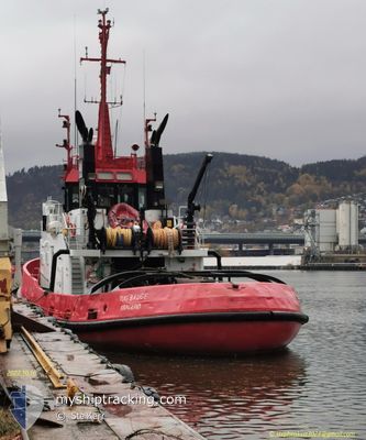
TUG BAUGE
Tug
Current Trip
| Time Travelled | 3 days |
|---|---|
| Remaining Time | 51 mins |
| Distance Travelled | 595.43 nm |
| Remaining Distance | 8.22 nm |
| AVG Speed | 8.4 Knots |
| MAX Speed | 13.6 Knots |
| AVG Wind | 15.5 knots |
| MAX Wind | 29 knots |
| MIN Temp | 9.5°C / 49.1°F |
| MAX Temp | 22.2°C / 71.96°F |
| Draught | 4.3 m |
| Position Received | Now |
Current Position
| Longitude | 9.44594° |
|---|---|
| Latitude | 58.77776° |
| Status | Under way using engine |
| Speed | 8 Knots |
| Course | 37° |
| Area | Skaggerak |
| Station | T-AIS |
| Position Received | Now |
Info
Information
The current position of TUG BAUGE is in Skaggerak with coordinates 58.77776° / 9.44594° as reported on 2024-06-02 14:07 by AIS to our vessel tracker app. The vessel's current speed is 8 Knots and is heading at the port of KRAGERO. The estimated time of arrival as calculated by vessel tracking app is 2024-06-02 14:59 LT
The vessel TUG BAUGE (IMO: 8027767, MMSI: 257541000) is a Tug that was built in 1981 ( 43 years old ). It's sailing under the flag of [NO] Norway.
In this page you can find informations about the vessels current position, last detected port calls, and current voyage information. If the vessels is not in coverage by AIS you will find the latest position.
The current position of TUG BAUGE is detected by our AIS receivers and we are not responsible for the reliability of the data. The last position was recorded while the vessel was in Coverage by the Ais receivers of our vessel tracking app.
The current draught of TUG BAUGE as reported by AIS is 4.3 meters
Weather
| Temperature | 16.6°C / 61.88°F |
|---|---|
| Wind Speed | 8 knots |
| Direction | 216° SW |
| Pressure | 1013.3 hPa |
| Humidity | 84.8 % |
| Cloud Coverage | 21 % |
Featured Company
Last Port Calls
| Port | Arrival | Departure | Time In Port |
|---|---|---|---|
| 2024-05-30 12:53 | 2024-05-30 13:22 | 28 m | |
| 2024-05-30 12:06 | 2024-05-30 12:49 | 43 m | |
| 2024-05-29 18:54 | 2024-05-29 19:32 | 38 m | |
| 2024-05-28 06:43 | 2024-05-29 16:22 | 1 d | |
| 2024-05-28 00:28 | 2024-05-28 01:34 | 1 h | |
| 2024-05-27 14:30 | 2024-05-27 16:52 | 2 h | |
| 2024-05-27 12:58 | 2024-05-27 13:34 | 36 m | |
| 2024-05-24 12:44 | 2024-05-27 12:22 | 2 d | |
| 2024-05-24 09:39 | 2024-05-24 10:09 | 30 m | |
| 2024-05-22 19:54 | 2024-05-23 16:55 | 21 h |
Last Trips
| Origin | Departure | Destination | Arrival | Distance | |
|---|---|---|---|---|---|
| 2024-05-30 14:49 | 2024-05-30 14:53 | 0.42 nm | |||
| 2024-05-29 21:32 | 2024-05-30 14:06 | 81.07 nm | |||
| 2024-05-29 18:22 | 2024-05-29 20:54 | 24.88 nm | |||
| 2024-05-28 03:34 | 2024-05-28 08:43 | 50.13 nm | |||
| 2024-05-27 18:52 | 2024-05-28 02:28 | 54.62 nm | |||
| 2024-05-27 15:34 | 2024-05-27 16:30 | 3.67 nm | |||
| 2024-05-27 14:22 | 2024-05-27 14:58 | 3.50 nm | |||
| 2024-05-24 12:09 | 2024-05-24 14:44 | 25.05 nm | |||
| 2024-05-23 18:55 | 2024-05-24 11:39 | 81.07 nm | |||
| 2024-05-22 07:55 | 2024-05-22 21:54 | 89.19 nm |
Events
| Time | Event | Details | Position / Dest | Info |
|---|---|---|---|---|
| 2024-06-02 05:41 | Destination Changed | KRAGERO KRISTIANSAND |
58.07646 / 8.07010
KRAGERO
|
Speed: 8.3 kn Course: 141° |
| 2024-06-02 05:13 | START Moving | 1.65 nm, North West of KYSTVEIEN |
58.13313 / 8.06470
KRISTIANSAND
|
Speed: 5.3 kn Course: 211° |
| 2024-06-02 04:53 | STOP Moving | 1.67 nm, North West of KYSTVEIEN |
58.13564 / 8.06782
KRISTIANSAND
|
Speed: 0.2 kn Course: 165° |
| 2024-06-02 00:58 | Change Sea Area | Norwegian part of the Skaggerak Norwegian part of the North Sea |
57.93322 / 7.11359
Skaggerak
KRISTIANSAND
|
Speed: 7.9 kn Course: 93° |
| 2024-06-01 09:29 | Destination Changed | KRISTIANSAND BREVIK |
59.87386 / 5.22848
KRISTIANSAND
|
Speed: 10.2 kn Course: 159° |
| 2024-06-01 09:29 | ETA Changed | 2024/06/02 07:00 2024/06/02 17:00 |
59.87386 / 5.22848
KRISTIANSAND
|
Speed: 10.2 kn Course: 159° |
| 2024-06-01 07:21 | ETA Changed | 2024/06/02 17:00 2025/05/30 15:00 |
60.18115 / 5.54526
BREVIK
|
Speed: 10.6 kn Course: 207° |
| 2024-06-01 07:15 | Destination Changed | BREVIK KRAGERO |
60.19697 / 5.55651
BREVIK
|
Speed: 10.8 kn Course: 198° |
| 2024-06-01 06:37 | Destination Changed | KRAGERO SAMNANGER |
60.30962 / 5.63558
KRAGERO
|
Speed: 12.8 kn Course: 194° |
| 2024-06-01 00:02 | ETA Changed | 2025/05/30 15:00 2024/05/30 15:00 |
59.73973 / 5.50610
SAMNANGER
|
Speed: 8.5 kn Course: 43° |