
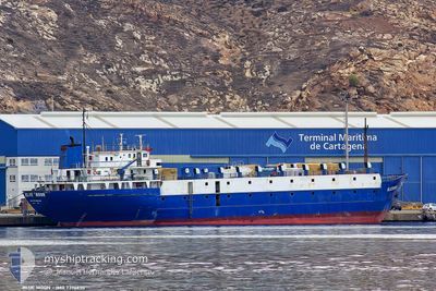
TULEEN
Livestock Carrier
Current Trip
| Time Travelled | 5 days |
|---|---|
| Remaining Time | --- |
| Distance Travelled | 1320.37 nm |
| Remaining Distance | --- |
| AVG Speed | 11.1 Knots |
| MAX Speed | 11.1 Knots |
| AVG Wind | 7.3 knots |
| MAX Wind | 17 knots |
| MIN Temp | 15.1°C / 59.18°F |
| MAX Temp | 31.3°C / 88.34°F |
| Draught | 4.3 m |
| Position Received | 1 m ago |
Current Position
| Longitude | 35.49080° |
|---|---|
| Latitude | 33.81824° |
| Status | Moored |
| Speed | |
| Course | 68° |
| Area | Mediterranean Sea - Eastern Basin |
| Station | T-AIS |
| Position Received | 1 m ago |
Info
Information
The current position of TULEEN is in Mediterranean Sea - Eastern Basin with coordinates 33.81824° / 35.49080° as reported on 2024-06-03 11:46 by AIS to our vessel tracker app. The vessel's current speed is 0 Knots
The vessel TULEEN (IMO: 7396630, MMSI: 511100448) is a Livestock Carrier that was built in 1975 ( 49 years old ). It's sailing under the flag of [PW] Palau.
In this page you can find informations about the vessels current position, last detected port calls, and current voyage information. If the vessels is not in coverage by AIS you will find the latest position.
The current position of TULEEN is detected by our AIS receivers and we are not responsible for the reliability of the data. The last position was recorded while the vessel was in Coverage by the Ais receivers of our vessel tracking app.
The current draught of TULEEN as reported by AIS is 4.3 meters
Weather
| Temperature | 31.1°C / 87.98°F |
|---|---|
| Wind Speed | 9 knots |
| Direction | 359° N |
| Pressure | 1010 hPa |
| Humidity | 34.6 % |
| Cloud Coverage | --- |
Featured Company
Events
| Time | Event | Details | Position / Dest | Info |
|---|---|---|---|---|
| 2024-06-03 11:31 | Status Changed | Moored Under way using engine |
33.81826 / 35.49079
ILHFA
|
Speed: Course: 68° |
| 2024-06-03 07:59 | STOP Moving | 6.14 nm, South of BEIRUT |
33.81825 / 35.49087
ILHFA
|
Speed: Course: 47° |
| 2024-06-03 07:41 | Change Sea Area | Lebanese part of the Mediterranean Sea - Eastern Basin Israeli part of the Mediterranean Sea - Eastern Basin |
33.79874 / 35.47706
Mediterranean Sea - Eastern Basin
ILHFA
|
Speed: 23.4 kn Course: 207.1° |
| 2024-06-03 07:37 | START Moving | 6.36 nm, South of BEIRUT |
33.81558 / 35.48727
ILHFA
|
Speed: 13.1 kn Course: 204.1° |
| 2024-06-03 07:35 | ETA Changed | 2024/06/03 11:00 2024/06/02 21:00 |
33.81826 / 35.49080
ILHFA
|
Speed: Course: 46° |
| 2024-06-03 07:10 | IN Coverage |
33.81826 / 35.49080
Mediterranean Sea - Eastern Basin
|
Speed: Course: 331.8° |
|
| 2024-06-03 01:42 | Status Changed | Default Under way using engine |
32.62582 / 34.39230
ILHFA
|
Speed: 1.1 kn Course: 100° |
| 2024-06-03 01:38 | OUT of Coverage |
32.62708 / 34.39191
Mediterranean Sea - Eastern Basin
|
Speed: 1.1 kn Course: 163.4° |
|
| 2024-06-03 01:36 | Status Changed | Under way using engine Default |
32.62769 / 34.39175
ILHFA
|
Speed: 1.5 kn Course: 104° |
| 2024-06-03 01:30 | Status Changed | Default Under way using engine |
32.62964 / 34.39132
ILHFA
|
Speed: 1.2 kn Course: 108° |