
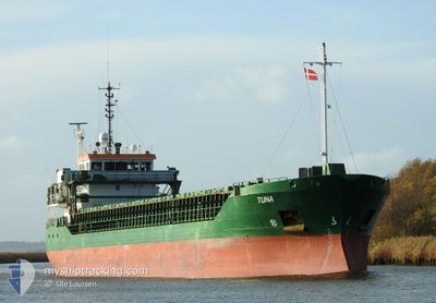
TUNA
General Cargo
Current Trip
LVSKU
| Time Travelled | 7 h, 49 mins |
|---|---|
| Remaining Time | --- |
| Distance Travelled | 31.11 nm |
| Remaining Distance | --- |
| AVG Speed | 9.5 Knots |
| MAX Speed | 9.8 Knots |
| AVG Wind | 10.7 knots |
| MAX Wind | 18.2 knots |
| MIN Temp | 15°C / 59°F |
| MAX Temp | 16.1°C / 60.98°F |
| Draught | 3.8 m |
| Position Received | 2 d ago |
Current Position
| Longitude | 20.05724° |
|---|---|
| Latitude | 59.56367° |
| Status | Under way using engine |
| Speed | 11.9 Knots |
| Course | 137.1° |
| Area | Baltic Sea |
| Station | T-AIS |
| Position Received | 2 d ago |
Info
Information
The current position of TUNA is in Baltic Sea with coordinates 59.56367° / 20.05724° as reported on 2024-06-21 02:54 by AIS to our vessel tracker app. The vessel's current speed is 11.9 Knots
The vessel TUNA (IMO: 9306691, MMSI: 244321000) is a General Cargo that was built in 2004 ( 20 years old ). It's sailing under the flag of [NL] Netherlands.
In this page you can find informations about the vessels current position, last detected port calls, and current voyage information. If the vessels is not in coverage by AIS you will find the latest position.
The current position of TUNA is detected by our AIS receivers and we are not responsible for the reliability of the data. The last position was recorded while the vessel was in Coverage by the Ais receivers of our vessel tracking app.
The current draught of TUNA as reported by AIS is 3.8 meters
Weather
| Temperature | 15.7°C / 60.26°F |
|---|---|
| Wind Speed | 17 knots |
| Direction | 87° E |
| Pressure | 1005.2 hPa |
| Humidity | 94.4 % |
| Cloud Coverage | 100 % |
Featured Company
Last Port Calls
| Port | Arrival | Departure | Time In Port |
|---|---|---|---|
| 2024-06-21 21:53 | 2024-06-22 19:25 | 21 h | |
| 2024-06-16 03:37 | 2024-06-16 16:03 | 12 h | |
| 2024-06-08 09:55 | 2024-06-09 08:34 | 22 h | |
| 2024-06-03 02:16 | 2024-06-05 15:09 | 2 d | |
| 2024-05-30 10:29 | 2024-06-01 09:11 | 1 d | |
| 2024-05-14 16:29 | 2024-05-15 15:02 | 22 h | |
| 2024-05-12 08:28 | 2024-05-12 19:36 | 11 h | |
| 2024-05-08 14:56 | 2024-05-09 08:48 | 17 h | |
| 2024-05-02 15:25 | 2024-05-03 18:05 | 1 d | |
| 2024-04-29 03:54 | 2024-04-30 14:12 | 1 d |
Most Visited Ports (Last year)
| Port | Arrivals | |
|---|---|---|
| 8 | ||
| 6 | ||
| 5 | ||
| 5 | ||
| 5 | ||
| 4 |
Last Trips
| Origin | Departure | Destination | Arrival | Distance | |
|---|---|---|---|---|---|
| 2024-06-16 18:03 | 2024-06-22 00:53 | 1063.24 nm | |||
| 2024-06-09 10:34 | 2024-06-16 05:37 | 836.24 nm | |||
| 2024-06-05 17:09 | 2024-06-08 11:55 | 221.31 nm | |||
| 2024-06-01 11:11 | 2024-06-03 04:16 | 318.22 nm | |||
| 2024-05-15 17:02 | 2024-05-30 12:29 | 1033.86 nm | |||
| 2024-05-12 21:36 | 2024-05-14 18:29 | 290.99 nm | |||
| 2024-05-09 11:48 | 2024-05-12 10:28 | 626.06 nm | |||
| 2024-05-03 20:05 | 2024-05-08 17:56 | 967.11 nm | |||
| 2024-04-30 16:12 | 2024-05-02 17:25 | 485.15 nm | |||
| 2024-04-22 17:40 | 2024-04-29 05:54 | 520.41 nm |
Events
| Time | Event | Details | Position / Dest | Info |
|---|---|---|---|---|
| 2024-06-22 19:25 | START Moving | 0.29 nm, West of SKULTE |
57.31736 / 24.39508
LVSKU
|
Speed: 6.6 kn Course: 278° |
| 2024-06-22 19:25 | PORT DEPARTURE |
|
57.31736 / 24.39508
LVSKU
|
Speed: 1.6 kn Course: 257° |
| 2024-06-21 22:01 | STOP Moving |
57.31750 / 24.40450
[LV] SKULTE
|
Speed: Course: 265° |
|
| 2024-06-21 21:53 | PORT ARRIVAL |
|
57.31697 / 24.40253
[LV] SKULTE
|
Speed: 7.3 kn Course: 101° |
| 2024-06-21 03:01 | Status Changed | Default Under way using engine |
59.54111 / 20.06590
LVSKU
|
Speed: 11.9 kn Course: 137.1° |
| 2024-06-21 02:54 | OUT of Coverage |
59.56367 / 20.05724
Baltic Sea
LVSKU
|
Speed: 11.9 kn Course: 137.1° |
|
| 2024-06-21 01:34 | Change Sea Area | Finnish part of the Baltic Sea Swedish part of the Baltic Sea |
59.75678 / 19.70883
Baltic Sea
LVSKU
|
Speed: 11.8 kn Course: 139.2° |
| 2024-06-21 01:16 | Detected in Sea | Swedish part of the Baltic Sea |
59.80233 / 19.63192
Baltic Sea
LVSKU
|
Speed: 12.1 kn Course: 140.8° |
| 2024-06-20 22:07 | Status Changed | Under way using engine Default |
60.30860 / 19.00220
LVSKU
|
Speed: 11.1 kn Course: 176° |
| 2024-06-20 22:05 | IN Coverage |
60.30860 / 19.00220
Gulf of Bothnia
LVSKU
|
Speed: 10.9 kn Course: 177.5° |