
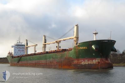
TUNDRA
Bulk Carrier
Current Trip
| Time Travelled | 4 days |
|---|---|
| Remaining Time | --- |
| Distance Travelled | 1279.95 nm |
| Remaining Distance | --- |
| AVG Speed | 10.7 Knots |
| MAX Speed | 17.9 Knots |
| AVG Wind | 14.4 knots |
| MAX Wind | 28.9 knots |
| MIN Temp | 6.3°C / 43.34°F |
| MAX Temp | 21.3°C / 70.34°F |
| Draught | 8.2 m |
| Position Received | 4 d ago |
Current Position
| Longitude | -70.66216° |
|---|---|
| Latitude | 47.15693° |
| Status | Under way using engine |
| Speed | 14.4 Knots |
| Course | 33.1° |
| Area | Gulf of St-Lawrence |
| Station | T-AIS |
| Position Received | 4 d ago |
Info
Information
The current position of TUNDRA is in Gulf of St-Lawrence with coordinates 47.15693° / -70.66216° as reported on 2024-05-28 16:21 by AIS to our vessel tracker app. The vessel's current speed is 14.4 Knots and is heading at the port of ARATU. The estimated time of arrival as calculated by vessel tracking app is 2024-06-14 01:00 LT
The vessel TUNDRA (IMO: 9415208, MMSI: 209015000) is a Bulk Carrier that was built in 2009 ( 15 years old ). It's sailing under the flag of [CY] Cyprus.
In this page you can find informations about the vessels current position, last detected port calls, and current voyage information. If the vessels is not in coverage by AIS you will find the latest position.
The current position of TUNDRA is detected by our AIS receivers and we are not responsible for the reliability of the data. The last position was recorded while the vessel was in Coverage by the Ais receivers of our vessel tracking app.
The current draught of TUNDRA as reported by AIS is 8.2 meters
Weather
| Temperature | 20.3°C / 68.54°F |
|---|---|
| Wind Speed | 20 knots |
| Direction | 188° S |
| Pressure | 1010.2 hPa |
| Humidity | 92.5 % |
| Cloud Coverage | 100 % |
Featured Company
Last Port Calls
| Port | Arrival | Departure | Time In Port |
|---|---|---|---|
| 2024-05-26 10:15 | 2024-05-28 03:02 | 1 d | |
| 2024-05-25 01:29 | 2024-05-25 02:15 | 45 m | |
| 2024-05-22 15:17 | 2024-05-22 16:25 | 1 h | |
| 2024-05-20 05:05 | 2024-05-21 16:41 | 1 d | |
| 2024-05-16 23:43 | 2024-05-17 01:37 | 1 h | |
| 2024-05-11 12:27 | 2024-05-16 19:34 | 5 d | |
| 2024-05-09 23:13 | 2024-05-10 00:38 | 1 h | |
| 2024-05-02 16:32 | 2024-05-09 02:41 | 6 d | |
| 2024-04-06 20:31 | 2024-04-14 07:57 | 7 d |
Most Visited Ports (Last year)
| Port | Arrivals | |
|---|---|---|
| 6 | ||
| 4 | ||
| 3 | ||
| 2 | ||
| 2 | ||
| 2 |
Last Trips
| Origin | Departure | Destination | Arrival | Distance | |
|---|---|---|---|---|---|
| 2024-05-24 22:15 | 2024-05-26 06:15 | 296.34 nm | |||
| 2024-05-22 12:25 | 2024-05-24 21:29 | 524.99 nm | |||
| 2024-05-21 12:41 | 2024-05-22 11:17 | 236.76 nm | |||
| 2024-05-16 21:37 | 2024-05-20 01:05 | 760.33 nm | |||
| 2024-05-16 15:34 | 2024-05-16 19:43 | 24.27 nm | |||
| 2024-05-09 20:38 | 2024-05-11 08:27 | 295.78 nm | |||
| 2024-05-08 22:41 | 2024-05-09 19:13 | 137.44 nm | |||
| 2024-04-14 04:57 | 2024-05-02 12:32 | 4295.89 nm | |||
| 2024-03-14 20:45 | 2024-04-06 17:31 | 3092.85 nm |
Events
| Time | Event | Details | Position / Dest | Info |
|---|---|---|---|---|
| 2024-05-28 16:43 | Status Changed | Default Under way using engine |
47.23000 / -70.57833
ARATU BRAZIL
|
Speed: 14.4 kn Course: 33.1° |
| 2024-05-28 16:21 | OUT of Coverage |
47.15693 / -70.66216
Gulf of St-Lawrence
ARATU BRAZIL
|
Speed: 14.4 kn Course: 33.1° |
|
| 2024-05-28 15:01 | Status Changed | Under way using engine Default |
46.90131 / -70.89465
ARATU BRAZIL
|
Speed: 12 kn Course: 49° |
| 2024-05-28 14:56 | Status Changed | Default Under way using engine |
46.89092 / -70.91271
ARATU BRAZIL
|
Speed: 11.7 kn Course: 55° |
| 2024-05-28 14:38 | Status Changed | Under way using engine Default |
46.85852 / -70.98133
ARATU BRAZIL
|
Speed: 10.5 kn Course: 66° |
| 2024-05-28 14:35 | Status Changed | Default Under way using engine |
46.85561 / -70.99046
ARATU BRAZIL
|
Speed: 10.2 kn Course: 74.1° |
| 2024-05-28 12:51 | Status Changed | Under way using engine Default |
46.74559 / -71.28714
ARATU BRAZIL
|
Speed: 7.6 kn Course: 73° |
| 2024-05-28 12:51 | IN Coverage |
46.74739 / -71.28116
Gulf of St-Lawrence
ARATU BRAZIL
|
Speed: 6.9 kn Course: 62.2° |
|
| 2024-05-28 07:03 | Status Changed | Default Under way using engine |
46.25443 / -72.72330
ARATU BRAZIL
|
Speed: 12.7 kn Course: 56.9° |
| 2024-05-28 06:58 | OUT of Coverage |
46.24497 / -72.74442
Gulf of St-Lawrence
ARATU BRAZIL
|
Speed: 12.7 kn Course: 56.9° |