
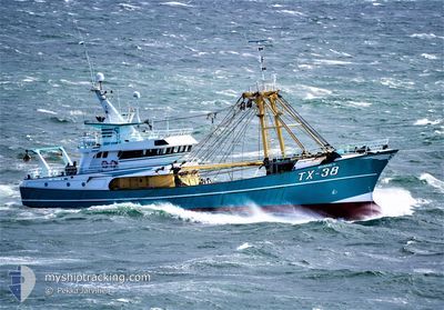
TX-38
Trawler
Current Trip
| Trip Time | 10 h, 49 mins |
|---|---|
| Trip Distance | 51.38 nm |
| AVG Speed | 9.7 Knots |
| MAX Speed | 11.2 Knots |
| Draught | 5 m |
| AVG Wind | 8.7 knots |
| MAX Wind | 11.5 knots |
| MIN Temp | 13°C / 55.4°F |
| MAX Temp | 14.6°C / 58.28°F |
| Position Received | Now |
Current Position
| Longitude | 3.59019° |
|---|---|
| Latitude | 51.44427° |
| Status | Under way using engine |
| Speed | |
| Course | 291° |
| Area | North Sea |
| Station | T-AIS |
| Position Received | Now |
Info
Information
The current position of TX-38 is in North Sea with coordinates 51.44427° / 3.59019° as reported on 2024-05-25 19:32 by AIS to our vessel tracker app. The vessel's current speed is 0 Knots and is currently inside the port of VLISSINGEN STATION.
The vessel TX-38 (IMO: 9225639, MMSI: 246485000) is a Trawler that was built in 2000 ( 24 years old ). It's sailing under the flag of [NL] Netherlands.
In this page you can find informations about the vessels current position, last detected port calls, and current voyage information. If the vessels is not in coverage by AIS you will find the latest position.
The current position of TX-38 is detected by our AIS receivers and we are not responsible for the reliability of the data. The last position was recorded while the vessel was in Coverage by the Ais receivers of our vessel tracking app.
The current draught of TX-38 as reported by AIS is 5 meters
Weather
| Temperature | 13.9°C / 57.02°F |
|---|---|
| Wind Speed | 3 knots |
| Direction | 247° WSW |
| Pressure | 1015.7 hPa |
| Humidity | 81.1 % |
| Cloud Coverage | 9 % |
Featured Company
Last Port Calls
| Port | Arrival | Departure | Time In Port |
|---|---|---|---|
| 2024-05-23 19:23 | |||
| 2024-05-21 07:45 | 2024-05-23 08:34 | 2 d | |
| 2024-05-16 21:50 | 2024-05-19 19:35 | 2 d | |
| 2024-05-09 19:57 | 2024-05-12 20:32 | 3 d | |
| 2024-05-02 22:19 | 2024-05-05 20:14 | 2 d | |
| 2024-04-25 18:58 | 2024-04-28 20:16 | 3 d | |
| 2024-04-18 20:14 | 2024-04-21 20:20 | 3 d | |
| 2024-04-11 19:39 | 2024-04-14 20:46 | 3 d | |
| 2024-04-05 00:51 | 2024-04-07 20:24 | 2 d | |
| 2024-04-01 21:47 |
Most Visited Ports (Last year)
| Port | Arrivals | |
|---|---|---|
| 44 |
Last Trips
| Origin | Departure | Destination | Arrival | Distance | |
|---|---|---|---|---|---|
| 2024-05-23 10:34 | 2024-05-23 21:23 | 51.38 nm | |||
| 2024-05-19 21:35 | 2024-05-21 09:45 | 204.56 nm | |||
| 2024-05-12 22:32 | 2024-05-16 23:50 | 150.21 nm | |||
| 2024-05-05 22:14 | 2024-05-09 21:57 | 152.36 nm | |||
| 2024-04-28 22:16 | 2024-05-03 00:19 | 187.11 nm | |||
| 2024-04-21 22:20 | 2024-04-25 20:58 | 140.40 nm | |||
| 2024-04-14 22:46 | 2024-04-18 22:14 | 172.13 nm | |||
| 2024-04-07 22:24 | 2024-04-11 21:39 | 141.60 nm | |||
| 2024-04-01 23:47 | 2024-04-05 02:51 | 474.22 nm |
Events
| Time | Event | Details | Position / Dest | Info |
|---|---|---|---|---|
| 2024-05-23 19:24 | STOP Moving |
51.44369 / 3.59092
[NL] VLISSINGEN STATION
|
Speed: 0.3 kn Course: 196° |
|
| 2024-05-23 19:23 | PORT ARRIVAL |
|
51.44369 / 3.59092
[NL] VLISSINGEN STATION
|
Speed: 1.3 kn Course: 217° |
| 2024-05-23 19:21 | START Moving | 0.29 nm, South East of VLISSINGEN STATION |
51.44306 / 3.59410
FISHINGGROUNDS
|
Speed: 3.8 kn Course: 292° |
| 2024-05-23 18:53 | STOP Moving | 0.42 nm, South East of VLISSINGEN STATION |
51.44218 / 3.59800
FISHINGGROUNDS
|
Speed: 0.3 kn Course: 253° |
| 2024-05-23 13:56 | Change Sea Area | Dutch part of the North Sea United Kingdom part of the North Sea |
51.90286 / 2.58166
North Sea
|
Speed: 9 kn Course: 115.8° |
| 2024-05-23 13:50 | Detected in Sea | United Kingdom part of the North Sea |
51.90915 / 2.56110
North Sea
|
Speed: 9 kn Course: 115.2° |
| 2024-05-23 13:50 | IN Coverage |
51.90915 / 2.56110
North Sea
|
Speed: 9 kn Course: 115.2° |
|
| 2024-05-23 08:34 | PORT DEPARTURE |
|
51.90915 / 2.56110
FISHINGGROUNDS
|
Speed: Course: 12° |
| 2024-05-21 07:45 | OUT of Coverage |
51.44558 / 3.58921
North Sea
[NL] VLISSINGEN STATION
|
Speed: Course: 1.4° |
|
| 2024-05-21 07:45 | IN Coverage |
51.44558 / 3.58921
North Sea
[NL] VLISSINGEN STATION
|
Speed: Course: 1.4° |