
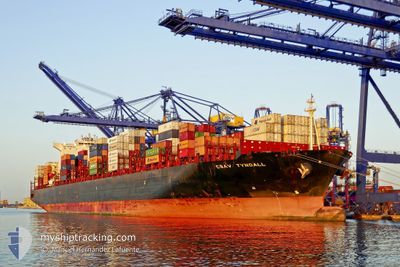
TYNDALL
Container Ship
Current Trip
KR PUS>PA CANAL
| Time Travelled | 15 days |
|---|---|
| Remaining Time | --- |
| Distance Travelled | 6540.81 nm |
| Remaining Distance | --- |
| AVG Speed | 17.4 Knots |
| MAX Speed | 19.7 Knots |
| AVG Wind | 12.1 knots |
| MAX Wind | 27.8 knots |
| MIN Temp | 2.7°C / 36.86°F |
| MAX Temp | 27.6°C / 81.68°F |
| Draught | 12.4 m |
| Position Received | 11 h, 13 m ago |
Current Position
| Longitude | -106.35876° |
|---|---|
| Latitude | 19.01682° |
| Status | Under way using engine |
| Speed | 17.8 Knots |
| Course | 126.7° |
| Area | North Pacific Ocean |
| Station | T-AIS |
| Position Received | 11 h, 13 m ago |
Info
Information
The current position of TYNDALL is in North Pacific Ocean with coordinates 19.01682° / -106.35876° as reported on 2024-05-26 14:11 by AIS to our vessel tracker app. The vessel's current speed is 17.8 Knots
The vessel TYNDALL (IMO: 9627928, MMSI: 636016321) is a Container Ship that was built in 2013 ( 11 years old ). It's sailing under the flag of [LR] Liberia.
In this page you can find informations about the vessels current position, last detected port calls, and current voyage information. If the vessels is not in coverage by AIS you will find the latest position.
The current position of TYNDALL is detected by our AIS receivers and we are not responsible for the reliability of the data. The last position was recorded while the vessel was in Coverage by the Ais receivers of our vessel tracking app.
The current draught of TYNDALL as reported by AIS is 12.4 meters
Weather
| Temperature | 27.4°C / 81.32°F |
|---|---|
| Wind Speed | 8 knots |
| Direction | 244° WSW |
| Pressure | 1010.1 hPa |
| Humidity | 70 % |
| Cloud Coverage | 99 % |
Featured Company
Last Port Calls
| Port | Arrival | Departure | Time In Port |
|---|---|---|---|
| 2024-05-09 19:50 | 2024-05-11 10:48 | 1 d | |
| 2024-05-05 01:00 | 2024-05-06 02:05 | 1 d | |
| 2024-04-08 12:16 | 2024-04-09 12:31 | 1 d | |
| 2024-04-02 07:32 | 2024-04-04 13:09 | 2 d | |
| 2024-03-30 10:51 | 2024-03-31 10:43 | 23 h | |
| 2024-03-24 21:10 | 2024-03-26 23:28 | 2 d |
Last Trips
| Origin | Departure | Destination | Arrival | Distance | |
|---|---|---|---|---|---|
| 2024-05-06 10:05 | 2024-05-10 04:50 | 1178.16 nm | |||
| 2024-04-09 07:31 | 2024-05-05 09:00 | 9584.20 nm | |||
| 2024-04-04 09:09 | 2024-04-08 07:16 | 1288.98 nm | |||
| 2024-03-31 05:43 | 2024-04-02 03:32 | 388.28 nm | |||
| 2024-03-26 18:28 | 2024-03-30 05:51 | 531.95 nm | |||
| 2024-02-25 21:32 | 2024-03-24 16:10 | 10648.22 nm |
Events
| Time | Event | Details | Position / Dest | Info |
|---|---|---|---|---|
| 2024-05-26 14:14 | Status Changed | Default Under way using engine |
19.00716 / -106.34556
KR PUS>PA CANAL
|
Speed: 17.8 kn Course: 126.7° |
| 2024-05-26 14:11 | OUT of Coverage |
19.01682 / -106.35876
North Pacific Ocean
KR PUS>PA CANAL
|
Speed: 17.8 kn Course: 126.7° |
|
| 2024-05-26 14:05 | Status Changed | Under way using engine Default |
19.03217 / -106.37996
KR PUS>PA CANAL
|
Speed: 17.6 kn Course: 127° |
| 2024-05-26 13:25 | Status Changed | Default Under way using engine |
19.15259 / -106.54700
KR PUS>PA CANAL
|
Speed: 18.2 kn Course: 128.1° |
| 2024-05-26 13:14 | Status Changed | Under way using engine Default |
19.18855 / -106.59680
KR PUS>PA CANAL
|
Speed: 18.2 kn Course: 129° |
| 2024-05-26 13:10 | Status Changed | Default Under way using engine |
19.20044 / -106.61285
KR PUS>PA CANAL
|
Speed: 18.1 kn Course: 127.7° |
| 2024-05-26 11:51 | Status Changed | Under way using engine Default |
19.44881 / -106.94021
KR PUS>PA CANAL
|
Speed: 18.5 kn Course: 128° |
| 2024-05-26 11:09 | Status Changed | Default Under way using engine |
19.57953 / -107.12205
KR PUS>PA CANAL
|
Speed: 18.3 kn Course: 127.8° |
| 2024-05-26 11:06 | Status Changed | Under way using engine Default |
19.59006 / -107.13671
KR PUS>PA CANAL
|
Speed: 18.5 kn Course: 126° |
| 2024-05-26 11:03 | Status Changed | Default Under way using engine |
19.59997 / -107.15043
KR PUS>PA CANAL
|
Speed: 18.5 kn Course: 127.7° |