
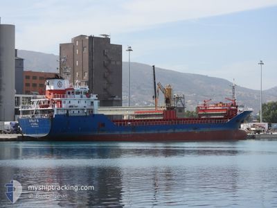
UGURS
General Cargo
Current Trip
| Time Travelled | 3 days |
|---|---|
| Remaining Time | 23 h, 35 mins |
| Distance Travelled | 666.71 nm |
| Remaining Distance | 186.83 nm |
| AVG Speed | 8.7 Knots |
| MAX Speed | 9.8 Knots |
| AVG Wind | 8.5 knots |
| MAX Wind | 15.1 knots |
| MIN Temp | 17.6°C / 63.68°F |
| MAX Temp | 23°C / 73.4°F |
| Draught | 6.1 m |
| Position Received | 26 m ago |
Current Position
| Longitude | 26.09086° |
|---|---|
| Latitude | 39.83317° |
| Status | Under way using engine |
| Speed | 7.9 Knots |
| Course | 339.9° |
| Area | Aegean Sea |
| Station | T-AIS |
| Position Received | 26 m ago |
Info
Information
The current position of UGURS is in Aegean Sea with coordinates 39.83317° / 26.09086° as reported on 2024-06-01 02:19 by AIS to our vessel tracker app. The vessel's current speed is 7.9 Knots and is heading at the port of DILISKELESI. The estimated time of arrival as calculated by vessel tracking app is 2024-06-02 02:21 LT
The vessel UGURS (IMO: 9539793, MMSI: 271040150) is a General Cargo that was built in 2010 ( 14 years old ). It's sailing under the flag of [TR] Turkey.
In this page you can find informations about the vessels current position, last detected port calls, and current voyage information. If the vessels is not in coverage by AIS you will find the latest position.
The current position of UGURS is detected by our AIS receivers and we are not responsible for the reliability of the data. The last position was recorded while the vessel was in Coverage by the Ais receivers of our vessel tracking app.
The current draught of UGURS as reported by AIS is 6.1 meters
Weather
| Temperature | 20°C / 68°F |
|---|---|
| Wind Speed | 8 knots |
| Direction | 147° SSE |
| Pressure | 1015.7 hPa |
| Humidity | 76.6 % |
| Cloud Coverage | --- |
Featured Company
Last Port Calls
| Port | Arrival | Departure | Time In Port |
|---|---|---|---|
| 2024-05-26 04:12 | 2024-05-28 22:57 | 2 d | |
| 2024-05-20 00:23 | 2024-05-23 20:25 | 3 d | |
| 2024-05-09 10:23 | 2024-05-13 21:45 | 4 d | |
| 2024-05-04 07:34 | 2024-05-05 22:06 | 1 d | |
| 2024-04-27 05:24 | 2024-04-30 09:03 | 3 d | |
| 2024-04-24 13:27 | 2024-04-25 21:30 | 1 d | |
| 2024-04-22 02:22 | 2024-04-22 20:28 | 18 h | |
| 2024-04-12 03:14 | 2024-04-15 11:58 | 3 d | |
| 2024-04-09 00:06 | 2024-04-11 12:25 | 2 d | |
| 2024-04-08 06:54 |
Most Visited Ports (Last year)
| Port | Arrivals | |
|---|---|---|
| 5 | ||
| 4 | ||
| 4 | ||
| 3 | ||
| 3 | ||
| 3 |
Last Trips
| Origin | Departure | Destination | Arrival | Distance | |
|---|---|---|---|---|---|
| 2024-05-23 22:25 | 2024-05-26 07:12 | 473.50 nm | |||
| 2024-05-14 00:45 | 2024-05-20 02:23 | 757.12 nm | |||
| 2024-05-06 01:06 | 2024-05-09 13:23 | 90.29 nm | |||
| 2024-04-30 12:03 | 2024-05-04 10:34 | 202.67 nm | |||
| 2024-04-26 00:30 | 2024-04-27 08:24 | 215.66 nm | |||
| 2024-04-22 23:28 | 2024-04-24 16:27 | 247.75 nm | |||
| 2024-04-15 13:58 | 2024-04-22 05:22 | 1277.48 nm | |||
| 2024-04-11 14:25 | 2024-04-12 05:14 | 142.11 nm | |||
| 2024-04-01 18:53 | 2024-04-09 02:06 | 1439.21 nm | |||
| 2024-04-01 18:53 | 2024-04-08 08:54 | 1434.73 nm |
Events
| Time | Event | Details | Position / Dest | Info |
|---|---|---|---|---|
| 2024-06-01 02:30 | Status Changed | Default Under way using engine |
39.85500 / 26.08833
DILISKELESI
|
Speed: 7.9 kn Course: 339.9° |
| 2024-06-01 02:13 | Status Changed | Under way using engine Default |
39.82097 / 26.09577
DILISKELESI
|
Speed: 7 kn Course: 10° |
| 2024-06-01 02:13 | IN Coverage |
39.82097 / 26.09577
Aegean Sea
DILISKELESI
|
Speed: 7.5 kn Course: 347.8° |
|
| 2024-06-01 01:03 | Status Changed | Default Under way using engine |
39.68333 / 26.02500
DILISKELESI
|
Speed: 8.7 kn Course: 24.4° |
| 2024-06-01 01:01 | OUT of Coverage |
39.67923 / 26.02376
Aegean Sea
DILISKELESI
|
Speed: 8.7 kn Course: 24.4° |
|
| 2024-06-01 00:56 | Status Changed | Under way using engine Default |
39.66750 / 26.01651
DILISKELESI
|
Speed: 8.8 kn Course: 25° |
| 2024-06-01 00:29 | Status Changed | Default Under way using engine |
39.60852 / 25.98036
DILISKELESI
|
Speed: 8.7 kn Course: 23.7° |
| 2024-05-31 23:56 | Status Changed | Under way using engine Default |
39.53373 / 25.94008
DILISKELESI
|
Speed: 8.9 kn Course: 23° |
| 2024-05-31 23:50 | Status Changed | Default Under way using engine |
39.51919 / 25.93216
DILISKELESI
|
Speed: 8.9 kn Course: 23.7° |
| 2024-05-31 23:49 | Detected in Sea | Turkish part of the Aegean Sea |
39.51689 / 25.93087
Aegean Sea
DILISKELESI
|
Speed: 8.9 kn Course: 23.7° |