
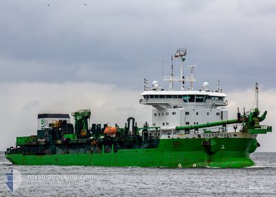
UILENSPIEGEL
Trailing Suction Hopper Dredger
Current Trip
EGAKI DREDGING
| Time Travelled | --- |
|---|---|
| Remaining Time | --- |
| Distance Travelled | 644.94 nm |
| Remaining Distance | --- |
| AVG Speed | 7.2 Knots |
| MAX Speed | 7.2 Knots |
| AVG Wind | 9.6 knots |
| MAX Wind | 18.9 knots |
| MIN Temp | 15.4°C / 59.72°F |
| MAX Temp | 34.8°C / 94.64°F |
| Draught | 9.8 m |
| Position Received | 4 h, 1 m ago |
Current Position
| Longitude | 30.07725° |
|---|---|
| Latitude | 31.35738° |
| Status | Restricted manoeuverability |
| Speed | 0.4 Knots |
| Course | 97° |
| Area | Mediterranean Sea - Eastern Basin |
| Station | T-AIS |
| Position Received | 4 h, 1 m ago |
Info
Information
The current position of UILENSPIEGEL is in Mediterranean Sea - Eastern Basin with coordinates 31.35738° / 30.07725° as reported on 2024-05-17 03:32 by AIS to our vessel tracker app. The vessel's current speed is 0.4 Knots
The vessel UILENSPIEGEL (IMO: 9247467, MMSI: 205146000) is a Trailing Suction Hopper Dredger that was built in 2002 ( 22 years old ). It's sailing under the flag of [BE] Belgium.
In this page you can find informations about the vessels current position, last detected port calls, and current voyage information. If the vessels is not in coverage by AIS you will find the latest position.
The current position of UILENSPIEGEL is detected by our AIS receivers and we are not responsible for the reliability of the data. The last position was recorded while the vessel was in Coverage by the Ais receivers of our vessel tracking app.
The current draught of UILENSPIEGEL as reported by AIS is 9.8 meters
Weather
| Temperature | 26.6°C / 79.88°F |
|---|---|
| Wind Speed | 4 knots |
| Direction | 169° S |
| Pressure | 1018.3 hPa |
| Humidity | 37 % |
| Cloud Coverage | --- |
Featured Company
Last Port Calls
Most Visited Ports (Last year)
| Port | Arrivals | |
|---|---|---|
| 302 | ||
| 1 |
Last Trips
| Origin | Departure | Destination | Arrival | Distance |
|---|
Events
| Time | Event | Details | Position / Dest | Info |
|---|---|---|---|---|
| 2024-05-17 07:28 | STOP Moving | 2.52 nm, North of ABU QIR |
31.35676 / 30.07683
EGAKI DREDGING
|
Speed: 0.3 kn Course: 108° |
| 2024-05-17 06:52 | START Moving | 1.82 nm, North of ABU QIR |
31.34515 / 30.07944
EGAKI DREDGING
|
Speed: 10.9 kn Course: 56° |
| 2024-05-17 05:44 | STOP Moving | 1.61 nm, North of ABU QIR |
31.34063 / 30.07257
EGAKI DREDGING
|
Speed: Course: 160° |
| 2024-05-17 05:27 | START Moving | 2.14 nm, North of ABU QIR |
31.35055 / 30.08341
EGAKI DREDGING
|
Speed: 7.2 kn Course: 172° |
| 2024-05-17 03:40 | Status Changed | Default Restricted manoeuverability |
31.35719 / 30.07698
EGAKI DREDGING
|
Speed: 0.4 kn Course: 97° |
| 2024-05-17 03:32 | OUT of Coverage |
31.35738 / 30.07725
Mediterranean Sea - Eastern Basin
|
Speed: 0.4 kn Course: 97° |
|
| 2024-05-17 03:05 | Status Changed | Restricted manoeuverability Default |
31.35792 / 30.07725
EGAKI DREDGING
|
Speed: 0.1 kn Course: 96° |
| 2024-05-17 02:48 | STOP Moving | 2.58 nm, North of ABU QIR |
31.35783 / 30.07732
EGAKI DREDGING
|
Speed: 0.1 kn Course: 101° |
| 2024-05-17 02:45 | Status Changed | Default Restricted manoeuverability |
31.35803 / 30.07750
EGAKI DREDGING
|
Speed: 10.8 kn Course: 342.5° |
| 2024-05-17 02:37 | Status Changed | Restricted manoeuverability Default |
31.34760 / 30.08220
EGAKI DREDGING
|
Speed: 2 kn Course: 144° |