
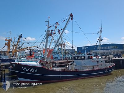
UK168 KEES KORF
Fishing
Current Trip
| Time Travelled | 2 days |
|---|---|
| Remaining Time | 20 h, 56 mins |
| Distance Travelled | 204.89 nm |
| Remaining Distance | 44.43 nm |
| AVG Speed | 3.8 Knots |
| MAX Speed | 8.4 Knots |
| AVG Wind | 9.6 knots |
| MAX Wind | 13 knots |
| MIN Temp | 15.9°C / 60.62°F |
| MAX Temp | 19.4°C / 66.92°F |
| Draught | 0 m |
| Position Received | 1 m ago |
Current Position
| Longitude | 5.40900° |
|---|---|
| Latitude | 53.45657° |
| Status | Engaged in Fishing |
| Speed | 2.1 Knots |
| Course | 74° |
| Area | North Sea |
| Station | T-AIS |
| Position Received | 1 m ago |
Info
Information
The current position of UK168 KEES KORF is in North Sea with coordinates 53.45657° / 5.40900° as reported on 2024-06-27 03:16 by AIS to our vessel tracker app. The vessel's current speed is 2.1 Knots and is heading at the port of DEN HELDER. The estimated time of arrival as calculated by vessel tracking app is 2024-06-28 00:13 LT
The vessel UK168 KEES KORF (IMO: 8432182, MMSI: 245572000) is a Fishing It's sailing under the flag of [NL] Netherlands.
In this page you can find informations about the vessels current position, last detected port calls, and current voyage information. If the vessels is not in coverage by AIS you will find the latest position.
The current position of UK168 KEES KORF is detected by our AIS receivers and we are not responsible for the reliability of the data. The last position was recorded while the vessel was in Coverage by the Ais receivers of our vessel tracking app.
Weather
| Temperature | 18.3°C / 64.94°F |
|---|---|
| Wind Speed | 6 knots |
| Direction | 166° SSE |
| Pressure | 1007.4 hPa |
| Humidity | 87.6 % |
| Cloud Coverage | 4 % |
Featured Company
Last Port Calls
| Port | Arrival | Departure | Time In Port |
|---|---|---|---|
| 2024-06-21 06:43 | 2024-06-24 08:19 | 3 d | |
| 2024-06-20 04:44 | 2024-06-20 15:37 | 10 h | |
| 2024-06-14 08:19 | 2024-06-17 08:04 | 2 d | |
| 2024-06-06 10:12 | 2024-06-13 05:32 | 6 d | |
| 2024-05-31 06:36 | 2024-06-03 08:03 | 3 d | |
| 2024-05-29 08:40 | 2024-05-29 13:32 | 4 h | |
| 2024-05-24 07:17 | 2024-05-27 00:09 | 2 d | |
| 2024-05-22 04:00 | 2024-05-22 14:25 | 10 h | |
| 2024-05-17 08:44 | 2024-05-21 07:04 | 3 d | |
| 2024-04-26 16:43 | 2024-05-16 09:05 | 19 d |
Most Visited Ports (Last year)
| Port | Arrivals | |
|---|---|---|
| 28 | ||
| 19 | ||
| 5 | ||
| 3 | ||
| 1 | ||
| 1 |
Last Trips
| Origin | Departure | Destination | Arrival | Distance | |
|---|---|---|---|---|---|
| 2024-06-20 17:37 | 2024-06-21 08:43 | 50.05 nm | |||
| 2024-06-17 10:04 | 2024-06-20 06:44 | 150.95 nm | |||
| 2024-06-13 07:32 | 2024-06-14 10:19 | 69.38 nm | |||
| 2024-06-03 10:03 | 2024-06-06 12:12 | 136.20 nm | |||
| 2024-05-29 15:32 | 2024-05-31 08:36 | 139.28 nm | |||
| 2024-05-27 02:09 | 2024-05-29 10:40 | 85.61 nm | |||
| 2024-05-22 16:25 | 2024-05-24 09:17 | 125.91 nm | |||
| 2024-05-21 09:04 | 2024-05-22 06:00 | 80.38 nm | |||
| 2024-05-16 11:05 | 2024-05-17 10:44 | 115.16 nm | |||
| 2024-04-26 13:11 | 2024-04-26 18:43 | 39.03 nm |
Events
| Time | Event | Details | Position / Dest | Info |
|---|---|---|---|---|
| 2024-06-26 23:03 | START Moving | 10.35 nm, North East of TERSCHELLING |
53.46637 / 5.43965
FISHING GROUNDS
|
Speed: 4.3 kn Course: 234° |
| 2024-06-26 22:59 | STOP Moving | 10.47 nm, North East of TERSCHELLING |
53.46782 / 5.44191
FISHING GROUNDS
|
Speed: 0.3 kn Course: 221° |
| 2024-06-26 17:32 | START Moving | 7.67 nm, North East of TERSCHELLING |
53.45092 / 5.36117
FISHING GROUNDS
|
Speed: 3.2 kn Course: 245° |
| 2024-06-26 17:26 | STOP Moving | 7.5 nm, North East of TERSCHELLING |
53.44899 / 5.35748
FISHING GROUNDS
|
Speed: 0.3 kn Course: 236° |
| 2024-06-26 05:57 | START Moving | 6.72 nm, North West of AMELAND |
53.51275 / 5.61060
FISHING GROUNDS
|
Speed: 3.1 kn Course: 219° |
| 2024-06-26 05:49 | STOP Moving | 6.69 nm, North West of AMELAND |
53.51077 / 5.60871
FISHING GROUNDS
|
Speed: 0.3 kn Course: 88° |
| 2024-06-25 23:58 | START Moving | 10.31 nm, West of AMELAND |
53.45660 / 5.46191
FISHING GROUNDS
|
Speed: 4.7 kn Course: 83° |
| 2024-06-25 23:54 | STOP Moving | 10.42 nm, West of AMELAND |
53.45632 / 5.45880
FISHING GROUNDS
|
Speed: 0.2 kn Course: 79° |
| 2024-06-25 10:45 | START Moving | 9.74 nm, North East of TERSCHELLING |
53.44330 / 5.44674
FISHING GROUNDS
|
Speed: 3.3 kn Course: 255° |
| 2024-06-25 10:36 | STOP Moving | 9.51 nm, North East of TERSCHELLING |
53.44227 / 5.44016
FISHING GROUNDS
|
Speed: 0.1 kn Course: 253° |