
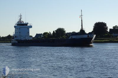
ULRIKE G
General Cargo
Current Trip
EG ALY
| Time Travelled | 1 day |
|---|---|
| Remaining Time | --- |
| Distance Travelled | 6.51 nm |
| Remaining Distance | --- |
| AVG Speed | 7.6 Knots |
| MAX Speed | 9.4 Knots |
| AVG Wind | 10.8 knots |
| MAX Wind | 12.6 knots |
| MIN Temp | 25.6°C / 78.08°F |
| MAX Temp | 26.6°C / 79.88°F |
| Draught | 3.5 m |
| Position Received | 46 m ago |
Current Position
| Longitude | 29.77623° |
|---|---|
| Latitude | 31.22912° |
| Status | At anchor |
| Speed | |
| Course | 273° |
| Area | Mediterranean Sea - Eastern Basin |
| Station | T-AIS |
| Position Received | 46 m ago |
Info
Information
The current position of ULRIKE G is in Mediterranean Sea - Eastern Basin with coordinates 31.22912° / 29.77623° as reported on 2024-06-26 20:37 by AIS to our vessel tracker app. The vessel's current speed is 0 Knots
The vessel ULRIKE G (IMO: 9156113, MMSI: 304407000) is a General Cargo that was built in 2002 ( 22 years old ). It's sailing under the flag of [AG] Antigua Barbuda.
In this page you can find informations about the vessels current position, last detected port calls, and current voyage information. If the vessels is not in coverage by AIS you will find the latest position.
The current position of ULRIKE G is detected by our AIS receivers and we are not responsible for the reliability of the data. The last position was recorded while the vessel was in Coverage by the Ais receivers of our vessel tracking app.
The current draught of ULRIKE G as reported by AIS is 3.5 meters
Weather
| Temperature | 25.5°C / 77.9°F |
|---|---|
| Wind Speed | 10 knots |
| Direction | 333° NNW |
| Pressure | 1007.9 hPa |
| Humidity | 79.6 % |
| Cloud Coverage | --- |
Featured Company
Last Port Calls
| Port | Arrival | Departure | Time In Port |
|---|---|---|---|
| 2024-06-24 16:24 | 2024-06-25 19:41 | 1 d | |
| 2024-06-21 07:59 | 2024-06-21 15:56 | 7 h | |
| 2024-06-15 04:58 | 2024-06-15 13:31 | 8 h | |
| 2024-06-01 17:50 | 2024-06-03 19:18 | 2 d | |
| 2024-05-12 18:08 | 2024-06-01 16:05 | 19 d | |
| 2024-05-10 03:41 | 2024-05-11 01:16 | 21 h | |
| 2024-04-24 01:58 | 2024-04-24 12:01 | 10 h | |
| 2024-04-21 01:59 | 2024-04-22 22:13 | 1 d | |
| 2024-04-16 19:28 | 2024-04-17 02:17 | 6 h | |
| 2024-04-12 05:20 | 2024-04-12 09:58 | 4 h |
Last Trips
| Origin | Departure | Destination | Arrival | Distance | |
|---|---|---|---|---|---|
| 2024-06-21 18:56 | 2024-06-24 18:24 | 272.31 nm | |||
| 2024-06-15 15:31 | 2024-06-21 10:59 | 1085.80 nm | |||
| 2024-06-03 21:18 | 2024-06-15 06:58 | 3064.24 nm | |||
| 2024-06-01 18:05 | 2024-06-01 19:50 | 11.18 nm | |||
| 2024-05-11 03:16 | 2024-05-12 20:08 | 375.02 nm | |||
| 2024-04-24 15:01 | 2024-05-10 05:41 | 3267.78 nm | |||
| 2024-04-23 01:13 | 2024-04-24 04:58 | 57.32 nm | |||
| 2024-04-17 05:17 | 2024-04-21 04:59 | 881.62 nm | |||
| 2024-04-12 11:58 | 2024-04-16 22:28 | 1079.46 nm | |||
| 2024-03-28 00:34 | 2024-04-12 07:20 | 3092.47 nm |
Events
| Time | Event | Details | Position / Dest | Info |
|---|---|---|---|---|
| 2024-06-26 20:43 | Status Changed | Default At anchor |
31.22910 / 29.77633
EG ALY
|
Speed: Course: 273° |
| 2024-06-26 20:31 | Status Changed | At anchor Default |
31.22918 / 29.77627
EG ALY
|
Speed: Course: 277° |
| 2024-06-26 20:19 | Status Changed | Default At anchor |
31.22900 / 29.77628
EG ALY
|
Speed: Course: 283° |
| 2024-06-26 20:13 | Status Changed | At anchor Default |
31.22898 / 29.77627
EG ALY
|
Speed: 0.1 kn Course: 290° |
| 2024-06-26 20:05 | IN Coverage |
31.22898 / 29.77627
Mediterranean Sea - Eastern Basin
|
Speed: Course: 0° |
|
| 2024-06-26 15:24 | Status Changed | Default At anchor |
31.22872 / 29.77611
EG ALY
|
Speed: Course: 302° |
| 2024-06-26 15:21 | OUT of Coverage |
31.22870 / 29.77607
Mediterranean Sea - Eastern Basin
|
Speed: Course: 93.7° |
|
| 2024-06-26 14:30 | Status Changed | At anchor Default |
31.22875 / 29.77615
EG ALY
|
Speed: 0.1 kn Course: 295° |
| 2024-06-26 14:03 | Status Changed | Default At anchor |
31.22881 / 29.77613
EG ALY
|
Speed: Course: 290° |
| 2024-06-26 13:51 | Status Changed | At anchor Default |
31.22890 / 29.77609
EG ALY
|
Speed: 0.1 kn Course: 292° |