
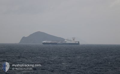
ULUSOY-15
Ro-Ro Cargo
Current Trip
| Time Travelled | 2 days |
|---|---|
| Remaining Time | 10 h, 42 mins |
| Distance Travelled | 793.94 nm |
| Remaining Distance | 172.68 nm |
| AVG Speed | 15.8 Knots |
| MAX Speed | 16.9 Knots |
| AVG Wind | 9.5 knots |
| MAX Wind | 17.5 knots |
| MIN Temp | 14.3°C / 57.74°F |
| MAX Temp | 24.6°C / 76.28°F |
| Draught | 6.9 m |
| Position Received | Now |
Current Position
| Longitude | 23.60757° |
|---|---|
| Latitude | 36.58099° |
| Status | Under way using engine |
| Speed | 16.1 Knots |
| Course | 57.4° |
| Area | Aegean Sea |
| Station | T-AIS |
| Position Received | Now |
Info
Information
The current position of ULUSOY-15 is in Aegean Sea with coordinates 36.58099° / 23.60757° as reported on 2024-05-18 23:16 by AIS to our vessel tracker app. The vessel's current speed is 16.1 Knots and is heading at the port of CESME. The estimated time of arrival as calculated by vessel tracking app is 2024-05-19 09:58 LT
The vessel ULUSOY-15 (IMO: 9506265, MMSI: 271043165) is a Ro-Ro Cargo that was built in 2013 ( 11 years old ). It's sailing under the flag of [TR] Turkey.
In this page you can find informations about the vessels current position, last detected port calls, and current voyage information. If the vessels is not in coverage by AIS you will find the latest position.
The current position of ULUSOY-15 is detected by our AIS receivers and we are not responsible for the reliability of the data. The last position was recorded while the vessel was in Coverage by the Ais receivers of our vessel tracking app.
The current draught of ULUSOY-15 as reported by AIS is 6.9 meters
Weather
| Temperature | 19.3°C / 66.74°F |
|---|---|
| Wind Speed | 5 knots |
| Direction | 72° ENE |
| Pressure | 1012.3 hPa |
| Humidity | 85.6 % |
| Cloud Coverage | 99 % |
Featured Company
Last Port Calls
| Port | Arrival | Departure | Time In Port |
|---|---|---|---|
| 2024-05-15 09:35 | 2024-05-16 21:23 | 1 d | |
| 2024-05-12 09:08 | 2024-05-12 21:51 | 12 h | |
| 2024-05-08 07:58 | 2024-05-09 21:05 | 1 d | |
| 2024-05-05 09:02 | 2024-05-05 20:05 | 11 h | |
| 2024-05-01 10:45 | 2024-05-02 21:36 | 1 d | |
| 2024-04-28 11:49 | 2024-04-28 23:42 | 11 h | |
| 2024-04-24 05:22 | 2024-04-25 23:28 | 1 d | |
| 2024-04-20 16:35 | 2024-04-21 17:38 | 1 d | |
| 2024-04-20 11:06 | 2024-04-20 15:56 | 4 h | |
| 2024-04-16 04:24 | 2024-04-17 23:39 | 1 d |
Last Trips
| Origin | Departure | Destination | Arrival | Distance | |
|---|---|---|---|---|---|
| 2024-05-13 00:51 | 2024-05-15 11:35 | 952.04 nm | |||
| 2024-05-09 23:05 | 2024-05-12 12:08 | 961.55 nm | |||
| 2024-05-05 23:05 | 2024-05-08 09:58 | 949.72 nm | |||
| 2024-05-02 23:36 | 2024-05-05 12:02 | 962.64 nm | |||
| 2024-04-29 02:42 | 2024-05-01 12:45 | 952.00 nm | |||
| 2024-04-26 01:28 | 2024-04-28 14:49 | 962.34 nm | |||
| 2024-04-21 20:38 | 2024-04-24 07:22 | 950.72 nm | |||
| 2024-04-20 18:56 | 2024-04-20 19:35 | 4.69 nm | |||
| 2024-04-18 01:39 | 2024-04-20 14:06 | 961.83 nm | |||
| 2024-04-13 20:34 | 2024-04-16 06:24 | 947.97 nm |
Events
| Time | Event | Details | Position / Dest | Info |
|---|---|---|---|---|
| 2024-05-18 22:22 | Status Changed | Under way using engine Default |
36.45306 / 23.35969
TRCES
|
Speed: 15.7 kn Course: 57° |
| 2024-05-18 22:18 | Status Changed | Default Under way using engine |
36.44259 / 23.33835
TRCES
|
Speed: 15.5 kn Course: 58.1° |
| 2024-05-18 21:16 | Change Sea Area | Greek part of the Aegean Sea Greek part of the Mediterranean Sea - Eastern Basin |
36.39684 / 23.02713
Aegean Sea
TRCES
|
Speed: 16 kn Course: 100.1° |
| 2024-05-18 21:09 | ETA Changed | 2024/05/19 10:30 2024/05/19 09:30 |
36.40265 / 22.98384
TRCES
|
Speed: 15.8 kn Course: 98° |
| 2024-05-18 21:01 | Change Sea Area | Greek part of the Mediterranean Sea - Eastern Basin Greek part of the Ionian Sea |
36.40652 / 22.94552
Mediterranean Sea - Eastern Basin
TRCES
|
Speed: 15.7 kn Course: 97.8° |
| 2024-05-18 21:01 | Status Changed | Under way using engine Default |
36.40652 / 22.94552
TRCES
|
Speed: 15.8 kn Course: 78° |
| 2024-05-18 21:01 | IN Coverage |
36.40652 / 22.94552
Mediterranean Sea - Eastern Basin
TRCES
|
Speed: 15.7 kn Course: 97.8° |
|
| 2024-05-18 12:42 | Status Changed | Default Under way using engine |
37.54356 / 20.81487
TRCES
|
Speed: 16.6 kn Course: 141.3° |
| 2024-05-18 12:41 | OUT of Coverage |
37.54967 / 20.80867
Ionian Sea
TRCES
|
Speed: 16.6 kn Course: 141.3° |
|
| 2024-05-18 05:30 | Detected in Sea | Greek part of the Ionian Sea |
39.15552 / 19.48793
Ionian Sea
TRCES
|
Speed: 16.1 kn Course: 147.7° |