
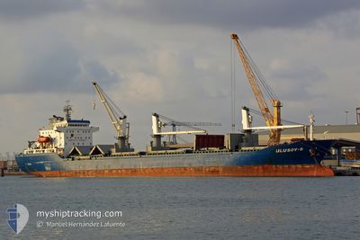
ULUSOY 8
Bulk Carrier
Current Trip
| Time Travelled | 17 days |
|---|---|
| Remaining Time | --- |
| Distance Travelled | 3183.07 nm |
| Remaining Distance | --- |
| AVG Speed | 9 Knots |
| MAX Speed | 11.4 Knots |
| AVG Wind | 13.4 knots |
| MAX Wind | 27.9 knots |
| MIN Temp | 13.9°C / 57.02°F |
| MAX Temp | 25.8°C / 78.44°F |
| Draught | 9.8 m |
| Position Received | 2 m ago |
Current Position
| Longitude | -0.16473° |
|---|---|
| Latitude | 49.48281° |
| Status | At anchor |
| Speed | |
| Course | 24° |
| Area | English Channel |
| Station | T-AIS |
| Position Received | 2 m ago |
Info
Information
The current position of ULUSOY 8 is in English Channel with coordinates 49.48281° / -0.16473° as reported on 2024-06-19 19:10 by AIS to our vessel tracker app. The vessel's current speed is 0 Knots
The vessel ULUSOY 8 (IMO: 9458250, MMSI: 271000973) is a Bulk Carrier that was built in 2008 ( 16 years old ). It's sailing under the flag of [TR] Turkey.
In this page you can find informations about the vessels current position, last detected port calls, and current voyage information. If the vessels is not in coverage by AIS you will find the latest position.
The current position of ULUSOY 8 is detected by our AIS receivers and we are not responsible for the reliability of the data. The last position was recorded while the vessel was in Coverage by the Ais receivers of our vessel tracking app.
The current draught of ULUSOY 8 as reported by AIS is 9.8 meters
Weather
| Temperature | 15.4°C / 59.72°F |
|---|---|
| Wind Speed | 22 knots |
| Direction | 49° NE |
| Pressure | 1019.5 hPa |
| Humidity | 86.1 % |
| Cloud Coverage | 18 % |
Featured Company
Most Visited Ports (Last year)
| Port | Arrivals | |
|---|---|---|
| 2 | ||
| 2 | ||
| 2 | ||
| 2 | ||
| 2 | ||
| 1 |
Last Trips
Events
| Time | Event | Details | Position / Dest | Info |
|---|---|---|---|---|
| 2024-06-18 10:16 | Status Changed | At anchor Default |
49.48426 / -.16618
FR URO
|
Speed: Course: 73° |
| 2024-06-18 10:13 | Status Changed | Default At anchor |
49.48426 / -.16616
FR URO
|
Speed: Course: 74° |
| 2024-06-17 15:19 | Status Changed | At anchor Default |
49.48306 / -.16203
FR URO
|
Speed: Course: -1° |
| 2024-06-17 15:14 | Status Changed | Default At anchor |
49.48167 / -.16167
FR URO
|
Speed: Course: 356° |
| 2024-06-17 10:04 | Status Changed | At anchor Default |
49.48444 / -.16421
FR URO
|
Speed: 0.2 kn Course: 70° |
| 2024-06-17 10:01 | Status Changed | Default At anchor |
49.48442 / -.16421
FR URO
|
Speed: 0.1 kn Course: 69° |
| 2024-06-17 05:16 | Status Changed | At anchor Default |
49.48551 / -.16038
FR URO
|
Speed: 0.1 kn Course: 244° |
| 2024-06-17 05:13 | Status Changed | Default At anchor |
49.48549 / -.16044
FR URO
|
Speed: Course: 243° |
| 2024-06-17 04:22 | STOP Moving | 11.08 nm, West of LE HAVRE |
49.48515 / -.16101
FR URO
|
Speed: 0.1 kn Course: 235° |
| 2024-06-17 04:16 | Status Changed | At anchor Under way using engine |
49.48583 / -.16193
FR URO
|
Speed: 0.9 kn Course: 200° |