
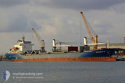
ULUSOY 8
Bulk Carrier
Current Trip
| Time Travelled | 6 days |
|---|---|
| Remaining Time | --- |
| Distance Travelled | 1426.36 nm |
| Remaining Distance | --- |
| AVG Speed | 9.8 Knots |
| MAX Speed | 11 Knots |
| AVG Wind | 8.7 knots |
| MAX Wind | 18.9 knots |
| MIN Temp | 20.7°C / 69.26°F |
| MAX Temp | 25.8°C / 78.44°F |
| Draught | 9.8 m |
| Position Received | 1 d ago |
Current Position
| Longitude | 10.91737° |
|---|---|
| Latitude | 37.53287° |
| Status | Under way using engine |
| Speed | 9.5 Knots |
| Course | 284.2° |
| Area | Mediterranean Sea - Western Basin |
| Station | T-AIS |
| Position Received | 1 d ago |
Info
Information
The current position of ULUSOY 8 is in Mediterranean Sea - Western Basin with coordinates 37.53287° / 10.91737° as reported on 2024-06-07 14:16 by AIS to our vessel tracker app. The vessel's current speed is 9.5 Knots and is heading at the port of ROUEN. The estimated time of arrival as calculated by vessel tracking app is 2024-06-16 06:00 LT
The vessel ULUSOY 8 (IMO: 9458250, MMSI: 271000973) is a Bulk Carrier that was built in 2008 ( 16 years old ). It's sailing under the flag of [TR] Turkey.
In this page you can find informations about the vessels current position, last detected port calls, and current voyage information. If the vessels is not in coverage by AIS you will find the latest position.
The current position of ULUSOY 8 is detected by our AIS receivers and we are not responsible for the reliability of the data. The last position was recorded while the vessel was in Coverage by the Ais receivers of our vessel tracking app.
The current draught of ULUSOY 8 as reported by AIS is 9.8 meters
Weather
| Temperature | 20.9°C / 69.62°F |
|---|---|
| Wind Speed | 19 knots |
| Direction | 263° W |
| Pressure | 1010.3 hPa |
| Humidity | 79.6 % |
| Cloud Coverage | 100 % |
Featured Company
Most Visited Ports (Last year)
| Port | Arrivals | |
|---|---|---|
| 2 | ||
| 2 | ||
| 2 | ||
| 2 | ||
| 2 | ||
| 1 |
Last Trips
Events
| Time | Event | Details | Position / Dest | Info |
|---|---|---|---|---|
| 2024-06-07 14:20 | Status Changed | Default Under way using engine |
37.53534 / 10.90503
FR URO
|
Speed: 9.5 kn Course: 284.2° |
| 2024-06-07 14:16 | OUT of Coverage |
37.53287 / 10.91737
Mediterranean Sea - Western Basin
FR URO
|
Speed: 9.5 kn Course: 284.2° |
|
| 2024-06-07 13:13 | Change Sea Area | Tunisian part of the Mediterranean Sea - Western Basin Maltese part of the Mediterranean Sea - Eastern Basin |
37.47773 / 11.12233
Mediterranean Sea - Western Basin
FR URO
|
Speed: 9.9 kn Course: 289.3° |
| 2024-06-07 13:11 | Status Changed | Under way using engine Default |
37.47590 / 11.12890
FR URO
|
Speed: 9.9 kn Course: 290° |
| 2024-06-07 13:11 | IN Coverage |
37.47773 / 11.12233
Mediterranean Sea - Western Basin
FR URO
|
Speed: 9.9 kn Course: 289.3° |
|
| 2024-06-06 21:33 | OUT of Coverage |
36.38141 / 13.70532
Mediterranean Sea - Eastern Basin
FR URO
|
Speed: 10.1 kn Course: 296.1° |
|
| 2024-06-06 18:02 | Draught Changed | 9.8 5 |
36.10444 / 14.35019
FR URO
|
Speed: 9.6 kn Course: 295.8° |
| 2024-06-06 18:02 | Destination Changed | FR URO EG DAM |
36.10444 / 14.35019
FR URO
|
Speed: 9.6 kn Course: 295.8° |
| 2024-06-06 18:02 | ETA Changed | 2024/06/16 06:00 2024/05/19 15:00 |
36.10444 / 14.35019
FR URO
|
Speed: 9.6 kn Course: 295.8° |
| 2024-06-06 17:46 | Detected in Sea | Maltese part of the Mediterranean Sea - Eastern Basin |
36.08652 / 14.39298
Mediterranean Sea - Eastern Basin
|
Speed: 9.6 kn Course: 299° |