
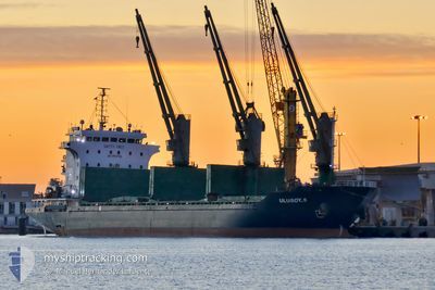
ULUSOY-9
Bulk Carrier
Current Trip
| Time Travelled | 27 days |
|---|---|
| Remaining Time | --- |
| Distance Travelled | 3177.40 nm |
| Remaining Distance | --- |
| AVG Speed | 10.7 Knots |
| MAX Speed | 14.7 Knots |
| AVG Wind | 13.3 knots |
| MAX Wind | 26.4 knots |
| MIN Temp | -3°C / 26.6°F |
| MAX Temp | 23.6°C / 74.48°F |
| Draught | 4.9 m |
| Position Received | 7 d ago |
Current Position
| Longitude | 33.47451° |
|---|---|
| Latitude | 70.45372° |
| Status | Under way using engine |
| Speed | 11.4 Knots |
| Course | 101.4° |
| Area | Barentsz Sea |
| Station | T-AIS |
| Position Received | 7 d ago |
Info
Information
The current position of ULUSOY-9 is in Barentsz Sea with coordinates 70.45372° / 33.47451° as reported on 2024-05-21 13:56 by AIS to our vessel tracker app. The vessel's current speed is 11.4 Knots
The vessel ULUSOY-9 (IMO: 9498884, MMSI: 271002569) is a Bulk Carrier that was built in 2008 ( 16 years old ). It's sailing under the flag of [TR] Turkey.
In this page you can find informations about the vessels current position, last detected port calls, and current voyage information. If the vessels is not in coverage by AIS you will find the latest position.
The current position of ULUSOY-9 is detected by our AIS receivers and we are not responsible for the reliability of the data. The last position was recorded while the vessel was in Coverage by the Ais receivers of our vessel tracking app.
The current draught of ULUSOY-9 as reported by AIS is 4.9 meters
Weather
| Temperature | 5.4°C / 41.72°F |
|---|---|
| Wind Speed | 6 knots |
| Direction | 89° E |
| Pressure | 1018.5 hPa |
| Humidity | 74.1 % |
| Cloud Coverage | 100 % |
Featured Company
Last Port Calls
| Port | Arrival | Departure | Time In Port |
|---|---|---|---|
| 2024-04-23 18:08 | 2024-05-01 19:43 | 8 d | |
| 2024-03-25 13:07 | 2024-04-03 12:13 | 8 d | |
| 2024-03-25 11:19 | 2024-03-25 11:30 | 11 m | |
| 2024-03-10 05:52 | 2024-03-11 15:14 | 1 d | |
| 2024-03-08 21:18 | |||
| 2024-03-02 18:47 |
Most Visited Ports (Last year)
| Port | Arrivals | |
|---|---|---|
| 3 | ||
| 2 | ||
| 2 | ||
| 2 | ||
| 2 | ||
| 2 |
Last Trips
| Origin | Departure | Destination | Arrival | Distance | |
|---|---|---|---|---|---|
| 2024-04-03 14:13 | 2024-04-23 20:08 | 2993.01 nm | |||
| 2024-03-25 12:30 | 2024-03-25 14:07 | 9.53 nm | |||
| 2024-03-25 12:30 | 2024-03-25 12:19 | 9.53 nm | |||
| 2024-03-09 00:18 | 2024-03-10 08:52 | 352.32 nm | |||
| 2024-02-23 14:39 | 2024-03-02 21:47 | 358.00 nm |
Events
| Time | Event | Details | Position / Dest | Info |
|---|---|---|---|---|
| 2024-05-23 07:37 | STOP Moving |
64.97334 / 40.05667
RUARH
|
Speed: Course: -1° |
|
| 2024-05-21 14:02 | Status Changed | Default Under way using engine |
70.44720 / 33.51603
RUARH
|
Speed: 11.4 kn Course: 101.4° |
| 2024-05-21 13:56 | OUT of Coverage |
70.45372 / 33.47451
Barentsz Sea
RUARH
|
Speed: 11.4 kn Course: 101.4° |
|
| 2024-05-21 12:03 | Change Sea Area | Russian part of the Barentsz Sea Norwegian part of the Barentsz Sea |
70.59093 / 32.54634
Barentsz Sea
RUARH
|
Speed: 10.6 kn Course: 109.7° |
| 2024-05-20 20:19 | Detected in Sea | Norwegian part of the Barentsz Sea |
71.60881 / 24.86784
Barentsz Sea
RUARH
|
Speed: 10.3 kn Course: 78.5° |