
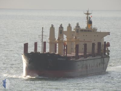
UNION MARK
Cargo
Current Trip
| Time Travelled | 3 days |
|---|---|
| Remaining Time | --- |
| Distance Travelled | 706.42 nm |
| Remaining Distance | --- |
| AVG Speed | 13.2 Knots |
| MAX Speed | 16.5 Knots |
| AVG Wind | 10.7 knots |
| MAX Wind | 15.4 knots |
| MIN Temp | 12°C / 53.6°F |
| MAX Temp | 16.6°C / 61.88°F |
| Draught | 6.2 m |
| Position Received | 1 d ago |
Current Position
| Longitude | 147.07700° |
|---|---|
| Latitude | -39.13201° |
| Status | Under way using engine |
| Speed | 13.9 Knots |
| Course | 91.4° |
| Area | Bass Strait |
| Station | T-AIS |
| Position Received | 1 d ago |
Info
Information
The current position of UNION MARK is in Bass Strait with coordinates -39.13201° / 147.07700° as reported on 2024-05-21 23:10 by AIS to our vessel tracker app. The vessel's current speed is 13.9 Knots and is heading at the port of LYTTELTON. The estimated time of arrival as calculated by vessel tracking app is 2024-05-26 22:00 LT
The vessel UNION MARK (IMO: 9775153, MMSI: 538008439) is a Cargo It's sailing under the flag of [MH] Marshall Is.
In this page you can find informations about the vessels current position, last detected port calls, and current voyage information. If the vessels is not in coverage by AIS you will find the latest position.
The current position of UNION MARK is detected by our AIS receivers and we are not responsible for the reliability of the data. The last position was recorded while the vessel was in Coverage by the Ais receivers of our vessel tracking app.
The current draught of UNION MARK as reported by AIS is 6.2 meters
Weather
| Temperature | 16°C / 60.8°F |
|---|---|
| Wind Speed | 12 knots |
| Direction | 231° SW |
| Pressure | 1021.4 hPa |
| Humidity | 69.1 % |
| Cloud Coverage | 44 % |
Featured Company
Events
| Time | Event | Details | Position / Dest | Info |
|---|---|---|---|---|
| 2024-05-21 23:10 | OUT of Coverage |
-39.13201 / 147.07700
Bass Strait
LYTTELTON,NZ
|
Speed: 13.9 kn Course: 91.4° |
|
| 2024-05-21 22:14 | Status Changed | Under way using engine Default |
-39.17802 / 146.82065
LYTTELTON,NZ
|
Speed: 13.4 kn Course: 64° |
| 2024-05-21 22:07 | Status Changed | Default Under way using engine |
-39.18852 / 146.79344
LYTTELTON,NZ
|
Speed: 13.5 kn Course: 65° |
| 2024-05-21 22:01 | Status Changed | Under way using engine Default |
-39.19874 / 146.76522
LYTTELTON,NZ
|
Speed: 13.5 kn Course: 65° |
| 2024-05-21 21:43 | Status Changed | Default Under way using engine |
-39.22567 / 146.68698
LYTTELTON,NZ
|
Speed: 13.5 kn Course: 66.6° |
| 2024-05-21 21:36 | Status Changed | Under way using engine Default |
-39.23624 / 146.65581
LYTTELTON,NZ
|
Speed: 13.6 kn Course: 67° |
| 2024-05-21 21:27 | Status Changed | Default Under way using engine |
-39.24952 / 146.61636
LYTTELTON,NZ
|
Speed: 13.6 kn Course: 65.6° |
| 2024-05-21 21:18 | Status Changed | Under way using engine Default |
-39.26397 / 146.57412
LYTTELTON,NZ
|
Speed: 13.5 kn Course: 64° |
| 2024-05-21 21:16 | Status Changed | Default Under way using engine |
-39.26766 / 146.56380
LYTTELTON,NZ
|
Speed: 13.7 kn Course: 85.8° |
| 2024-05-21 14:33 | Status Changed | Under way using engine Default |
-38.59226 / 144.82728
LYTTELTON,NZ
|
Speed: 13.6 kn Course: 126° |