
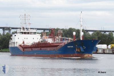
UNITAR
General Cargo
Current Trip
| Time Travelled | 1 day |
|---|---|
| Remaining Time | 11 h, 45 mins |
| Distance Travelled | 228.13 nm |
| Remaining Distance | 145.40 nm |
| AVG Speed | 8.1 Knots |
| MAX Speed | 13.1 Knots |
| AVG Wind | 11.3 knots |
| MAX Wind | 16.9 knots |
| MIN Temp | 11.5°C / 52.7°F |
| MAX Temp | 20.6°C / 69.08°F |
| Draught | 5.9 m |
| Position Received | Now |
Current Position
| Longitude | 8.66207° |
|---|---|
| Latitude | 53.92730° |
| Status | Under way using engine |
| Speed | 13.2 Knots |
| Course | 150° |
| Area | North Sea |
| Station | T-AIS |
| Position Received | Now |
Info
Information
The current position of UNITAR is in North Sea with coordinates 53.92730° / 8.66207° as reported on 2024-05-03 17:27 by AIS to our vessel tracker app. The vessel's current speed is 13.2 Knots and is heading at the port of NYBORG. The estimated time of arrival as calculated by vessel tracking app is 2024-05-04 05:12 LT
The vessel UNITAR (IMO: 9505687, MMSI: 257364000) is a General Cargo that was built in 2009 ( 15 years old ). It's sailing under the flag of [NO] Norway.
In this page you can find informations about the vessels current position, last detected port calls, and current voyage information. If the vessels is not in coverage by AIS you will find the latest position.
The current position of UNITAR is detected by our AIS receivers and we are not responsible for the reliability of the data. The last position was recorded while the vessel was in Coverage by the Ais receivers of our vessel tracking app.
The current draught of UNITAR as reported by AIS is 5.9 meters
Weather
| Temperature | 12.6°C / 54.68°F |
|---|---|
| Wind Speed | 15 knots |
| Direction | 226° SW |
| Pressure | 1011.1 hPa |
| Humidity | 87.7 % |
| Cloud Coverage | 78 % |
Featured Company
Last Port Calls
| Port | Arrival | Departure | Time In Port |
|---|---|---|---|
| 2024-05-01 14:07 | 2024-05-02 13:45 | 23 h | |
| 2024-04-28 06:06 | 2024-04-28 20:52 | 14 h | |
| 2024-04-27 22:21 | 2024-04-27 22:23 | 2 m | |
| 2024-04-25 19:32 | 2024-04-26 09:18 | 13 h | |
| 2024-04-25 19:28 | |||
| 2024-04-25 17:22 | 2024-04-25 18:17 | 54 m | |
| 2024-04-23 08:16 | 2024-04-24 23:51 | 1 d | |
| 2024-04-20 11:57 | 2024-04-20 20:39 | 8 h | |
| 2024-04-20 03:40 | 2024-04-20 03:42 | 2 m | |
| 2024-04-17 21:58 | 2024-04-17 22:31 | 33 m |
Last Trips
| Origin | Departure | Destination | Arrival | Distance | |
|---|---|---|---|---|---|
| 2024-04-28 22:52 | 2024-05-01 16:07 | 614.61 nm | |||
| 2024-04-28 00:23 | 2024-04-28 08:06 | 75.85 nm | |||
| 2024-04-26 11:18 | 2024-04-28 00:21 | 305.02 nm | |||
| 2024-04-25 20:17 | 2024-04-25 21:32 | 8.78 nm | |||
| 2024-04-25 20:17 | 2024-04-25 21:28 | 8.63 nm | |||
| 2024-04-25 01:51 | 2024-04-25 19:22 | 167.24 nm | |||
| 2024-04-20 22:39 | 2024-04-23 10:16 | 508.91 nm | |||
| 2024-04-20 05:42 | 2024-04-20 13:57 | 75.57 nm | |||
| 2024-04-17 23:31 | 2024-04-20 05:40 | 436.04 nm | |||
| 2024-04-17 22:53 | 2024-04-17 22:58 | 0.86 nm |
Events
| Time | Event | Details | Position / Dest | Info |
|---|---|---|---|---|
| 2024-05-03 17:06 | Status Changed | Under way using engine Default |
53.96437 / 8.55775
DKNBG
|
Speed: 12.8 kn Course: 102° |
| 2024-05-03 16:36 | Status Changed | Default Under way using engine |
53.98405 / 8.38193
DKNBG
|
Speed: 12.2 kn Course: 100.1° |
| 2024-05-03 16:29 | Status Changed | Under way using engine Default |
53.98801 / 8.34188
DKNBG
|
Speed: 12.2 kn Course: 101° |
| 2024-05-03 16:19 | IN Coverage |
53.98801 / 8.34188
North Sea
DKNBG
|
Speed: 12.2 kn Course: 100.1° |
|
| 2024-05-03 15:32 | Status Changed | Default Under way using engine |
53.98128 / 8.07275
DKNBG
|
Speed: 9 kn Course: 78.1° |
| 2024-05-03 15:25 | OUT of Coverage |
53.97780 / 8.04407
North Sea
DKNBG
|
Speed: 9 kn Course: 78.1° |
|
| 2024-05-03 15:19 | Status Changed | Under way using engine Default |
53.97441 / 8.01703
DKNBG
|
Speed: 9 kn Course: 77° |
| 2024-05-03 15:12 | IN Coverage |
53.97449 / 8.01773
North Sea
DKNBG
|
Speed: 9.1 kn Course: 79.1° |
|
| 2024-05-03 13:43 | Status Changed | Default Under way using engine |
53.92287 / 7.64318
DKNBG
|
Speed: 8.3 kn Course: 79.4° |
| 2024-05-03 13:37 | OUT of Coverage |
53.91989 / 7.62036
North Sea
DKNBG
|
Speed: 8.3 kn Course: 79.4° |