
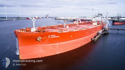
UNIVERSAL CHALLENGER
Tanker
Current Trip
CNDXE
| Time Travelled | 44 days |
|---|---|
| Remaining Time | --- |
| Distance Travelled | 7528.55 nm |
| Remaining Distance | --- |
| AVG Speed | 11.4 Knots |
| MAX Speed | 16.5 Knots |
| AVG Wind | 9.8 knots |
| MAX Wind | 27 knots |
| MIN Temp | 24.8°C / 76.64°F |
| MAX Temp | 33.5°C / 92.3°F |
| Draught | 20.3 m |
| Position Received | 7 d ago |
Current Position
| Longitude | 57.19623° |
|---|---|
| Latitude | 25.02693° |
| Status | Under way using engine |
| Speed | 13.2 Knots |
| Course | 124.4° |
| Area | Gulf of Oman |
| Station | T-AIS |
| Position Received | 7 d ago |
Info
Information
The current position of UNIVERSAL CHALLENGER is in Gulf of Oman with coordinates 25.02693° / 57.19623° as reported on 2024-05-24 06:48 by AIS to our vessel tracker app. The vessel's current speed is 13.2 Knots
The vessel UNIVERSAL CHALLENGER (IMO: 9851854, MMSI: 636021022) is a Tanker It's sailing under the flag of [LR] Liberia.
In this page you can find informations about the vessels current position, last detected port calls, and current voyage information. If the vessels is not in coverage by AIS you will find the latest position.
The current position of UNIVERSAL CHALLENGER is detected by our AIS receivers and we are not responsible for the reliability of the data. The last position was recorded while the vessel was in Coverage by the Ais receivers of our vessel tracking app.
The current draught of UNIVERSAL CHALLENGER as reported by AIS is 20.3 meters
Weather
| Temperature | 29.6°C / 85.28°F |
|---|---|
| Wind Speed | 19 knots |
| Direction | 198° SSW |
| Pressure | 1010.4 hPa |
| Humidity | 76.8 % |
| Cloud Coverage | 100 % |
Featured Company
Events
| Time | Event | Details | Position / Dest | Info |
|---|---|---|---|---|
| 2024-05-24 06:50 | Status Changed | Default Under way using engine |
25.02246 / 57.20344
CNDXE
|
Speed: 13.2 kn Course: 124.4° |
| 2024-05-24 06:48 | OUT of Coverage |
25.02693 / 57.19623
Gulf of Oman
CNDXE
|
Speed: 13.2 kn Course: 124.4° |
|
| 2024-05-24 06:40 | Status Changed | Under way using engine Default |
25.04389 / 57.16915
CNDXE
|
Speed: 13.2 kn Course: 124° |
| 2024-05-24 06:31 | Status Changed | Default Under way using engine |
25.06167 / 57.13833
CNDXE
|
Speed: 13.2 kn Course: 124.6° |
| 2024-05-24 06:14 | Change Sea Area | Omani part of the Gulf of Oman United Arab Emirates part of the Gulf of Oman |
25.09900 / 57.08125
Gulf of Oman
CNDXE
|
Speed: 13.4 kn Course: 138.2° |
| 2024-05-24 05:14 | Status Changed | Under way using engine Default |
25.24284 / 56.90516
CNDXE
|
Speed: 13.1 kn Course: 138° |
| 2024-05-24 04:56 | Status Changed | Default Under way using engine |
25.28689 / 56.85297
CNDXE
|
Speed: 12.9 kn Course: 135.4° |
| 2024-05-24 03:05 | Change Sea Area | United Arab Emirates part of the Gulf of Oman Omani part of the Gulf of Oman |
25.66454 / 56.76689
Gulf of Oman
CNDXE
|
Speed: 13 kn Course: 190.9° |
| 2024-05-24 01:29 | Change Sea Area | Omani part of the Gulf of Oman Omani part of the Persian Gulf |
26.01787 / 56.77126
Gulf of Oman
CNDXE
|
Speed: 12.9 kn Course: 188° |
| 2024-05-24 01:29 | Status Changed | Under way using engine Default |
26.01787 / 56.77126
CNDXE
|
Speed: 13.2 kn Course: 180° |