
UNIVERSAL FRONTIER
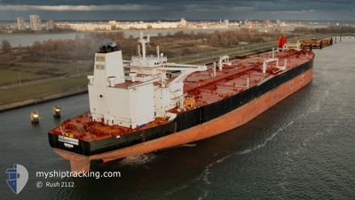
Tanker
Current Trip
| Time Travelled | 33 days |
|---|---|
| Remaining Time | 5 days |
| Distance Travelled | 8666.08 nm |
| Remaining Distance | 2495.96 nm |
| AVG Speed | 12.3 Knots |
| MAX Speed | 15.6 Knots |
| AVG Wind | 10.9 knots |
| MAX Wind | 33 knots |
| MIN Temp | 25.9°C / 78.62°F |
| MAX Temp | 33.6°C / 92.48°F |
| Draught | 21 m |
| Position Received | 3 d ago |
Current Position
| Longitude | 104.41327° |
|---|---|
| Latitude | 1.35286° |
| Status | Constrained by her draught |
| Speed | 12.6 Knots |
| Course | 51.4° |
| Area | South China Sea |
| Station | T-AIS |
| Position Received | 3 d ago |
Info
Information
The current position of UNIVERSAL FRONTIER is in South China Sea with coordinates 1.35286° / 104.41327° as reported on 2024-05-29 10:19 by AIS to our vessel tracker app. The vessel's current speed is 12.6 Knots and is heading at the port of ULSAN. The estimated time of arrival as calculated by vessel tracking app is 2024-06-06 20:01 LT
The vessel UNIVERSAL FRONTIER (IMO: 9829382, MMSI: 636022828) is a Tanker It's sailing under the flag of [LR] Liberia.
In this page you can find informations about the vessels current position, last detected port calls, and current voyage information. If the vessels is not in coverage by AIS you will find the latest position.
The current position of UNIVERSAL FRONTIER is detected by our AIS receivers and we are not responsible for the reliability of the data. The last position was recorded while the vessel was in Coverage by the Ais receivers of our vessel tracking app.
The current draught of UNIVERSAL FRONTIER as reported by AIS is 21 meters
Weather
| Temperature | 30°C / 86°F |
|---|---|
| Wind Speed | 7 knots |
| Direction | 189° S |
| Pressure | 1009.1 hPa |
| Humidity | 75.5 % |
| Cloud Coverage | 80 % |
Featured Company
Last Port Calls
| Port | Arrival | Departure | Time In Port |
|---|---|---|---|
| 2024-04-25 00:59 | 2024-04-29 04:51 | 4 d |
Most Visited Ports (Last year)
| Port | Arrivals | |
|---|---|---|
| 3 | ||
| 1 | ||
| 1 | ||
| 1 | ||
| 1 | ||
| 1 |
Last Trips
| Origin | Departure | Destination | Arrival | Distance | |
|---|---|---|---|---|---|
| 2024-02-07 14:16 | 2024-04-25 08:59 | 11450.47 nm |
Events
| Time | Event | Details | Position / Dest | Info |
|---|---|---|---|---|
| 2024-05-29 10:26 | Status Changed | Default Constrained by her draught |
1.36826 / 104.43163
IQBSR > KRUSN
|
Speed: 12.6 kn Course: 51.4° |
| 2024-05-29 10:19 | Change Sea Area | Malaysian part of the South China Sea Malaysian part of the Singapore Strait |
1.35287 / 104.41327
South China Sea
IQBSR > KRUSN
|
Speed: 12.6 kn Course: 51.4° |
| 2024-05-29 10:19 | Status Changed | Constrained by her draught Default |
1.35287 / 104.41327
IQBSR > KRUSN
|
Speed: 12.5 kn Course: 52° |
| 2024-05-29 10:19 | OUT of Coverage |
1.35287 / 104.41327
South China Sea
IQBSR > KRUSN
|
Speed: 12.6 kn Course: 51.4° |
|
| 2024-05-29 10:02 | Status Changed | Default Constrained by her draught |
1.31668 / 104.36721
IQBSR > KRUSN
|
Speed: 12.1 kn Course: 52.6° |
| 2024-05-29 09:44 | Status Changed | Constrained by her draught Default |
1.28135 / 104.31959
IQBSR > KRUSN
|
Speed: 12.3 kn Course: 79° |
| 2024-05-29 09:18 | Status Changed | Default Constrained by her draught |
1.26994 / 104.23102
IQBSR > KRUSN
|
Speed: 12.3 kn Course: 86.6° |
| 2024-05-29 09:13 | Status Changed | Constrained by her draught Default |
1.26874 / 104.21340
IQBSR > KRUSN
|
Speed: 12.4 kn Course: 84° |
| 2024-05-29 09:09 | Status Changed | Default Constrained by her draught |
1.26750 / 104.20152
IQBSR > KRUSN
|
Speed: 12.4 kn Course: 85.1° |
| 2024-05-29 08:55 | Change Sea Area | Malaysian part of the Singapore Strait Indonesian part of the Singapore Strait |
1.26131 / 104.15333
Singapore Strait
IQBSR > KRUSN
|
Speed: 12.3 kn Course: 81.9° |