
USGOVVESSEL
Not available
Current Trip
| Trip Time | 46 days |
|---|---|
| Trip Distance | 7340.50 nm |
| AVG Speed | 9.9 Knots |
| MAX Speed | 9.9 Knots |
| Draught | 0 m |
| AVG Wind | 6.8 knots |
| MAX Wind | 24 knots |
| MIN Temp | 11.9°C / 53.42°F |
| MAX Temp | 27.8°C / 82.04°F |
| Position Received | 1 d ago |
Current Position
| Longitude | 4.04707° |
|---|---|
| Latitude | 51.96132° |
| Status | Under way using engine |
| Speed | |
| Course | --- |
| Area | North Sea |
| Station | T-AIS |
| Position Received | 1 d ago |
Info
Information
The current position of USGOVVESSEL is in North Sea with coordinates 51.96132° / 4.04707° as reported on 2024-06-27 08:56 by AIS to our vessel tracker app. The vessel's current speed is 0 Knots and is currently inside the port of MAASVLAKTE - ROTTERDAM.
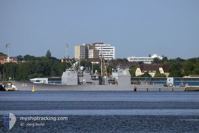
The vessel USGOVVESSEL (MMSI: 338936000) is a Not available It's sailing under the flag of [US] USA.
In this page you can find informations about the vessels current position, last detected port calls, and current voyage information. If the vessels is not in coverage by AIS you will find the latest position.
The current position of USGOVVESSEL is detected by our AIS receivers and we are not responsible for the reliability of the data. The last position was recorded while the vessel was in Coverage by the Ais receivers of our vessel tracking app.
Weather
| Temperature | 17.4°C / 63.32°F |
|---|---|
| Wind Speed | 9 knots |
| Direction | 203° SSW |
| Pressure | 1007.9 hPa |
| Humidity | 89.1 % |
| Cloud Coverage | 51 % |
Featured Company
Last Port Calls
| Port | Arrival | Departure | Time In Port |
|---|---|---|---|
| 2024-06-27 08:11 | |||
| 2024-05-06 11:42 | 2024-05-11 15:59 | 5 d |
Last Trips
| Origin | Departure | Destination | Arrival | Distance | |
|---|---|---|---|---|---|
| 2024-05-11 11:59 | 2024-06-27 10:11 | 7340.50 nm |
Events
| Time | Event | Details | Position / Dest | Info |
|---|---|---|---|---|
| 2024-06-27 08:56 | OUT of Coverage |
51.96132 / 4.04707
North Sea
[NL] MAASVLAKTE - ROTTERDAM
|
Speed: Course: 86.1° |
|
| 2024-06-27 08:31 | STOP Moving |
51.96073 / 4.04750
[NL] MAASVLAKTE - ROTTERDAM
|
Speed: 0.1 kn Course: 511° |
|
| 2024-06-27 08:11 | PORT ARRIVAL |
|
51.96262 / 4.07982
[NL] MAASVLAKTE - ROTTERDAM
|
Speed: 4.1 kn Course: 270.7° |
| 2024-06-27 02:25 | Change Sea Area | Dutch part of the North Sea United Kingdom part of the North Sea |
51.96276 / 2.62453
North Sea
|
Speed: 15.4 kn Course: 92.1° |
| 2024-06-26 19:36 | Change Sea Area | United Kingdom part of the North Sea Dutch part of the North Sea |
52.04564 / 2.67117
North Sea
|
Speed: 14.5 kn Course: 261.5° |
| 2024-06-26 01:29 | Detected in Sea | Dutch part of the North Sea |
52.33272 / 2.98953
North Sea
|
Speed: 12.8 kn Course: 147.9° |
| 2024-06-25 21:43 | Detected in Sea | United Kingdom part of the North Sea |
53.39936 / 2.82932
North Sea
|
Speed: 16.4 kn Course: 200.9° |
| 2024-06-25 21:43 | IN Coverage |
53.39936 / 2.82932
North Sea
|
Speed: 16.4 kn Course: 200.9° |
|
| 2024-06-25 20:05 | OUT of Coverage |
53.82963 / 3.12492
North Sea
|
Speed: 20 kn Course: 179° |
|
| 2024-06-25 20:02 | Change Sea Area | Dutch part of the North Sea Norwegian part of the North Sea |
53.84441 / 3.12450
North Sea
|
Speed: 15 kn Course: 174.7° |