
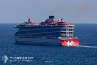
VALIANT LADY
Passenger
Current Trip
| Time Travelled | 1 day |
|---|---|
| Remaining Time | 55 mins |
| Distance Travelled | 255.24 nm |
| Remaining Distance | 10.42 nm |
| AVG Speed | 10.6 Knots |
| MAX Speed | 18.1 Knots |
| AVG Wind | 8.3 knots |
| MAX Wind | 14.7 knots |
| MIN Temp | 28.8°C / 83.84°F |
| MAX Temp | 29.7°C / 85.46°F |
| Draught | 8 m |
| Position Received | 1 m ago |
Current Position
| Longitude | -79.98189° |
|---|---|
| Latitude | 25.79231° |
| Status | Under way using engine |
| Speed | 7.5 Knots |
| Course | 269.2° |
| Area | North Atlantic Ocean |
| Station | T-AIS |
| Position Received | 1 m ago |
Info
Information
The current position of VALIANT LADY is in North Atlantic Ocean with coordinates 25.79231° / -79.98189° as reported on 2024-06-30 08:04 by AIS to our vessel tracker app. The vessel's current speed is 7.5 Knots and is heading at the port of MIAMI. The estimated time of arrival as calculated by vessel tracking app is 2024-06-30 09:01 LT
The vessel VALIANT LADY (IMO: 9805336, MMSI: 311000983) is a Passenger It's sailing under the flag of [BS] Bahamas.
In this page you can find informations about the vessels current position, last detected port calls, and current voyage information. If the vessels is not in coverage by AIS you will find the latest position.
The current position of VALIANT LADY is detected by our AIS receivers and we are not responsible for the reliability of the data. The last position was recorded while the vessel was in Coverage by the Ais receivers of our vessel tracking app.
The current draught of VALIANT LADY as reported by AIS is 8 meters
Weather
| Temperature | 29.3°C / 84.74°F |
|---|---|
| Wind Speed | 8 knots |
| Direction | 73° ENE |
| Pressure | 1017.8 hPa |
| Humidity | 70.6 % |
| Cloud Coverage | 100 % |
Featured Company
Last Port Calls
| Port | Arrival | Departure | Time In Port |
|---|---|---|---|
| 2024-06-28 11:27 | 2024-06-28 21:11 | 9 h | |
| 2024-06-26 09:29 | 2024-06-26 22:42 | 13 h | |
| 2024-06-23 14:59 | 2024-06-23 23:07 | 8 h | |
| 2024-06-21 09:00 | 2024-06-21 22:54 | 13 h | |
| 2024-06-19 06:15 | 2024-06-19 07:12 | 56 m | |
| 2024-06-18 13:27 | 2024-06-18 23:19 | 9 h | |
| 2024-06-16 09:27 | 2024-06-16 22:53 | 13 h | |
| 2024-06-14 11:21 | 2024-06-14 21:11 | 9 h | |
| 2024-06-12 09:16 | 2024-06-13 00:17 | 15 h | |
| 2024-06-09 13:19 | 2024-06-09 23:20 | 10 h |
Last Trips
| Origin | Departure | Destination | Arrival | Distance | |
|---|---|---|---|---|---|
| 2024-06-26 18:42 | 2024-06-28 07:27 | 258.13 nm | |||
| 2024-06-23 19:07 | 2024-06-26 05:29 | 772.66 nm | |||
| 2024-06-21 18:54 | 2024-06-23 10:59 | 689.69 nm | |||
| 2024-06-19 02:12 | 2024-06-21 05:00 | 632.83 nm | |||
| 2024-06-18 18:19 | 2024-06-19 01:15 | 120.49 nm | |||
| 2024-06-16 18:53 | 2024-06-18 08:27 | 640.32 nm | |||
| 2024-06-14 17:11 | 2024-06-16 05:27 | 275.58 nm | |||
| 2024-06-12 20:17 | 2024-06-14 07:21 | 257.69 nm | |||
| 2024-06-09 19:20 | 2024-06-12 05:16 | 778.07 nm | |||
| 2024-06-07 18:46 | 2024-06-09 09:19 | 691.44 nm |
Events
| Time | Event | Details | Position / Dest | Info |
|---|---|---|---|---|
| 2024-06-30 04:02 | Detected in Sea | United States part of the North Atlantic Ocean |
25.37292 / -79.70661
North Atlantic Ocean
USMIA
|
Speed: 7.8 kn Course: 259.8° |
| 2024-06-30 02:52 | Status Changed | Under way using engine Default |
25.44957 / -79.60650
USMIA
|
Speed: 6.4 kn Course: 197° |
| 2024-06-30 02:40 | Status Changed | Default Under way using engine |
25.47019 / -79.59952
USMIA
|
Speed: 6.6 kn Course: 197.2° |
| 2024-06-30 00:15 | Destination Changed | USMIA USBIM |
25.68920 / -79.41746
USMIA
|
Speed: 7.9 kn Course: 228.2° |
| 2024-06-30 00:15 | ETA Changed | 2024/06/30 08:30 2024/06/29 11:00 |
25.68920 / -79.41746
USMIA
|
Speed: 7.9 kn Course: 228.2° |
| 2024-06-29 23:07 | START Moving |
25.76110 / -79.29948
USBIM
|
Speed: 6.3 kn Course: 312.6° |
|
| 2024-06-29 22:58 | Status Changed | Under way using engine Default |
25.75301 / -79.28885
USBIM
|
Speed: Course: 309° |
| 2024-06-29 22:49 | IN Coverage |
25.75301 / -79.28885
North Atlantic Ocean
|
Speed: 0.3 kn Course: 315.4° |
|
| 2024-06-29 11:46 | Status Changed | Default Under way using engine |
25.75231 / -79.28896
USBIM
|
Speed: 0.7 kn Course: 310° |
| 2024-06-29 11:36 | OUT of Coverage |
25.75282 / -79.28943
North Atlantic Ocean
USBIM
|
Speed: 0.7 kn Course: 144.6° |