
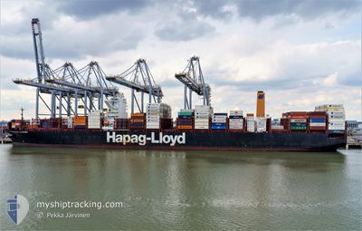
VALPARAISO EXPRESS
Cargo
Current Trip
| Time Travelled | 3 days |
|---|---|
| Remaining Time | 7 days |
| Distance Travelled | 1272.58 nm |
| Remaining Distance | 2760.73 nm |
| AVG Speed | 14.8 Knots |
| MAX Speed | 21.5 Knots |
| AVG Wind | 10 knots |
| MAX Wind | 24 knots |
| MIN Temp | 11°C / 51.8°F |
| MAX Temp | 14.9°C / 58.82°F |
| Draught | 12.4 m |
| Position Received | 2 d ago |
Current Position
| Longitude | -5.69496° |
|---|---|
| Latitude | 49.52910° |
| Status | Under way using engine |
| Speed | 17.5 Knots |
| Course | 263.8° |
| Area | Celtic Sea |
| Station | T-AIS |
| Position Received | 2 d ago |
Info
Information
The current position of VALPARAISO EXPRESS is in Celtic Sea with coordinates 49.52910° / -5.69496° as reported on 2024-05-06 23:59 by AIS to our vessel tracker app. The vessel's current speed is 17.5 Knots and is heading at the port of BOCA CHIKA. The estimated time of arrival as calculated by vessel tracking app is 2024-05-16 20:32 LT
The vessel VALPARAISO EXPRESS (IMO: 9777589, MMSI: 218833000) is a Cargo It's sailing under the flag of [DE] Germany.
In this page you can find informations about the vessels current position, last detected port calls, and current voyage information. If the vessels is not in coverage by AIS you will find the latest position.
The current position of VALPARAISO EXPRESS is detected by our AIS receivers and we are not responsible for the reliability of the data. The last position was recorded while the vessel was in Coverage by the Ais receivers of our vessel tracking app.
The current draught of VALPARAISO EXPRESS as reported by AIS is 12.4 meters
Weather
| Temperature | 14.9°C / 58.82°F |
|---|---|
| Wind Speed | 12 knots |
| Direction | 252° WSW |
| Pressure | 1011.9 hPa |
| Humidity | 86.6 % |
| Cloud Coverage | 19 % |
Featured Company
Last Port Calls
| Port | Arrival | Departure | Time In Port |
|---|---|---|---|
| 2024-05-04 18:02 | 2024-05-05 22:29 | 1 d | |
| 2024-04-30 11:17 | 2024-05-03 13:19 | 3 d | |
| 2024-04-27 12:09 | 2024-04-28 10:47 | 22 h | |
| 2024-04-24 07:09 | 2024-04-26 12:00 | 2 d | |
| 2024-04-13 10:18 | 2024-04-14 15:38 | 1 d | |
| 2024-04-10 22:50 | 2024-04-11 22:44 | 23 h | |
| 2024-04-08 22:26 | 2024-04-09 20:47 | 22 h | |
| 2024-04-02 03:05 | 2024-04-03 05:54 | 1 d | |
| 2024-03-27 11:17 | 2024-03-30 00:23 | 2 d | |
| 2024-03-26 14:21 | 2024-03-27 01:03 | 10 h |
Most Visited Ports (Last year)
| Port | Arrivals | |
|---|---|---|
| 10 | ||
| 10 | ||
| 10 | ||
| 6 | ||
| 6 | ||
| 6 |
Last Trips
| Origin | Departure | Destination | Arrival | Distance | |
|---|---|---|---|---|---|
| 2024-05-03 15:19 | 2024-05-04 20:02 | 404.17 nm | |||
| 2024-04-28 11:47 | 2024-04-30 13:17 | 415.30 nm | |||
| 2024-04-26 14:00 | 2024-04-27 13:09 | 167.60 nm | |||
| 2024-04-14 11:38 | 2024-04-24 09:09 | 4030.50 nm | |||
| 2024-04-11 17:44 | 2024-04-13 06:18 | 615.08 nm | |||
| 2024-04-09 15:47 | 2024-04-10 17:50 | 292.42 nm | |||
| 2024-04-03 00:54 | 2024-04-08 17:26 | 1484.07 nm | |||
| 2024-03-29 21:23 | 2024-04-01 22:05 | 1334.75 nm | |||
| 2024-03-26 22:03 | 2024-03-27 08:17 | 58.91 nm | |||
| 2024-03-23 11:38 | 2024-03-26 11:21 | 1302.07 nm |
Events
| Time | Event | Details | Position / Dest | Info |
|---|---|---|---|---|
| 2024-05-07 00:06 | Status Changed | Default Under way using engine |
49.52736 / -5.74803
BEANR>DOCAU
|
Speed: 17.5 kn Course: 263.8° |
| 2024-05-06 23:59 | Status Changed | Under way using engine Default |
49.52910 / -5.69496
BEANR>DOCAU
|
Speed: 17.5 kn Course: 264° |
| 2024-05-06 23:59 | OUT of Coverage |
49.52910 / -5.69496
Celtic Sea
BEANR>DOCAU
|
Speed: 17.5 kn Course: 263.8° |
|
| 2024-05-06 23:18 | Status Changed | Default Under way using engine |
49.55590 / -5.39965
BEANR>DOCAU
|
Speed: 17 kn Course: 257.7° |
| 2024-05-06 23:08 | Change Sea Area | United Kingdom part of the Celtic Sea United Kingdom part of the English Channel |
49.56649 / -5.32261
Celtic Sea
BEANR>DOCAU
|
Speed: 17 kn Course: 257.5° |
| 2024-05-06 21:55 | Status Changed | Under way using engine Default |
49.65994 / -4.78229
BEANR>DOCAU
|
Speed: 19.1 kn Course: 254° |
| 2024-05-06 21:42 | Status Changed | Default Under way using engine |
49.67833 / -4.68567
BEANR>DOCAU
|
Speed: 18.9 kn Course: 253.5° |
| 2024-05-06 21:27 | Status Changed | Under way using engine Default |
49.70164 / -4.56528
BEANR>DOCAU
|
Speed: 18.8 kn Course: 254° |
| 2024-05-06 21:27 | Status Changed | Default Under way using engine |
49.70224 / -4.56219
BEANR>DOCAU
|
Speed: 18.8 kn Course: 253.5° |
| 2024-05-06 17:44 | Change Sea Area | United Kingdom part of the English Channel Guernsey part of the English Channel |
49.99783 / -3.00821
English Channel
BEANR>DOCAU
|
Speed: 15.4 kn Course: 254.4° |