
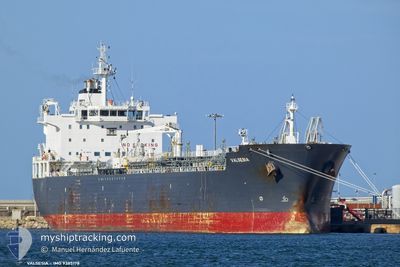
VALSESIA
Oil/Chemical Tanker
Current Trip
| Time Travelled | 7 days |
|---|---|
| Remaining Time | 12 h, 25 mins |
| Distance Travelled | 352.38 nm |
| Remaining Distance | 95.16 nm |
| AVG Speed | 7 Knots |
| MAX Speed | 13.4 Knots |
| AVG Wind | 9.2 knots |
| MAX Wind | 19 knots |
| MIN Temp | 23.3°C / 73.94°F |
| MAX Temp | 26.7°C / 80.06°F |
| Draught | 7.5 m |
| Position Received | Now |
Current Position
| Longitude | 15.49665° |
|---|---|
| Latitude | 37.13780° |
| Status | Under way using engine |
| Speed | 7.9 Knots |
| Course | 7° |
| Area | Ionian Sea |
| Station | T-AIS |
| Position Received | Now |
Info
Information
The current position of VALSESIA is in Ionian Sea with coordinates 37.13780° / 15.49665° as reported on 2024-06-25 23:50 by AIS to our vessel tracker app. The vessel's current speed is 7.9 Knots and is heading at the port of MILAZZO. The estimated time of arrival as calculated by vessel tracking app is 2024-06-26 12:16 LT
The vessel VALSESIA (IMO: 9385178, MMSI: 215063000) is a Oil/Chemical Tanker that was built in 2008 ( 16 years old ). It's sailing under the flag of [MT] Malta.
In this page you can find informations about the vessels current position, last detected port calls, and current voyage information. If the vessels is not in coverage by AIS you will find the latest position.
The current position of VALSESIA is detected by our AIS receivers and we are not responsible for the reliability of the data. The last position was recorded while the vessel was in Coverage by the Ais receivers of our vessel tracking app.
The current draught of VALSESIA as reported by AIS is 7.5 meters
Weather
| Temperature | 23.6°C / 74.48°F |
|---|---|
| Wind Speed | 7 knots |
| Direction | 92° E |
| Pressure | 1010.4 hPa |
| Humidity | 86.9 % |
| Cloud Coverage | --- |
Featured Company
Last Port Calls
| Port | Arrival | Departure | Time In Port |
|---|---|---|---|
| 2024-06-17 15:32 | 2024-06-18 15:25 | 23 h | |
| 2024-06-14 10:57 | 2024-06-15 19:53 | 1 d | |
| 2024-06-05 07:46 | 2024-06-07 04:36 | 1 d | |
| 2024-05-27 06:12 | 2024-05-31 04:05 | 3 d | |
| 2024-05-24 14:46 | 2024-05-25 11:13 | 20 h | |
| 2024-05-21 18:17 | 2024-05-23 04:14 | 1 d | |
| 2024-05-20 17:28 | 2024-05-21 06:07 | 12 h | |
| 2024-05-09 19:02 | 2024-05-11 19:55 | 2 d | |
| 2024-05-04 04:52 | 2024-05-07 05:38 | 3 d | |
| 2024-04-30 12:36 | 2024-05-03 10:28 | 2 d |
Last Trips
| Origin | Departure | Destination | Arrival | Distance | |
|---|---|---|---|---|---|
| 2024-06-15 20:53 | 2024-06-17 16:32 | 345.50 nm | |||
| 2024-06-07 06:36 | 2024-06-14 11:57 | 444.37 nm | |||
| 2024-05-31 06:05 | 2024-06-05 09:46 | 370.57 nm | |||
| 2024-05-25 13:13 | 2024-05-27 08:12 | 330.78 nm | |||
| 2024-05-23 06:14 | 2024-05-24 16:46 | 357.09 nm | |||
| 2024-05-21 08:07 | 2024-05-21 20:17 | 7.05 nm | |||
| 2024-05-11 21:55 | 2024-05-20 19:28 | 712.90 nm | |||
| 2024-05-07 07:38 | 2024-05-09 21:02 | 373.74 nm | |||
| 2024-05-03 12:28 | 2024-05-04 06:52 | 112.21 nm | |||
| 2024-04-29 09:34 | 2024-04-30 14:36 | 6.80 nm |
Events
| Time | Event | Details | Position / Dest | Info |
|---|---|---|---|---|
| 2024-06-25 18:19 | Change Sea Area | Italian part of the Ionian Sea Italian part of the Mediterranean Sea - Eastern Basin |
36.64258 / 15.28548
Ionian Sea
IT MLZ
|
Speed: 5.1 kn Course: 23° |
| 2024-06-25 17:31 | Status Changed | Under way using engine Default |
36.57797 / 15.25013
IT MLZ
|
Speed: 5.5 kn Course: 24° |
| 2024-06-25 17:27 | Status Changed | Default Under way using engine |
36.57193 / 15.24673
IT MLZ
|
Speed: 5.5 kn Course: 25° |
| 2024-06-25 16:52 | Status Changed | Under way using engine Default |
36.52420 / 15.21790
IT MLZ
|
Speed: 5.3 kn Course: 17° |
| 2024-06-25 16:36 | IN Coverage |
36.52558 / 15.21858
Mediterranean Sea - Eastern Basin
IT MLZ
|
Speed: 5.2 kn Course: 21° |
|
| 2024-06-25 15:48 | Status Changed | Default Under way using engine |
36.43833 / 15.17825
IT MLZ
|
Speed: 5 kn Course: 23° |
| 2024-06-25 15:46 | OUT of Coverage |
36.43617 / 15.17712
Mediterranean Sea - Eastern Basin
IT MLZ
|
Speed: 5 kn Course: 23° |
|
| 2024-06-25 15:45 | Status Changed | Under way using engine Default |
36.43450 / 15.17618
IT MLZ
|
Speed: 4.9 kn Course: 25° |
| 2024-06-25 15:15 | Status Changed | Default Under way using engine |
36.39667 / 15.15553
IT MLZ
|
Speed: 4.9 kn Course: 25° |
| 2024-06-25 15:13 | Status Changed | Under way using engine Default |
36.39343 / 15.15375
IT MLZ
|
Speed: 4.9 kn Course: 25° |