
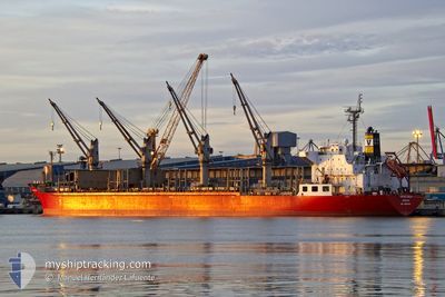
VANTAGE DREAM
Bulk Carrier
Current Trip
| Time Travelled | 13 days |
|---|---|
| Remaining Time | 5 days |
| Distance Travelled | 3303.95 nm |
| Remaining Distance | 1538.34 nm |
| AVG Speed | 10.3 Knots |
| MAX Speed | 10.3 Knots |
| AVG Wind | 11.8 knots |
| MAX Wind | 26.7 knots |
| MIN Temp | 21.4°C / 70.52°F |
| MAX Temp | 37.4°C / 99.32°F |
| Draught | 9 m |
| Position Received | 1 m ago |
Current Position
| Longitude | 30.05927° |
|---|---|
| Latitude | 32.29148° |
| Status | Under way using engine |
| Speed | 11.8 Knots |
| Course | 286.5° |
| Area | Mediterranean Sea - Eastern Basin |
| Station | T-AIS |
| Position Received | 1 m ago |
Info
Information
The current position of VANTAGE DREAM is in Mediterranean Sea - Eastern Basin with coordinates 32.29148° / 30.05927° as reported on 2024-06-11 01:33 by AIS to our vessel tracker app. The vessel's current speed is 11.8 Knots and is heading at the port of SAGUNTO. The estimated time of arrival as calculated by vessel tracking app is 2024-06-16 12:05 LT
The vessel VANTAGE DREAM (IMO: 9616606, MMSI: 636019143) is a Bulk Carrier that was built in 2011 ( 13 years old ). It's sailing under the flag of [LR] Liberia.
In this page you can find informations about the vessels current position, last detected port calls, and current voyage information. If the vessels is not in coverage by AIS you will find the latest position.
The current position of VANTAGE DREAM is detected by our AIS receivers and we are not responsible for the reliability of the data. The last position was recorded while the vessel was in Coverage by the Ais receivers of our vessel tracking app.
The current draught of VANTAGE DREAM as reported by AIS is 9 meters
Weather
| Temperature | 24.7°C / 76.46°F |
|---|---|
| Wind Speed | 8 knots |
| Direction | 314° NW |
| Pressure | 1010.4 hPa |
| Humidity | 73.7 % |
| Cloud Coverage | --- |
Featured Company
Last Port Calls
| Port | Arrival | Departure | Time In Port |
|---|---|---|---|
| 2024-06-10 03:40 | 2024-06-10 13:00 | 9 h | |
| 2024-05-26 09:25 | 2024-05-28 02:09 | 1 d | |
| 2024-05-21 04:53 | 2024-05-24 05:44 | 3 d | |
| 2024-05-17 07:12 | 2024-05-19 09:43 | 2 d | |
| 2024-05-04 21:14 | 2024-05-07 13:53 | 2 d | |
| 2024-05-01 18:41 | 2024-05-03 22:56 | 2 d |
Most Visited Ports (Last year)
| Port | Arrivals | |
|---|---|---|
| 3 | ||
| 2 | ||
| 2 | ||
| 1 | ||
| 1 | ||
| 1 |
Last Trips
| Origin | Departure | Destination | Arrival | Distance | |
|---|---|---|---|---|---|
| 2024-05-28 07:39 | 2024-06-10 05:40 | 3078.33 nm | |||
| 2024-05-24 11:14 | 2024-05-26 14:55 | 267.61 nm | |||
| 2024-05-19 15:13 | 2024-05-21 10:23 | 84.17 nm | |||
| 2024-05-07 19:23 | 2024-05-17 12:42 | 1988.77 nm | |||
| 2024-05-04 04:26 | 2024-05-05 02:44 | 16.27 nm | |||
| 2024-03-28 17:21 | 2024-05-02 00:11 | 3898.19 nm |
Events
| Time | Event | Details | Position / Dest | Info |
|---|---|---|---|---|
| 2024-06-11 00:18 | Status Changed | Under way using engine Default |
32.21686 / 30.33844
ES SAG
|
Speed: 11.7 kn Course: 287° |
| 2024-06-11 00:09 | IN Coverage |
32.21836 / 30.33289
Mediterranean Sea - Eastern Basin
ES SAG
|
Speed: 11.7 kn Course: 288.1° |
|
| 2024-06-10 22:49 | Status Changed | Default Under way using engine |
32.14201 / 30.66557
ES SAG
|
Speed: 11.8 kn Course: 287.4° |
| 2024-06-10 22:44 | OUT of Coverage |
32.13703 / 30.68618
Mediterranean Sea - Eastern Basin
ES SAG
|
Speed: 11.8 kn Course: 287.4° |
|
| 2024-06-10 22:42 | Status Changed | Under way using engine Default |
32.13533 / 30.69237
ES SAG
|
Speed: 11.8 kn Course: 289° |
| 2024-06-10 22:21 | Status Changed | Default Under way using engine |
32.10513 / 30.76737
ES SAG
|
Speed: 12.1 kn Course: 291.6° |
| 2024-06-10 22:13 | Status Changed | Under way using engine Default |
32.09417 / 30.79800
ES SAG
|
Speed: 12.1 kn Course: 291° |
| 2024-06-10 22:09 | Status Changed | Default Under way using engine |
32.08900 / 30.81356
ES SAG
|
Speed: 12.1 kn Course: 291.1° |
| 2024-06-10 21:58 | Status Changed | Under way using engine Default |
32.07550 / 30.85466
ES SAG
|
Speed: 12.2 kn Course: 290° |
| 2024-06-10 21:58 | IN Coverage |
32.07550 / 30.85466
Mediterranean Sea - Eastern Basin
ES SAG
|
Speed: 12.2 kn Course: 289.7° |