
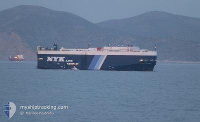
VEGA LEADER
Vehicles Carrier
Current Trip
| Time Travelled | 20 h, 34 mins |
|---|---|
| Remaining Time | --- |
| Distance Travelled | 296.38 nm |
| Remaining Distance | --- |
| AVG Speed | 14.7 Knots |
| MAX Speed | 17.2 Knots |
| AVG Wind | 8.4 knots |
| MAX Wind | 13 knots |
| MIN Temp | 19.4°C / 66.92°F |
| MAX Temp | 28.5°C / 83.3°F |
| Draught | 8.8 m |
| Position Received | Now |
Current Position
| Longitude | 24.74039° |
|---|---|
| Latitude | 38.15154° |
| Status | Under way using engine |
| Speed | 16.8 Knots |
| Course | 205° |
| Area | Aegean Sea |
| Station | T-AIS |
| Position Received | Now |
Info
Information
The current position of VEGA LEADER is in Aegean Sea with coordinates 38.15154° / 24.74039° as reported on 2024-06-17 14:39 by AIS to our vessel tracker app. The vessel's current speed is 16.8 Knots and is heading at the port of VIGO. The estimated time of arrival as calculated by vessel tracking app is 2024-06-23 14:00 LT
The vessel VEGA LEADER (IMO: 9213818, MMSI: 355948000) is a Vehicles Carrier that was built in 2000 ( 24 years old ). It's sailing under the flag of [PA] Panama.
In this page you can find informations about the vessels current position, last detected port calls, and current voyage information. If the vessels is not in coverage by AIS you will find the latest position.
The current position of VEGA LEADER is detected by our AIS receivers and we are not responsible for the reliability of the data. The last position was recorded while the vessel was in Coverage by the Ais receivers of our vessel tracking app.
The current draught of VEGA LEADER as reported by AIS is 8.8 meters
Weather
| Temperature | 25.4°C / 77.72°F |
|---|---|
| Wind Speed | 7 knots |
| Direction | 342° NNW |
| Pressure | 1012.7 hPa |
| Humidity | 68 % |
| Cloud Coverage | 8 % |
Featured Company
Last Port Calls
| Port | Arrival | Departure | Time In Port |
|---|---|---|---|
| 2024-06-16 01:44 | 2024-06-16 18:06 | 16 h | |
| 2024-06-13 17:52 | 2024-06-15 00:34 | 1 d | |
| 2024-06-13 15:35 | 2024-06-13 15:47 | 11 m | |
| 2024-06-12 12:54 | 2024-06-12 23:17 | 10 h | |
| 2024-06-07 18:01 | 2024-06-08 16:06 | 22 h | |
| 2024-06-05 09:04 | 2024-06-06 08:10 | 23 h | |
| 2024-06-02 10:22 | 2024-06-02 17:25 | 7 h | |
| 2024-05-30 00:48 | 2024-05-31 10:14 | 1 d | |
| 2024-05-27 05:47 | 2024-05-27 17:09 | 11 h | |
| 2024-05-25 16:06 | 2024-05-27 00:27 | 1 d |
Last Trips
| Origin | Departure | Destination | Arrival | Distance | |
|---|---|---|---|---|---|
| 2024-06-15 03:34 | 2024-06-16 04:44 | 97.41 nm | |||
| 2024-06-13 18:47 | 2024-06-13 20:52 | 1.60 nm | |||
| 2024-06-13 02:17 | 2024-06-13 18:35 | 19.39 nm | |||
| 2024-06-08 18:06 | 2024-06-12 15:54 | 1334.14 nm | |||
| 2024-06-06 10:10 | 2024-06-07 20:01 | 535.67 nm | |||
| 2024-06-02 19:25 | 2024-06-05 11:04 | 974.45 nm | |||
| 2024-05-31 11:14 | 2024-06-02 12:22 | 704.28 nm | |||
| 2024-05-27 19:09 | 2024-05-30 01:48 | 805.13 nm | |||
| 2024-05-27 02:27 | 2024-05-27 07:47 | 64.38 nm | |||
| 2024-05-24 20:25 | 2024-05-25 18:06 | 309.30 nm |
Events
| Time | Event | Details | Position / Dest | Info |
|---|---|---|---|---|
| 2024-06-17 13:37 | ETA Changed | 2024/06/23 14:00 2024/06/23 16:00 |
38.40666 / 24.91274
TR GEM>ES VGO
|
Speed: 16.5 kn Course: 208.9° |
| 2024-06-17 07:33 | Change Sea Area | Greek part of the Aegean Sea Turkish part of the Aegean Sea |
39.89552 / 25.83859
Aegean Sea
TR GEM>ES VGO
|
Speed: 17.2 kn Course: 215.7° |
| 2024-06-17 07:32 | Status Changed | Under way using engine Default |
39.89780 / 25.84070
TR GEM>ES VGO
|
Speed: 17.2 kn Course: 223° |
| 2024-06-17 07:20 | IN Coverage |
39.89552 / 25.83859
Aegean Sea
TR GEM>ES VGO
|
Speed: 17.2 kn Course: 215.7° |
|
| 2024-06-17 06:32 | Status Changed | Default Under way using engine |
40.02277 / 26.14183
TR GEM>ES VGO
|
Speed: 14.6 kn Course: 263.3° |
| 2024-06-17 06:26 | Change Sea Area | Turkish part of the Aegean Sea Turkish part of the Sea of Marmara |
40.02577 / 26.17358
Aegean Sea
TR GEM>ES VGO
|
Speed: 14.6 kn Course: 263.3° |
| 2024-06-17 06:26 | OUT of Coverage |
40.02577 / 26.17358
Aegean Sea
TR GEM>ES VGO
|
Speed: 14.6 kn Course: 263.3° |
|
| 2024-06-17 04:20 | Status Changed | Under way using engine Default |
40.35354 / 26.64279
TR GEM>ES VGO
|
Speed: 9.9 kn Course: 233° |
| 2024-06-17 04:04 | IN Coverage |
40.34754 / 26.63743
Sea of Marmara
TR GEM>ES VGO
|
Speed: 15.4 kn Course: 214.3° |
|
| 2024-06-17 01:56 | OUT of Coverage |
40.55101 / 27.06309
Sea of Marmara
TR GEM>ES VGO
|
Speed: 15.1 kn Course: 241.7° |