
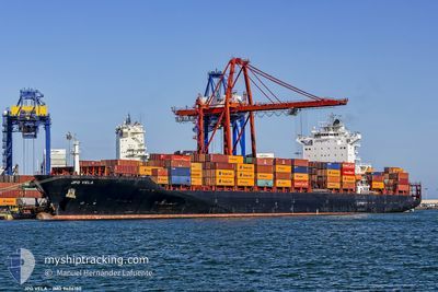
VELA
Container Ship
Current Trip
| Time Travelled | 23 h, 0 mins |
|---|---|
| Remaining Time | --- |
| Distance Travelled | 357.57 nm |
| Remaining Distance | --- |
| AVG Speed | 15.7 Knots |
| MAX Speed | 16.7 Knots |
| AVG Wind | 13.1 knots |
| MAX Wind | 16 knots |
| MIN Temp | 9.6°C / 49.28°F |
| MAX Temp | 15.3°C / 59.54°F |
| Draught | 9.7 m |
| Position Received | 22 h, 44 m ago |
Current Position
| Longitude | -71.67073° |
|---|---|
| Latitude | -33.57237° |
| Status | Under way using engine |
| Speed | 14.4 Knots |
| Course | 294.5° |
| Area | South Pacific Ocean |
| Station | T-AIS |
| Position Received | 22 h, 44 m ago |
Info
Information
The current position of VELA is in South Pacific Ocean with coordinates -33.57237° / -71.67073° as reported on 2024-05-14 11:42 by AIS to our vessel tracker app. The vessel's current speed is 14.4 Knots and is heading at the port of TIANJIN. The estimated time of arrival as calculated by vessel tracking app is 2024-06-11 10:00 LT
The vessel VELA (IMO: 9406180, MMSI: 636019716) is a Container Ship that was built in 2009 ( 15 years old ). It's sailing under the flag of [LR] Liberia.
In this page you can find informations about the vessels current position, last detected port calls, and current voyage information. If the vessels is not in coverage by AIS you will find the latest position.
The current position of VELA is detected by our AIS receivers and we are not responsible for the reliability of the data. The last position was recorded while the vessel was in Coverage by the Ais receivers of our vessel tracking app.
The current draught of VELA as reported by AIS is 9.7 meters
Weather
| Temperature | 15.4°C / 59.72°F |
|---|---|
| Wind Speed | 15 knots |
| Direction | 206° SSW |
| Pressure | 1018 hPa |
| Humidity | 59.4 % |
| Cloud Coverage | 96 % |
Featured Company
Last Port Calls
| Port | Arrival | Departure | Time In Port |
|---|---|---|---|
| 2024-05-13 11:32 | 2024-05-14 11:27 | 23 h | |
| 2024-05-08 12:57 | 2024-05-09 02:23 | 13 h | |
| 2024-05-01 00:11 | 2024-05-01 15:43 | 15 h | |
| 2024-04-07 14:45 | 2024-04-08 10:51 | 20 h | |
| 2024-04-02 10:31 | 2024-04-02 22:16 | 11 h | |
| 2024-03-26 18:32 | 2024-03-27 06:13 | 11 h | |
| 2024-03-23 19:16 | 2024-03-24 17:28 | 22 h | |
| 2024-03-20 16:52 | 2024-03-21 22:22 | 1 d |
Most Visited Ports (Last year)
| Port | Arrivals | |
|---|---|---|
| 6 | ||
| 6 | ||
| 5 | ||
| 5 | ||
| 5 | ||
| 3 |
Last Trips
| Origin | Departure | Destination | Arrival | Distance | |
|---|---|---|---|---|---|
| 2024-05-08 21:23 | 2024-05-13 07:32 | 1339.16 nm | |||
| 2024-05-01 10:43 | 2024-05-08 07:57 | 1306.30 nm | |||
| 2024-04-08 19:51 | 2024-04-30 19:11 | 8280.54 nm | |||
| 2024-04-03 06:16 | 2024-04-07 23:45 | 757.64 nm | |||
| 2024-03-27 14:13 | 2024-04-02 18:31 | 505.42 nm | |||
| 2024-03-25 01:28 | 2024-03-27 02:32 | 468.41 nm | |||
| 2024-03-22 07:22 | 2024-03-24 03:16 | 689.22 nm |
Events
| Time | Event | Details | Position / Dest | Info |
|---|---|---|---|---|
| 2024-05-14 11:52 | Status Changed | Default Under way using engine |
-33.55339 / -71.71778
CNXNG
|
Speed: 14.4 kn Course: 294.5° |
| 2024-05-14 11:42 | OUT of Coverage |
-33.57237 / -71.67073
South Pacific Ocean
CNXNG
|
Speed: 14.4 kn Course: 294.5° |
|
| 2024-05-14 11:37 | Change Sea Area | Chilean (disputed - Chilean point of view) part of the South Pacific Ocean Peruvian (disputed - Peruvian point of view) part of the South Pacific Ocean |
-33.57904 / -71.65254
South Pacific Ocean
CNXNG
|
Speed: 13.5 kn Course: 278.6° |
| 2024-05-14 11:27 | PORT DEPARTURE |
|
-33.58424 / -71.62748
CNXNG
|
Speed: 5 kn Course: 276° |
| 2024-05-14 11:26 | Draught Changed | 9.7 11.1 |
-33.58428 / -71.62484
[CL] SAN ANTONIO
|
Speed: 5.6 kn Course: 270° |
| 2024-05-14 11:26 | Destination Changed | CNXNG CLIIC |
-33.58428 / -71.62484
[CL] SAN ANTONIO
|
Speed: 5.6 kn Course: 270° |
| 2024-05-14 11:26 | ETA Changed | 2024/06/11 10:00 2024/05/13 10:00 |
-33.58428 / -71.62484
[CL] SAN ANTONIO
|
Speed: 5.6 kn Course: 270° |
| 2024-05-14 11:11 | START Moving |
-33.59013 / -71.61962
[CL] SAN ANTONIO
|
Speed: 3.1 kn Course: 163° |
|
| 2024-05-14 10:47 | Status Changed | Under way using engine Default |
-33.59262 / -71.61740
[CL] SAN ANTONIO
|
Speed: Course: 181° |
| 2024-05-14 10:47 | IN Coverage |
-33.59278 / -71.61722
South Pacific Ocean
[CL] SAN ANTONIO
|
Speed: Course: 160.6° |