
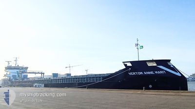
VERTOM ANNE MARIT
Cargo
Current Trip
Current Position
| Longitude | -0.26541° |
|---|---|
| Latitude | 53.74130° |
| Status | Moored |
| Speed | |
| Course | 17° |
| Area | North Sea |
| Station | T-AIS |
| Position Received | 6 m ago |
Info
Information
The current position of VERTOM ANNE MARIT is in North Sea with coordinates 53.74130° / -0.26541° as reported on 2024-06-06 20:50 by AIS to our vessel tracker app. The vessel's current speed is 0 Knots and is currently inside the port of HULL.
The vessel VERTOM ANNE MARIT (IMO: 9938755, MMSI: 245184000) is a Cargo It's sailing under the flag of [NL] Netherlands.
In this page you can find informations about the vessels current position, last detected port calls, and current voyage information. If the vessels is not in coverage by AIS you will find the latest position.
The current position of VERTOM ANNE MARIT is detected by our AIS receivers and we are not responsible for the reliability of the data. The last position was recorded while the vessel was in Coverage by the Ais receivers of our vessel tracking app.
The current draught of VERTOM ANNE MARIT as reported by AIS is 4 meters
Weather
| Temperature | 9.9°C / 49.82°F |
|---|---|
| Wind Speed | 6 knots |
| Direction | 282° WNW |
| Pressure | 1016.5 hPa |
| Humidity | 75.6 % |
| Cloud Coverage | 44 % |
Featured Company
Last Port Calls
| Port | Arrival | Departure | Time In Port |
|---|---|---|---|
| 2024-06-05 00:22 | |||
| 2024-05-18 09:55 | 2024-06-03 22:07 | 16 d | |
| 2024-04-29 03:09 | 2024-05-02 20:42 | 3 d | |
| 2024-04-23 12:12 | 2024-04-26 17:14 | 3 d | |
| 2024-04-07 20:02 | 2024-04-10 01:17 | 2 d | |
| 2024-04-06 19:36 | 2024-04-06 20:24 | 48 m | |
| 2024-04-02 10:31 | 2024-04-06 19:12 | 4 d | |
| 2024-04-02 08:48 | 2024-04-02 10:23 | 1 h |
Last Trips
| Origin | Departure | Destination | Arrival | Distance | |
|---|---|---|---|---|---|
| 2024-06-03 23:07 | 2024-06-05 01:22 | 235.79 nm | |||
| 2024-05-02 23:42 | 2024-05-18 10:55 | 3385.94 nm | |||
| 2024-04-26 20:14 | 2024-04-29 06:09 | 662.66 nm | |||
| 2024-04-10 03:17 | 2024-04-23 15:12 | 3068.47 nm | |||
| 2024-04-06 22:24 | 2024-04-07 22:02 | 240.28 nm | |||
| 2024-04-06 21:12 | 2024-04-06 21:36 | 0.53 nm | |||
| 2024-04-02 12:23 | 2024-04-02 12:31 | 0.43 nm | |||
| 2024-03-28 02:43 | 2024-04-02 10:48 | 1222.34 nm |
Events
| Time | Event | Details | Position / Dest | Info |
|---|---|---|---|---|
| 2024-06-05 08:44 | Status Changed | Moored Default |
53.74090 / -.26487
[GB] HULL
|
Speed: Course: 107° |
| 2024-06-05 08:41 | Status Changed | Default Moored |
53.74089 / -.26485
[GB] HULL
|
Speed: Course: 107° |
| 2024-06-05 01:29 | Status Changed | Moored Under way using engine |
53.74088 / -.26484
[GB] HULL
|
Speed: Course: 107° |
| 2024-06-05 00:22 | PORT ARRIVAL |
|
53.73971 / -.27706
[GB] HULL
|
Speed: 0.8 kn Course: 80° |
| 2024-06-05 00:18 | STOP Moving | 0.38 nm, South West of HULL |
53.73912 / -.27793
GBHUL
|
Speed: 0.3 kn Course: 92° |
| 2024-06-04 20:54 | Status Changed | Under way using engine Default |
53.52804 / .29149
GBHUL
|
Speed: 6.1 kn Course: 300° |
| 2024-06-04 20:48 | Status Changed | Default Under way using engine |
53.52231 / .30759
GBHUL
|
Speed: 5.4 kn Course: 303.4° |
| 2024-06-04 20:38 | Status Changed | Under way using engine Default |
53.51378 / .32885
GBHUL
|
Speed: 7.3 kn Course: 303° |
| 2024-06-04 20:36 | IN Coverage |
53.51378 / .32885
North Sea
GBHUL
|
Speed: 6.8 kn Course: 303.6° |
|
| 2024-06-04 16:44 | OUT of Coverage |
53.34862 / .96767
North Sea
GBHUL
|
Speed: 8.7 kn Course: 295.3° |