
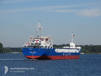
VERTOM ISA
General Cargo
Current Trip
| Time Travelled | 9 days |
|---|---|
| Remaining Time | --- |
| Distance Travelled | 448.71 nm |
| Remaining Distance | 73.30 nm |
| AVG Speed | 8.8 Knots |
| MAX Speed | 12.3 Knots |
| AVG Wind | 8.3 knots |
| MAX Wind | 18.9 knots |
| MIN Temp | 7.1°C / 44.78°F |
| MAX Temp | 17.6°C / 63.68°F |
| Draught | 3 m |
| Position Received | Now |
Current Position
| Longitude | -0.08062° |
|---|---|
| Latitude | 49.47274° |
| Status | At anchor |
| Speed | 0.3 Knots |
| Course | 204° |
| Area | English Channel |
| Station | T-AIS |
| Position Received | Now |
Info
Information
The current position of VERTOM ISA is in English Channel with coordinates 49.47274° / -0.08062° as reported on 2024-05-14 00:35 by AIS to our vessel tracker app. The vessel's current speed is 0.3 Knots and is heading at the port of ROUEN. The estimated time of arrival as calculated by vessel tracking app is 2024-05-13 11:54 LT
The vessel VERTOM ISA (IMO: 9507362, MMSI: 253743000) is a General Cargo that was built in 2010 ( 14 years old ). It's sailing under the flag of [LU] Luxembourg.
In this page you can find informations about the vessels current position, last detected port calls, and current voyage information. If the vessels is not in coverage by AIS you will find the latest position.
The current position of VERTOM ISA is detected by our AIS receivers and we are not responsible for the reliability of the data. The last position was recorded while the vessel was in Coverage by the Ais receivers of our vessel tracking app.
The current draught of VERTOM ISA as reported by AIS is 3 meters
Weather
| Temperature | 14°C / 57.2°F |
|---|---|
| Wind Speed | 9 knots |
| Direction | 169° S |
| Pressure | 1001.7 hPa |
| Humidity | 96.4 % |
| Cloud Coverage | 100 % |
Featured Company
Last Port Calls
| Port | Arrival | Departure | Time In Port |
|---|---|---|---|
| 2024-05-02 10:53 | 2024-05-04 01:00 | 1 d | |
| 2024-04-29 10:17 | 2024-04-29 10:55 | 38 m | |
| 2024-04-28 16:06 | 2024-04-29 10:16 | 18 h | |
| 2024-04-26 22:53 | 2024-04-28 15:52 | 1 d | |
| 2024-04-17 00:34 | 2024-04-18 11:42 | 1 d | |
| 2024-04-14 07:31 | 2024-04-16 15:24 | 2 d | |
| 2024-04-11 17:48 | 2024-04-12 19:53 | 1 d | |
| 2024-04-10 02:57 | 2024-04-11 15:17 | 1 d | |
| 2024-04-07 16:31 | 2024-04-09 06:37 | 1 d | |
| 2024-04-05 00:17 | 2024-04-05 01:05 | 48 m |
Last Trips
| Origin | Departure | Destination | Arrival | Distance | |
|---|---|---|---|---|---|
| 2024-04-29 12:55 | 2024-05-02 11:53 | 585.81 nm | |||
| 2024-04-29 12:16 | 2024-04-29 12:17 | 0.14 nm | |||
| 2024-04-28 17:52 | 2024-04-28 18:06 | 0.48 nm | |||
| 2024-04-18 13:42 | 2024-04-27 00:53 | 848.24 nm | |||
| 2024-04-16 17:24 | 2024-04-17 02:34 | 75.27 nm | |||
| 2024-04-12 20:53 | 2024-04-14 09:31 | 273.59 nm | |||
| 2024-04-11 16:17 | 2024-04-11 18:48 | 19.75 nm | |||
| 2024-04-09 07:37 | 2024-04-10 03:57 | 161.84 nm | |||
| 2024-04-05 03:05 | 2024-04-07 17:31 | 226.08 nm | |||
| 2024-03-22 17:35 | 2024-04-05 02:17 | 869.63 nm |
Events
| Time | Event | Details | Position / Dest | Info |
|---|---|---|---|---|
| 2024-05-13 13:02 | Status Changed | At anchor Under way using engine |
49.47258 / -.08023
FRURO
|
Speed: 0.2 kn Course: 219° |
| 2024-05-13 13:01 | STOP Moving | 7.91 nm, West of LE HAVRE |
49.47259 / -.08021
FRURO
|
Speed: 0.3 kn Course: 221° |
| 2024-05-13 07:43 | Status Changed | Under way using engine Default |
49.84220 / -1.31165
FRURO
|
Speed: 9 kn Course: 112° |
| 2024-05-13 07:38 | Status Changed | Default Under way using engine |
49.84642 / -1.32770
FRURO
|
Speed: 8.6 kn Course: 112° |
| 2024-05-13 06:23 | Change Sea Area | French part of the English Channel Guernsey part of the English Channel |
49.91746 / -1.56996
English Channel
FRURO
|
Speed: 7.8 kn Course: 115.5° |
| 2024-05-13 06:22 | Status Changed | Under way using engine Default |
49.91795 / -1.57159
FRURO
|
Speed: 7.8 kn Course: 116° |
| 2024-05-13 06:10 | IN Coverage |
49.91746 / -1.56996
English Channel
FRURO
|
Speed: 7.8 kn Course: 115.5° |
|
| 2024-05-13 03:26 | Status Changed | Default Under way using engine |
50.04872 / -2.03631
FRURO
|
Speed: 7.3 kn Course: 121° |
| 2024-05-13 03:18 | OUT of Coverage |
50.05715 / -2.05704
English Channel
FRURO
|
Speed: 7.3 kn Course: 121° |
|
| 2024-05-13 03:12 | Status Changed | Under way using engine Default |
50.06340 / -2.07303
FRURO
|
Speed: 7.5 kn Course: 121° |