
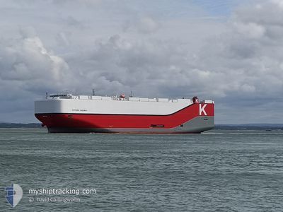
VICTORIA HIGHWAY
Cargo
Current Trip
| Time Travelled | 3 days |
|---|---|
| Remaining Time | --- |
| Distance Travelled | 1380.36 nm |
| Remaining Distance | 2311.84 nm |
| AVG Speed | 18.1 Knots |
| MAX Speed | 22 Knots |
| AVG Wind | 10.3 knots |
| MAX Wind | 21.8 knots |
| MIN Temp | 16.6°C / 61.88°F |
| MAX Temp | 27.2°C / 80.96°F |
| Draught | 9.8 m |
| Position Received | 1 d ago |
Current Position
| Longitude | -69.10134° |
|---|---|
| Latitude | 35.15563° |
| Status | Under way using engine |
| Speed | 19.4 Knots |
| Course | 64.9° |
| Area | North Atlantic Ocean |
| Station | T-AIS |
| Position Received | 1 d ago |
Info
Information
The current position of VICTORIA HIGHWAY is in North Atlantic Ocean with coordinates 35.15563° / -69.10134° as reported on 2024-06-10 12:24 by AIS to our vessel tracker app. The vessel's current speed is 19.4 Knots and is heading at the port of SOUTHAMPTON. The estimated time of arrival as calculated by vessel tracking app is 2024-06-18 05:00 LT
The vessel VICTORIA HIGHWAY (IMO: 9827255, MMSI: 374069000) is a Cargo It's sailing under the flag of [PA] Panama.
In this page you can find informations about the vessels current position, last detected port calls, and current voyage information. If the vessels is not in coverage by AIS you will find the latest position.
The current position of VICTORIA HIGHWAY is detected by our AIS receivers and we are not responsible for the reliability of the data. The last position was recorded while the vessel was in Coverage by the Ais receivers of our vessel tracking app.
The current draught of VICTORIA HIGHWAY as reported by AIS is 9.8 meters
Weather
| Temperature | 16.8°C / 62.24°F |
|---|---|
| Wind Speed | 4 knots |
| Direction | 220° SW |
| Pressure | 1021.9 hPa |
| Humidity | 98.9 % |
| Cloud Coverage | 100 % |
Featured Company
Last Port Calls
| Port | Arrival | Departure | Time In Port |
|---|---|---|---|
| 2024-06-08 08:45 | 2024-06-09 04:25 | 19 h | |
| 2024-06-06 00:26 | 2024-06-07 20:43 | 1 d | |
| 2024-06-02 23:45 | 2024-06-03 22:31 | 22 h | |
| 2024-06-02 02:10 | 2024-06-02 23:22 | 21 h | |
| 2024-06-01 14:07 | 2024-06-02 01:22 | 11 h | |
| 2024-05-19 19:32 | 2024-05-22 22:13 | 3 d | |
| 2024-05-17 02:04 | 2024-05-18 12:11 | 1 d | |
| 2024-05-15 17:11 | 2024-05-16 21:33 | 1 d | |
| 2024-05-13 18:51 | 2024-05-14 12:17 | 17 h | |
| 2024-04-29 14:20 | 2024-04-30 07:33 | 17 h |
Most Visited Ports (Last year)
| Port | Arrivals | |
|---|---|---|
| 4 | ||
| 4 | ||
| 4 | ||
| 4 | ||
| 3 | ||
| 3 |
Last Trips
| Origin | Departure | Destination | Arrival | Distance | |
|---|---|---|---|---|---|
| 2024-06-07 16:43 | 2024-06-08 04:45 | 167.75 nm | |||
| 2024-06-03 18:31 | 2024-06-05 20:26 | 700.61 nm | |||
| 2024-06-02 19:22 | 2024-06-02 19:45 | 1.11 nm | |||
| 2024-06-01 21:22 | 2024-06-01 22:10 | 4.50 nm | |||
| 2024-05-23 00:13 | 2024-06-01 10:07 | 3933.08 nm | |||
| 2024-05-18 14:11 | 2024-05-19 21:32 | 359.08 nm | |||
| 2024-05-16 23:33 | 2024-05-17 04:04 | 65.48 nm | |||
| 2024-05-14 13:17 | 2024-05-15 19:11 | 481.97 nm | |||
| 2024-04-30 03:33 | 2024-05-13 19:51 | 3840.61 nm | |||
| 2024-04-28 17:32 | 2024-04-29 10:20 | 168.44 nm |
Events
| Time | Event | Details | Position / Dest | Info |
|---|---|---|---|---|
| 2024-06-10 12:29 | Status Changed | Default Under way using engine |
35.16667 / -69.07000
US CHS > GBSOU
|
Speed: 19.4 kn Course: 64.9° |
| 2024-06-10 12:24 | Status Changed | Under way using engine Default |
35.15563 / -69.10134
US CHS > GBSOU
|
Speed: 19 kn Course: 64° |
| 2024-06-10 12:24 | OUT of Coverage |
35.15563 / -69.10134
North Atlantic Ocean
US CHS > GBSOU
|
Speed: 19.4 kn Course: 64.9° |
|
| 2024-06-10 12:23 | Status Changed | Default Under way using engine |
35.15333 / -69.10667
US CHS > GBSOU
|
Speed: 19.4 kn Course: 65.6° |
| 2024-06-10 12:23 | Status Changed | Under way using engine Default |
35.15288 / -69.10854
US CHS > GBSOU
|
Speed: 19 kn Course: 64° |
| 2024-06-10 12:17 | Status Changed | Default Under way using engine |
35.13833 / -69.14167
US CHS > GBSOU
|
Speed: 19.3 kn Course: 64.1° |
| 2024-06-10 12:10 | Status Changed | Under way using engine Default |
35.12353 / -69.18305
US CHS > GBSOU
|
Speed: 19.3 kn Course: 63° |
| 2024-06-10 12:05 | Status Changed | Default Under way using engine |
35.11170 / -69.21236
US CHS > GBSOU
|
Speed: 19.3 kn Course: 63° |
| 2024-06-10 11:48 | Status Changed | Under way using engine Default |
35.06930 / -69.31306
US CHS > GBSOU
|
Speed: 19 kn Course: 63° |
| 2024-06-10 11:47 | Status Changed | Default Under way using engine |
35.06667 / -69.31834
US CHS > GBSOU
|
Speed: 19.3 kn Course: 63.7° |