
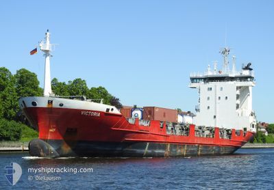
VICTORIA
Container Ship
Current Trip
| Trip Time | 3 days |
|---|---|
| Trip Distance | 1120.53 nm |
| AVG Speed | 10.7 Knots |
| MAX Speed | 16.7 Knots |
| Draught | 6.1 m |
| AVG Wind | 9.5 knots |
| MAX Wind | 19.9 knots |
| MIN Temp | 9.6°C / 49.28°F |
| MAX Temp | 24.7°C / 76.46°F |
| Position Received | 12 h, 14 m ago |
Current Position
| Longitude | 30.13887° |
|---|---|
| Latitude | 59.89338° |
| Status | Under way using engine |
| Speed | 6.7 Knots |
| Course | 110° |
| Area | Gulf of Finland |
| Station | T-AIS |
| Position Received | 12 h, 14 m ago |
Info
Information
The current position of VICTORIA is in Gulf of Finland with coordinates 59.89338° / 30.13887° as reported on 2024-05-31 14:56 by AIS to our vessel tracker app. The vessel's current speed is 6.7 Knots and is currently inside the port of ST PETERSBURG.
The vessel VICTORIA (IMO: 9165308, MMSI: 277550000) is a Container Ship that was built in 1998 ( 26 years old ). It's sailing under the flag of [LT] Lithuania.
In this page you can find informations about the vessels current position, last detected port calls, and current voyage information. If the vessels is not in coverage by AIS you will find the latest position.
The current position of VICTORIA is detected by our AIS receivers and we are not responsible for the reliability of the data. The last position was recorded while the vessel was in Coverage by the Ais receivers of our vessel tracking app.
The current draught of VICTORIA as reported by AIS is 6.1 meters
Weather
| Temperature | 16.3°C / 61.34°F |
|---|---|
| Wind Speed | 5 knots |
| Direction | 112° ESE |
| Pressure | 1015.8 hPa |
| Humidity | 90.7 % |
| Cloud Coverage | 70 % |
Featured Company
Last Port Calls
| Port | Arrival | Departure | Time In Port |
|---|---|---|---|
| 2024-05-31 15:02 | |||
| 2024-05-24 17:14 | 2024-05-27 21:44 | 3 d | |
| 2024-05-20 03:24 | 2024-05-20 18:48 | 15 h | |
| 2024-05-15 17:12 | 2024-05-16 01:26 | 8 h | |
| 2024-05-10 14:40 | 2024-05-11 08:00 | 17 h | |
| 2024-05-08 03:07 | 2024-05-08 03:09 | 1 m | |
| 2024-05-06 08:41 | 2024-05-06 19:27 | 10 h | |
| 2024-05-04 15:21 | 2024-05-04 16:24 | 1 h | |
| 2024-05-01 15:25 | 2024-05-02 09:25 | 17 h | |
| 2024-04-28 08:38 | 2024-04-28 08:42 | 3 m |
Most Visited Ports (Last year)
| Port | Arrivals | |
|---|---|---|
| 21 | ||
| 20 | ||
| 19 | ||
| 9 | ||
| 6 | ||
| 6 |
Last Trips
| Origin | Departure | Destination | Arrival | Distance | |
|---|---|---|---|---|---|
| 2024-05-27 23:44 | 2024-05-31 18:02 | 1120.53 nm | |||
| 2024-05-20 21:48 | 2024-05-24 19:14 | 1131.27 nm | |||
| 2024-05-16 03:26 | 2024-05-20 06:24 | 1122.66 nm | |||
| 2024-05-11 11:00 | 2024-05-15 19:12 | 1137.21 nm | |||
| 2024-05-08 05:09 | 2024-05-10 17:40 | 791.30 nm | |||
| 2024-05-06 21:27 | 2024-05-08 05:07 | 332.18 nm | |||
| 2024-05-04 18:24 | 2024-05-06 10:41 | 345.62 nm | |||
| 2024-05-02 12:25 | 2024-05-04 17:21 | 788.61 nm | |||
| 2024-04-28 10:42 | 2024-05-01 18:25 | 826.06 nm | |||
| 2024-04-27 02:38 | 2024-04-28 10:38 | 331.93 nm |
Events
| Time | Event | Details | Position / Dest | Info |
|---|---|---|---|---|
| 2024-05-31 15:38 | STOP Moving |
59.86858 / 30.21594
[RU] ST PETERSBURG
|
Speed: Course: 119° |
|
| 2024-05-31 15:02 | Status Changed | Default Under way using engine |
59.88909 / 30.16058
[RU] ST PETERSBURG
|
Speed: 6.7 kn Course: 110° |
| 2024-05-31 15:02 | PORT ARRIVAL |
|
59.88909 / 30.16058
[RU] ST PETERSBURG
|
Speed: 6.7 kn Course: 110° |
| 2024-05-31 14:56 | OUT of Coverage |
59.89338 / 30.13887
Gulf of Finland
[RU] ST PETERSBURG
|
Speed: 6.7 kn Course: 110° |
|
| 2024-05-31 14:46 | IN Coverage |
59.90053 / 30.10433
Gulf of Finland
RU LED
|
Speed: 8.7 kn Course: 112° |
|
| 2024-05-31 14:43 | Status Changed | Under way using engine Default |
59.90321 / 30.09160
RU LED
|
Speed: 10.1 kn Course: 112° |
| 2024-05-31 10:49 | Status Changed | Default Under way using engine |
60.03015 / 28.99445
RU LED
|
Speed: 12.8 kn Course: 91° |
| 2024-05-31 10:48 | OUT of Coverage |
60.03019 / 28.98982
Gulf of Finland
RU LED
|
Speed: 12.8 kn Course: 91° |
|
| 2024-05-31 04:23 | Change Sea Area | Russian part of the Gulf of Finland Estonian part of the Gulf of Finland |
59.96278 / 26.42900
Gulf of Finland
RU LED
|
Speed: 13.6 kn Course: 75° |
| 2024-05-31 03:47 | Change Sea Area | Estonian part of the Gulf of Finland Finnish part of the Gulf of Finland |
59.92697 / 26.16765
Gulf of Finland
RU LED
|
Speed: 13.8 kn Course: 75.7° |