
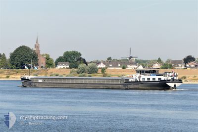
VICTUS
Not available
Current Trip
| Time Travelled | 20 h, 5 mins |
|---|---|
| Remaining Time | 1 day |
| Distance Travelled | 86.10 nm |
| Remaining Distance | 241.56 nm |
| AVG Speed | 6.6 Knots |
| MAX Speed | 9.2 Knots |
| AVG Wind | 11.3 knots |
| MAX Wind | 20.4 knots |
| MIN Temp | 13.1°C / 55.58°F |
| MAX Temp | 17.7°C / 63.86°F |
| Draught | 0 m |
| Position Received | 1 m ago |
Current Position
| Longitude | 5.78798° |
|---|---|
| Latitude | 51.87700° |
| Status | Under way using engine |
| Speed | 6 Knots |
| Course | 98° |
| Area | North Sea |
| Station | T-AIS |
| Position Received | 1 m ago |
Info
Information
The current position of VICTUS is in North Sea with coordinates 51.87700° / 5.78798° as reported on 2024-06-01 09:35 by AIS to our vessel tracker app. The vessel's current speed is 6 Knots and is heading at the port of MANNHEIM. The estimated time of arrival as calculated by vessel tracking app is 2024-06-03 01:04 LT
The vessel VICTUS (MMSI: 244850067) is a Not available It's sailing under the flag of [NL] Netherlands.
In this page you can find informations about the vessels current position, last detected port calls, and current voyage information. If the vessels is not in coverage by AIS you will find the latest position.
The current position of VICTUS is detected by our AIS receivers and we are not responsible for the reliability of the data. The last position was recorded while the vessel was in Coverage by the Ais receivers of our vessel tracking app.
Weather
| Temperature | 17.2°C / 62.96°F |
|---|---|
| Wind Speed | 10 knots |
| Direction | 352° N |
| Pressure | 1016.4 hPa |
| Humidity | 82.2 % |
| Cloud Coverage | 100 % |
Featured Company
Last Port Calls
| Port | Arrival | Departure | Time In Port |
|---|---|---|---|
| 2024-05-31 12:43 | 2024-05-31 13:31 | 47 m | |
| 2024-05-31 10:07 | 2024-05-31 10:54 | 47 m | |
| 2024-05-31 06:25 | 2024-05-31 09:46 | 3 h | |
| 2024-05-30 11:03 | 2024-05-31 06:12 | 19 h | |
| 2024-05-30 07:28 | 2024-05-30 08:06 | 38 m | |
| 2024-05-27 14:29 | 2024-05-29 17:38 | 2 d | |
| 2024-05-27 10:00 | 2024-05-27 13:20 | 3 h | |
| 2024-05-22 13:04 | 2024-05-22 13:15 | 10 m | |
| 2024-05-21 16:34 | 2024-05-22 12:37 | 20 h | |
| 2024-05-21 15:19 | 2024-05-21 15:28 | 9 m |
Last Trips
| Origin | Departure | Destination | Arrival | Distance | |
|---|---|---|---|---|---|
| 2024-05-31 12:54 | 2024-05-31 14:43 | 10.95 nm | |||
| 2024-05-31 11:46 | 2024-05-31 12:07 | 2.37 nm | |||
| 2024-05-31 08:12 | 2024-05-31 08:25 | 1.33 nm | |||
| 2024-05-30 10:06 | 2024-05-30 13:03 | 10.74 nm | |||
| 2024-05-29 19:38 | 2024-05-30 09:28 | 66.43 nm | |||
| 2024-05-27 15:20 | 2024-05-27 16:29 | 9.68 nm | |||
| 2024-05-22 15:15 | 2024-05-27 12:00 | 298.76 nm | |||
| 2024-05-22 14:37 | 2024-05-22 15:04 | 4.61 nm | |||
| 2024-05-21 17:28 | 2024-05-21 18:34 | 5.59 nm | |||
| 2024-05-20 05:42 | 2024-05-21 17:19 | 127.24 nm |
Events
| Time | Event | Details | Position / Dest | Info |
|---|---|---|---|---|
| 2024-06-01 03:18 | START Moving | 0.26 nm, West of WERKENDAM |
51.80798 / 4.86986
MANNHEIM
|
Speed: 3.5 kn Course: 66.6° |
| 2024-06-01 03:17 | Status Changed | Under way using engine Moored |
51.80758 / 4.86833
MANNHEIM
|
Speed: Course: 511° |
| 2024-05-31 22:07 | Status Changed | Moored Under way using engine |
51.80719 / 4.86707
MANNHEIM
|
Speed: Course: 511° |
| 2024-05-31 21:28 | STOP Moving | 0.36 nm, West of WERKENDAM |
51.80721 / 4.86709
MANNHEIM
|
Speed: 0.3 kn Course: 511° |
| 2024-05-31 19:14 | IN Coverage |
51.69279 / 4.49604
North Sea
MANNHEIM
|
Speed: 8.3 kn Course: 90.3° |
|
| 2024-05-31 17:36 | OUT of Coverage |
51.65798 / 4.33870
North Sea
MANNHEIM
|
Speed: 8.7 kn Course: 78.1° |
|
| 2024-05-31 16:44 | START Moving | 2.68 nm, East of BRUINISSE |
51.66114 / 4.16121
MANNHEIM
|
Speed: 3.9 kn Course: 86° |
| 2024-05-31 16:42 | Status Changed | Under way using engine Moored |
51.66107 / 4.15845
MANNHEIM
|
Speed: Course: 511° |
| 2024-05-31 16:34 | Status Changed | Moored Under way using engine |
51.66109 / 4.15807
MANNHEIM
|
Speed: Course: 511° |
| 2024-05-31 16:15 | STOP Moving | 2.56 nm, East of BRUINISSE |
51.66109 / 4.15808
MANNHEIM
|
Speed: 0.2 kn Course: 511° |