
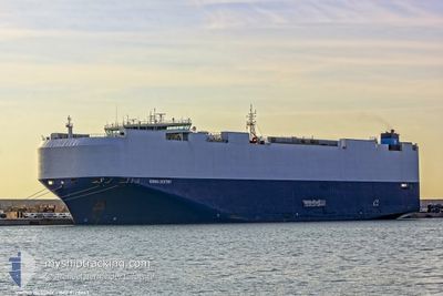
VIKING DESTINY
Cargo
Current Trip
| Time Travelled | 4 days |
|---|---|
| Remaining Time | 1 day |
| Distance Travelled | 1614.95 nm |
| Remaining Distance | 587.25 nm |
| AVG Speed | 15.4 Knots |
| MAX Speed | 19.4 Knots |
| AVG Wind | 12.4 knots |
| MAX Wind | 19 knots |
| MIN Temp | 12°C / 53.6°F |
| MAX Temp | 20.4°C / 68.72°F |
| Draught | 8.9 m |
| Position Received | 10 h, 52 m ago |
Current Position
| Longitude | -9.84071° |
|---|---|
| Latitude | 37.75447° |
| Status | Under way using engine |
| Speed | 16.4 Knots |
| Course | 168.4° |
| Area | North Atlantic Ocean |
| Station | T-AIS |
| Position Received | 10 h, 52 m ago |
Info
Information
The current position of VIKING DESTINY is in North Atlantic Ocean with coordinates 37.75447° / -9.84071° as reported on 2024-05-18 02:42 by AIS to our vessel tracker app. The vessel's current speed is 16.4 Knots and is heading at the port of TARRAGONA. The estimated time of arrival as calculated by vessel tracking app is 2024-05-20 01:07 LT
The vessel VIKING DESTINY (IMO: 9728863, MMSI: 538007385) is a Cargo It's sailing under the flag of [MH] Marshall Is.
In this page you can find informations about the vessels current position, last detected port calls, and current voyage information. If the vessels is not in coverage by AIS you will find the latest position.
The current position of VIKING DESTINY is detected by our AIS receivers and we are not responsible for the reliability of the data. The last position was recorded while the vessel was in Coverage by the Ais receivers of our vessel tracking app.
The current draught of VIKING DESTINY as reported by AIS is 8.9 meters
Weather
| Temperature | 16.8°C / 62.24°F |
|---|---|
| Wind Speed | 9 knots |
| Direction | 312° NW |
| Pressure | 1014.8 hPa |
| Humidity | 68 % |
| Cloud Coverage | --- |
Featured Company
Last Port Calls
| Port | Arrival | Departure | Time In Port |
|---|---|---|---|
| 2024-05-13 10:04 | 2024-05-14 00:29 | 14 h | |
| 2024-05-08 00:38 | 2024-05-08 21:34 | 20 h | |
| 2024-05-07 01:09 | 2024-05-07 14:17 | 13 h | |
| 2024-05-06 00:53 | 2024-05-06 12:28 | 11 h | |
| 2024-04-30 06:02 | 2024-04-30 23:36 | 17 h | |
| 2024-04-23 14:19 | 2024-04-24 23:07 | 1 d | |
| 2024-04-22 19:19 | 2024-04-23 13:59 | 18 h | |
| 2024-04-19 22:43 | 2024-04-20 15:27 | 16 h | |
| 2024-04-19 16:58 | 2024-04-19 22:03 | 5 h | |
| 2024-04-17 18:49 | 2024-04-19 15:31 | 1 d |
Most Visited Ports (Last year)
| Port | Arrivals | |
|---|---|---|
| 12 | ||
| 7 | ||
| 6 | ||
| 6 | ||
| 6 | ||
| 5 |
Last Trips
| Origin | Departure | Destination | Arrival | Distance | |
|---|---|---|---|---|---|
| 2024-05-08 23:34 | 2024-05-13 12:04 | 324.49 nm | |||
| 2024-05-07 16:17 | 2024-05-08 02:38 | 70.51 nm | |||
| 2024-05-06 13:28 | 2024-05-07 03:09 | 211.36 nm | |||
| 2024-05-01 01:36 | 2024-05-06 01:53 | 2101.55 nm | |||
| 2024-04-25 02:07 | 2024-04-30 08:02 | 1289.69 nm | |||
| 2024-04-23 16:59 | 2024-04-23 17:19 | 2.04 nm | |||
| 2024-04-20 18:27 | 2024-04-22 22:19 | 80.86 nm | |||
| 2024-04-20 01:03 | 2024-04-20 01:43 | 4.54 nm | |||
| 2024-04-19 18:31 | 2024-04-19 19:58 | 13.68 nm | |||
| 2024-04-06 16:33 | 2024-04-17 21:49 | 3297.10 nm |
Events
| Time | Event | Details | Position / Dest | Info |
|---|---|---|---|---|
| 2024-05-18 02:51 | Status Changed | Default Under way using engine |
37.71628 / -9.83074
ESTAR
|
Speed: 16.4 kn Course: 168.4° |
| 2024-05-18 02:42 | OUT of Coverage |
37.75447 / -9.84071
North Atlantic Ocean
ESTAR
|
Speed: 16.4 kn Course: 168.4° |
|
| 2024-05-18 00:13 | Status Changed | Under way using engine Default |
38.42236 / -10.01710
ESTAR
|
Speed: 16.6 kn Course: 165° |
| 2024-05-18 00:06 | Status Changed | Default Under way using engine |
38.45365 / -10.02801
ESTAR
|
Speed: 16.7 kn Course: 166.1° |
| 2024-05-17 23:36 | Status Changed | Under way using engine Default |
38.58756 / -10.06819
ESTAR
|
Speed: 16.3 kn Course: 168° |
| 2024-05-17 23:24 | Status Changed | Default Under way using engine |
38.64167 / -10.08333
ESTAR
|
Speed: 16 kn Course: 169.4° |
| 2024-05-17 23:20 | Status Changed | Under way using engine Default |
38.65941 / -10.08859
ESTAR
|
Speed: 16 kn Course: 178° |
| 2024-05-17 23:14 | Status Changed | Default Under way using engine |
38.68699 / -10.09118
ESTAR
|
Speed: 16 kn Course: 179.1° |
| 2024-05-17 19:16 | Change Sea Area | Portuguese part of the North Atlantic Ocean United Kingdom part of the English Channel |
39.78697 / -10.07886
North Atlantic Ocean
ESTAR
|
Speed: 16.6 kn Course: 179.7° |
| 2024-05-17 19:16 | Status Changed | Under way using engine Default |
39.78697 / -10.07886
ESTAR
|
Speed: 16.6 kn Course: 179° |